Dust Storm Blows over Taklimakan Desert

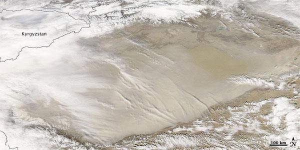
NASA's Aqua satellite today (March 2) captured this image of dust stirring over the Taklimakan Desert.
Along the southern rim of the Tarim Basin, which the Taklimakan Desert fills, thick dust completely obscures the desert floor.
Clouds hover over the dust, some of them casting shadows onto the sea of tan and beige below. Along the northern edge of the desert, skies appear clearer.
Situated between the mountain ranges of the Tien Shan (or Tian Shan) in the north, and the Kunlun Shan in the south, the Taklimakan Desert is China's biggest, hottest, driest desert , according to a NASA statement.
Isolated from the effects of the Asian monsoon and Arctic storms , the desert receives little water. Lacking drainage for the water it does receive, the desert has accumulated large quantities of salt.
Most of the Taklimakan is covered by mobile sand dunes.
Sign up for the Live Science daily newsletter now
Get the world’s most fascinating discoveries delivered straight to your inbox.


