'Fossil Seismograph' Reveals Ancient Earthquakes
Ripples of mud in ancient lake bottoms could serve as evidence of earthquakes that ruptured in millennia past, researchers suggest.
By deducing the history of earthquakes in a locale, it may be possible to calculate how often quakes might occur there in the future, they added.
For about a century, scientists have analyzed earthquakes with instruments known as seismometers that detect the seismic rumbling temblors give off, investigating the resulting seismographs for details on a quake's magnitude and behavior. However, as one might expect, researching the specifics of earthquakes that shook before seismometers were developed is difficult.
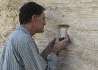
Now, geologists at Tel Aviv University in Israel suggest that wavy features found in rock layers at two locations in the Dead Sea region could point out a new way to learn about ancient earthquakes .
"This helps us to understand the intensity of earthquakes in bygone eras," said researcher Shmuel Marco at Tel Aviv University. "We've expanded the window of observation beyond 100 years, to create, if you will, a 'fossil seismograph.'"
Wavy rocks
The layers of mud at these sites were laid down at the bottom of an ancient lake that preceded the formation of the Dead Sea. They were deposited in a very steady manner over some 70,000 years, but at times disruptions pulled heavier sediment up into layers of lighter ones above them in wavy patterns. The scientists propose the physics governing these deformations is similar to phenomena seen in clouds, the sea and other turbulent fluids known as the "Kelvin-Helmholtz Instability."
Sign up for the Live Science daily newsletter now
Get the world’s most fascinating discoveries delivered straight to your inbox.

After Marco and his colleagues analyzed more than 300 such folds, taking into account details such as the thickness of each layer and the physical properties of the sediments, they found that computer models they developed could see that such distortions were likely caused by earthquakes.
These deformations began as moderate wave-like folds, evolved into complex recumbent folds, and finally grew unstable and fragmented. This process advanced depending on the earthquake size the stronger the earthquake, the more intense the deformation thus giving researchers a way to estimate how powerful these past quakes were.
It seems unlikely that other sediment-shaping events caused these folds, Marco noted: "Other disturbances such as large flash floods look different. They can be recognized by the input of coarse-grained material into the lake."
Looking into past
Along the Dead Sea fault alone, the researchers suggest they might be able to detect signs of earthquakes over a span of some 120,000 years. "For comparison, seismographs provide information on the last 100 years; history and archaeology, about 3,000 years," Marco told OurAmazingPlanet.
The researchers note this technique is relevant where earthquakes affect bodies of water, such as the West Coast of the United States . Since these ripples are linked with surface ruptures of faults, they likely reflect a minimum of magnitude-6 quakes, he added.
Marco and his colleagues Eyal Hefetz and Nadav Wetzer initially detailed their findings in the April 2010 issue of the journal Geology. They are now looking at other evidence of past quakes by analyzing archaeological sites that show earthquake-triggered damage.


