Nation's Weather Radar Gets Revolutionary Upgrade
The largest upgrade to the nation's weather radars since Doppler radars were installed in the early 1990s is now under way.
Meteorologists with the National Weather Service (NWS) in Norman, Okla., launched the first field test of the massive upgrade earlier this month. If everything goes according to plan, the upgrade will replace all of the NWS's 169 Doppler radars over the next few years.
Called dual polarization, the upgrade will play a big role in spotting tornadoes, meteorologists said, because the new technology can see the unseen. [Related: Twisted Science: Why Tornado Forecasting Is Tough ]
Seeing the unseen
Dual-pol radars are so precise that they can see individual types of precipitation, such as hail and rain a level of detail that will come in handy during severe weather .
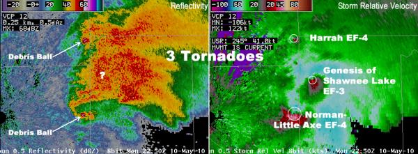
Say a tornado is swirling debris such as grass, leafs and twigs a sign that a funnel cloud has touched down. If the debris is within 60 to 75 miles (97 to 120 kilometers) of dual-pol radar, meteorologists will be able to see it, and can then warn the public that a tornado is on the ground.
"As long as it gets lofted high enough for the radar to see it and sample it, it has a really distinct signal in dual-pol," said Paul Schlatter, the NWS meteorologist in Norman that is training forecasters on the new radars.
Sign up for the Live Science daily newsletter now
Get the world’s most fascinating discoveries delivered straight to your inbox.
This will come in handy if, say, a tornado is cloaked in a rain cloud, making it invisible to the naked eye and current Doppler radar.
"When a tornado is wrapped in rain it's almost impossible to see it," said Bob Henson, a meteorologist with the University Corporation of Atmospheric Research in Boulder, Colo.
Dual-pol radars beam both horizontal and vertical pulses. The radars measure how strong the pulses are when they return, providing two-dimensional information about the sizes, shapes and types of particles in the air.
Tornado blind spot
Today, a combination of Doppler radar images and storm spotters are needed to report a tornado (storm survey teams study any damage to confirm the tornado after the storm has passed).
Doppler radars can say only that a storm is tightly spinning, but not that a tornado has touched down. This is where storm spotters come in, but they are not the same as storm chasers, who track storms likely to spawn tornadoes, so they aren't always around when a funnel cloud forms. More often than not, a tornado is not reported until it hits something.
"It's really the house getting hit that's the main way," said Greg Carbin, the warning coordination meteorologist with the Storm Prediction Center in Norman.
Dual-pol radars will help fill in this blind spot, aiding so-called "now-casts," or tracking a tornado that is currently on the ground and endangering people, Schlatter said.
"Even if there isn't a spotter there, the radar will be able to see it and forecasters will be able to get that information out and confirm that a tornado is occurring," Schlatter told OurAmazingPlanet.
- Weirdo Weather: 7 Rare Weather Events
- 7 Ways the Earth Changes in the Blink of an Eye
- Skyscraper Storms: 7 Big City Tornadoes
Email OurAmazingPlanet staff writer Brett Israel at bisrael@techmedianetwork.com. Follow him on Twitter @btisrael.
