Worst Weather of the Year Underway
Get the world’s most fascinating discoveries delivered straight to your inbox.
You are now subscribed
Your newsletter sign-up was successful
Want to add more newsletters?

Delivered Daily
Daily Newsletter
Sign up for the latest discoveries, groundbreaking research and fascinating breakthroughs that impact you and the wider world direct to your inbox.

Once a week
Life's Little Mysteries
Feed your curiosity with an exclusive mystery every week, solved with science and delivered direct to your inbox before it's seen anywhere else.

Once a week
How It Works
Sign up to our free science & technology newsletter for your weekly fix of fascinating articles, quick quizzes, amazing images, and more
Delivered daily
Space.com Newsletter
Breaking space news, the latest updates on rocket launches, skywatching events and more!

Once a month
Watch This Space
Sign up to our monthly entertainment newsletter to keep up with all our coverage of the latest sci-fi and space movies, tv shows, games and books.

Once a week
Night Sky This Week
Discover this week's must-see night sky events, moon phases, and stunning astrophotos. Sign up for our skywatching newsletter and explore the universe with us!
Join the club
Get full access to premium articles, exclusive features and a growing list of member rewards.
Bad news for most of the country: The worst severe weather of the year will rev up this weekend.
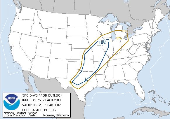
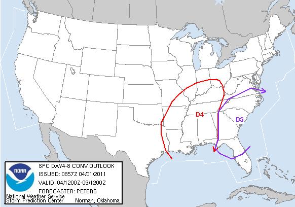
Forecasters see widespread severe weather , lasting several days, beginning in the Midwest and spreading to deadly Dixie Alley in the South by Sunday (April 3). The storms will move up the East Coast to the Mid-Atlantic states early next week and should push off the coast by Wednesday, according to the National Storm Prediction Center in Norman, Okla.
Blame the jet stream the fast current of air in the upper atmosphere that hovers over North America. It's currently flying east from the Rockies, dipping low and colliding with the warm, moist air blasting up from the Gulf of Mexico.
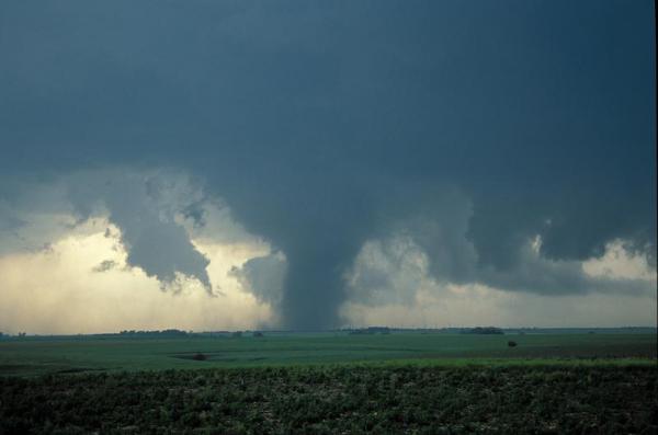
That's a recipe for tornadoes , and forecasters say that over the next few days there is a serious threat for the supercell storms that spin off twisters. Large hail and brutal winds are expected. [Infographic: Tornado! An Inside Look at Tornado Season ]
Storms a-brewin'
Textbook tornadoes form in the United States where warm, moist Gulf of Mexico air collides with cool, northern air, creating massive storms. Most of the Earth's tornadoes form in Tornado Alley, but the deadliest tornadoes strike Dixie Alley.
Most of the biggest and baddest tornadoes spin off supercell storms, which are up to 50,000 feet (15,000 meters) tall and can last for hours. Supercells need three main ingredients to form: energy, rotation and a cap. The regions with severe weather watches have plenty of all three in early spring. Once the ingredients are mixed, a supercell storm can spit out a tornado in minutes.
Get the world’s most fascinating discoveries delivered straight to your inbox.
The energy comes from the collision of warm, moist air from the Gulf of Mexico and southward flowing cool, dry Arctic air. The warm air rises and hits wind shear, a layer of the atmosphere where the winds change direction over a short height, and creates the rotation (think of a pinwheel with air pushing in opposite directions on the top and bottom). Below the pinwheel, a cap of warm air bottles up surface heat below about 10,000 feet (3,000 m).
Heat builds until it punches through the cap, triggering a thunderstorm. With enough air shooting up and down, the pinwheel is knocked on its side, creating a huge rotating mass of clouds called a mesocyclone the hallmark of a tornado-spawning supercell storm.
April = severe weather
April is synonymous with severe weather. Some of the deadliest tornadoes in recent U.S. history struck during April:
- The Super Outbreak: The largest 24-hour tornado outbreak on record. 148 tornadoes across 13 counties killed about 330 in the Midwest and South on April 3 and 4, 1974.
- Red River Valley Tornado Outbreak: Also known as Terrible Tuesday, 59 tornadoes killed 58 people on April 10 and 11, 1979, across the southern Plains and the Mississippi River Valley.
- April 2010 Tornado Outbreak: 88 confirmed tornadoes, including a massive EF-4 storm (the second-largest on the tornado rating scale), killed 10 people across the South.
- Infographic: Tornado! An Inside Look at Tornado Season
- Twisted Science: Why Tornado Forecasting Is Tough
- 12 Twisted Tornado Facts
Email OurAmazingPlanet staff writer Brett Israel at bisrael@techmedianetwork.com. Follow him on Twitter @btisrael.
 Live Science Plus


