Before & After: Mississippi River Floods
Cairo, Ill., Before Floods
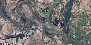
In late April 2011, unrelenting spring rains pounded the Mississippi Basin once again, and water levels on the Ohio and Mississippi Rivers rose to record levels.
The above image shows the rivers at normal spring levels in 2010.
Cairo, Ill., After Floods
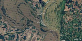
This image, taken by the Landsat-5 satellite on May 3, 2011, shows the confluence of the two swollen rivers. Floods blanket farmland along both rivers.
In the face of potentially disastrous flooding, the U.S. Army Corps of Engineers set into motion a plan devised after the devastating floods of 1927. They decided to flood the New Madrid Floodway south of Cairo, Illi., and the confluence of the two rivers. So far, the plan has worked and water levels near Cairo have dropped.
Levee Pre Breach Illinois
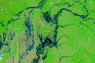
This image, taken on April 29, 2011, shows a wider view of the area affected by the flooding near Cairo before the Corps of Engineers blasted holes in the Birds Point levee.
The patches of green in the image show that the floodway is made up mostly of farmland.
Levee Breach Illinois
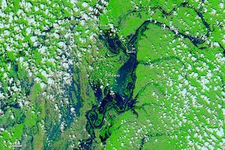
This image, taken on May 3, 2011, shows the floodway beginning to fill up after a hole was blasted in the levee.
Sign up for the Live Science daily newsletter now
Get the world’s most fascinating discoveries delivered straight to your inbox.
Mississippi Before Floods
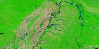
The same floods that prompted authorities to breach a levee near Cairo, Ill., has started forcing residents from their homes farther south along the Mississippi River. [Mightiest Floods of the Mississippi River ]
The Moderate Resolution Imaging Spectroradiometer (MODIS) on NASA's Aqua satellite acquired this image, which shows more typical spring conditions along the Mississippi, on May 5, 2010, exactly one year before the following image.
Mississippi After Floods
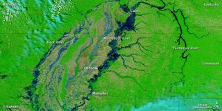
This image, acquired on May 5, 2011, shows the substantially swollen river, from north of Cairo to south of Memphis. In the west, the Black River is also swollen, and large areas of standing water appear between the Black and Mississippi Rivers.
On May 6, 2011, the Advanced Hydrological Prediction Service (AHPS) reported that the Mississippi's water level had reached 46.68 feet (14.23 meters) at Osceola, Arkansas, and 46.14 feet (14.06 meters) at Memphis, Tenn. At both locations, the Mississippi is in major flood stage and expected to continue rising.


