Space Station Gets Unprecedented Views of Earth Coasts
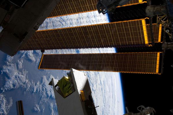
Advanced technology aboard the International Space Station is now providing unprecedented views of the planet's coastlines.
Knowing what activity is occurring along Earth's coasts is key for planning and carrying out humanitarian relief and military actions, as well as monitoring for pollution, coral reef health and other environmental concerns. However, the millions of square miles that make up the coasts of oceans are complicated in nature, consisting of dissolved matter and suspended detritus that obscure water and sea bottom types that can vary quickly over just dozens of yards.
Now the Hyperspectral Imager for the Coastal Ocean (HICO), installed on the International Space Station in 2009, is providing unprecedented new views of coastlines around the world.
HICO captures one scene per 90-minute orbit, with each scene spanning an area of about 26 miles (42 kilometers) wide and 118 miles (190 km) long. The pictures have a high enough resolution to image the complexity of coastal features, and HICO can scan over a wide range of brightnesses, enabling it to image both the dark open ocean and bright features such as river plumes . So far, the imager has collected more than 2,500 images of coastal sites.
"I find the global reach of HICO on the International Space Station exciting," said researcher Michael Corson, principal investigator for HICO at the Naval Research Laboratory in Washington. "If a scientist requests hyperspectral imagery of a location, either for naval or civilian research, we can readily add that location to our target deck or take the image the next time the space station overflies it. This enables exploratory imaging to test ideas relating to coastal environments worldwide, which would be prohibitively expensive from aircraft platforms."
How it works
Hyperspectral imagers collect light from a range of wavelengths, yielding significantly more details about vegetation, minerals and other aspects of a scene than comparable technologies such as multispectral imagers, which rely primarily on the shapes of objects.
Sign up for the Live Science daily newsletter now
Get the world’s most fascinating discoveries delivered straight to your inbox.
There are few hyperspectral imagers currently operating in orbit, and HICO is the first made specifically for scanning the environmental details of the coastal ocean from space. It analyzes visible light, which provides data on the properties of the water, sea bottom sediments, dissolved organic matter, plankton and other coastal ocean components, as well as shortwave infrared wavelengths, which are used to correct for atmospheric elements and sea surface reflections.
"We're certainly able to track things like red tides with a lot more fidelity than past instruments, and there's benefit to that because they make people sick," Corson said, referring to a phenomenon where algae rapidly builds up in patches in surface waters. The algae can vary in color from red to green, and these blooms can deplete oxygen in the water column and sometimes release toxins.

HICO could set the stage for more advanced coastal ocean imagers. For instance, such a device on a small satellite in a low-Earth, sun-synchronous orbit could gather far more data and monitor unfolding events such as severe coastal weather and pollution plumes. In addition, a similar sensor in geosynchronous orbit, such as the Geostationary Coastal and Air Pollution Events (GEO-CAPE) instrument proposed by NASA, could provide hourly images of U.S. coastal waters. HICO could simulate the kind of data such devices might bring to help optimize their design, Corson said.
The researchers envision that a next-generation spaceborne hyperspectral imager for coastlines would "image at 30-meter resolution, comparable to harbor charts; launch into a polar orbit to access the entire globe; and include wavelength bands further into the infrared wavelengths for enhanced monitoring of vegetation," Corson said. "The primary hurdle in building and operating the next-generation system is obtaining the needed funding in the current fiscal climate."
Paving the way
HICO was built and integrated into the module it resides on in the space station in just 24 months at a fraction of the cost of a traditional space instrument. The researchers achieved these savings by using off-the-shelf components whenever possible, including the camera, spectrometer, the control computer, solid state memory and a rotation mechanism to aim the imager.
The relatively benign levels of damaging radiation in the environment at the space station enabled the use of these parts without radiation shielding beyond that provided by the structure. This overall strategy could provide a model for rapidly taking an experiment from the lab to space, researchers added. The station also provides the device ample electrical power and a way to communicate with its controllers.
In addition, HICO helped pave the way for launching U.S. payloads to the International Space Station on the unmanned Japanese H-II Transfer Vehicle (HTV), "which will be one of the primary means of launching supplies to the space station after the retirement of the space shuttle fleet," Corson said. "In addition to the technical achievement of flawless payload integration, launch and docking to the space station, the HICO program provides a model of cooperation between the United States Department of Defense, NASA and the Japan Aerospace Exploration Agency [JAXA] on the many intricate details of a space program."
The scientists detailed their work with HICO in the May 10 issue of the journal Eos.


