
In Images: Chilean Volcano Erupts
Puyehue Chile Volcano Eruption
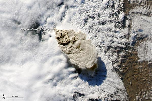
On June 4, Chile's Puyehue-Cordón Caulle volcano began erupting with the opening of a fissure -- the first major eruption at the complex in 51 years, according to the Eruptions blog.
The spewing volcano emitted ash to a maximum altitude of 45,000 feet (14,000 meters), according to the Buenos Aires Volcanic Ash Advisory Center (VAAC). The ash plume remained at or above 40,000 feet (12,000) for at least the next two days.
In this satellite image, the brown ash plume reaches high above the clouds covering much of the scene, and casts a dark shadow towards the southeast. Along the leading edge of the plume, it appears heavier material is falling out of the ash cloud, while finer particles remain suspended in the atmosphere.
Puyehue Chile Volcano Plume Long
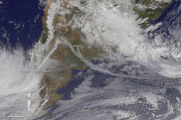
Two days of continuous emissions at the Puyehue-Cordón Caulle Volcanic Complex created an ash plume that extended more than 1,000 nautical miles (1,900 kilometers): from Chile, over the coast of Argentina, and out into the Atlantic Ocean. [Image Gallery: Volcanoes from Space ]
Puyehue Chile Volcano Ash Plume Close
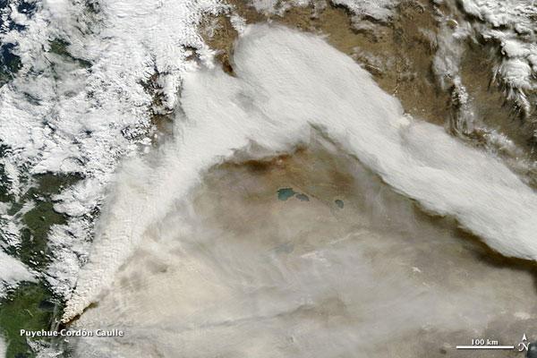
Puyehue-Cordón Caulle is located in Puyehue National Park in the Andes of Ranco Province of Chile, just west of the border with Argentina.
Over the border, near the town of Bariloc, a layer of ash at least 12 inches (30 centimeters) deep covered the ground, the Buenos Aires Herald reported. Argentinian police collected golfball-sized pumice near the border, which is at least 13 miles (21 kilometers) from the eruption. [The World's 5 Most Active Volcanoes ]
Puyehue Chile Volcano
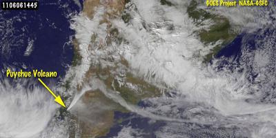
This image of the eruption of the volcano (left center) was captured by the GOES-13 Satellite on June 6 at 14:45 UTC (10:45 a.m. EDT). The plume is blowing northeast, then turns toward the southeast and over the Atlantic Ocean. GOES-13 monitors the eastern United States and the Atlantic Ocean.
Get the world’s most fascinating discoveries delivered straight to your inbox.
Puyehue Chile Volcano Space
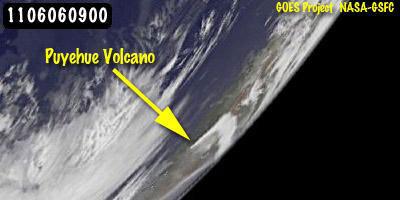
This GOES-11 satellite image was taken from a farther vantage point, all the way over the western United States, but the triangular-shaped ash plume was still visible.
The ash plume has disrupted air travel in South America.
 Live Science Plus


