
7 Most Dangerous Places on Earth
Get the world’s most fascinating discoveries delivered straight to your inbox.
You are now subscribed
Your newsletter sign-up was successful
Want to add more newsletters?

Delivered Daily
Daily Newsletter
Sign up for the latest discoveries, groundbreaking research and fascinating breakthroughs that impact you and the wider world direct to your inbox.

Once a week
Life's Little Mysteries
Feed your curiosity with an exclusive mystery every week, solved with science and delivered direct to your inbox before it's seen anywhere else.

Once a week
How It Works
Sign up to our free science & technology newsletter for your weekly fix of fascinating articles, quick quizzes, amazing images, and more

Delivered daily
Space.com Newsletter
Breaking space news, the latest updates on rocket launches, skywatching events and more!

Once a month
Watch This Space
Sign up to our monthly entertainment newsletter to keep up with all our coverage of the latest sci-fi and space movies, tv shows, games and books.

Once a week
Night Sky This Week
Discover this week's must-see night sky events, moon phases, and stunning astrophotos. Sign up for our skywatching newsletter and explore the universe with us!
Join the club
Get full access to premium articles, exclusive features and a growing list of member rewards.
Intro
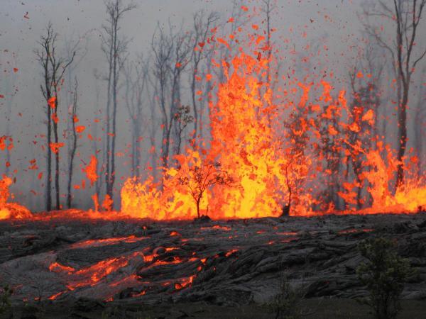
From its churning, sometimes stormy atmosphere to its shifting tectonic plates, Earth can be a dangerous place. Earthquakes, floods and other natural disasters killed more than 780,000 people between 2009 and 2009, according to the UN International Strategy for Disaster Reduction Secretariat. Millions more were injured or displaced. No one knows how the next decade will shape out, but some areas have more reason to worry than others.
Lake Nyos, Cameroon
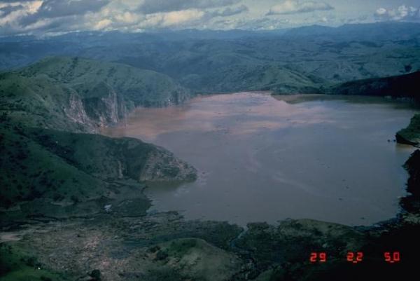
A silent killer lurks beneath the surface of this West African lake. A pocket of magma deep below the lake bed leaks carbon dioxide into the lake above. Under the pressure of 650 feet (200 meters) of water, this carbon dioxide stays dissolved, much like the carbonation in a bottle of soda.
But on the night of August 21, 1986, the water in the lake abruptly turned over, and the now-depressurized carbon dioxide exploded upward like a shaken soft drink. The resulting carbon dioxide cloud rushed downhill, asphyxiating 1,700 people and thousands more animals. In the 15 miles (24 kilometers) of valleys below the lake, almost nothing survived.
Today, pipes are used to siphon carbon dioxide-rich water from the bottom of Lake Nyos. The pipes prevent carbon dioxide buildup, but that doesn't make Lake Nyos entirely safe, said George Kling, a University of Michigan geochemist who was on the team that originally investigated the 1986 disaster.
"We're keeping ahead of the game, but we're not drawing the gas down very quickly," Kling said. "That means that it still is a very dangerous lake."
Naples, Italy
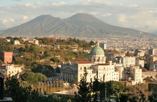
In 79 A.D., Mount Vesuvius blew its top, burying the ancient cities of Pompeii and Herculaneum. More than 50 subsequent eruptions and the eerie human-shaped cavities left behind in the volcano's ash haven't dissuaded people from populating the slopes of this volcano by the sea. The city of Naples lies at its base, and up to 650,000 people may live on its slopes, according to Guido Bertolaso, the head of Italy's civil protection agency. An impending eruption could force the evacuation of more than a million people.
Vesuvius isn't the only active volcano threatening this densely-populated area. The Mediterranean Sea off the coast of Italy is littered with volcanoes. The most worrisome, according to Bertolaso, is the resort island of Ischia. An eruption there would affect Naples and "could be worse than a hypothetical Vesuvius eruption," Bertolaso said.
Get the world’s most fascinating discoveries delivered straight to your inbox.
Miami, Florida
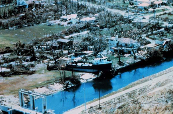
No one can predict where a hurricane will hit next, but south Florida is always a reasonable bet. The U.S. Geological Survey estimates the southern tip of Florida can expect more than 60 hurricanes over a 100-year period. And in 2008, sustainability company SustainLane ranked Miami as the most risky city for natural disasters in the United States.
Hurricane destruction in Miami and the nearby Florida Keys is nothing new. In 1926, the Great Miami Hurricane destroyed or damaged every building in downtown Miami and killed at least 373 people, according to the Red Cross. Less than 10 years later, the Labor Day hurricane of 1935 killed 408 people in the Florida Keys. In 1960, Hurricane Donna roared through the Keys and South Florida, bringing with it 11 to 15-foot storm surges.
Perhaps the most famous hurricane to hit south Florida was 1992's Hurricane Andrew . Andrew blasted through Florida as a Category 4 storm with winds so high they broke measurement instruments. According to the National Oceanic and Atmospheric Administration, Andrew killed 23 people in the United States. The destruction totaled more than $26.5 billion.
The Sahel region of Africa
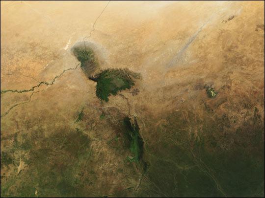
Drought often doesn't get as much attention as other natural disasters, but it can be a killer. According to the United Nations Environmental Programme, more than 100,000 people died because of drought in the Sahel region of Africa from 1972 to 1984. Another 750,000 were unable to grow their own crops and were completely dependent on food aid.
The arid Sahel region borders the Sahara Desert , stretching across northern Africa through Mauritania, Senegal, Mali, Niger, Burkina Faso, Nigeria, Chad, Sudan, Algeria, Ethiopia and Eritrea. According to the U.N., human exploitation of the area's limited water is causing desertification, raising the risk of future drought and famine.
Guatemala
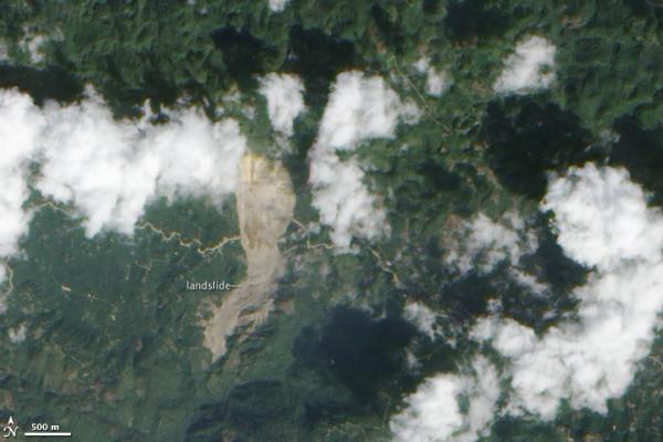
Central America gets hit by a triple threat of natural disasters: earthquakes, hurricanes and mudslides.
Along with the western coast of North and South America, Central America lies on the Ring of Fire, a seismically active loop that encircles the Pacific Ocean. Guatemala isn't the only country affected, but it's been hit hard: In 1976, a 7.5-magnitude earthquake killed 23,000 people, according to the USGS. Thanks to the country's mountainous terrain, landslides hampered transportation and rescue efforts.
The combination of topography and weather can be deadly as well. Heavy rains can saturate hillsides, leading to devastating mudslides. In 2005, the remnants of Hurricane Stan soaked Guatemala, El Salvador and southern Mexico, causing more than 900 mudslides. Entire villages were buried; one, Panabaj, was declared a cemetery after officials gave up hope of excavating the bodies of 300 missing villagers. The exact death toll is unknown, but some estimates suggest that up to 2,000 people lost their lives.
Java and Sumatra, Indonesia
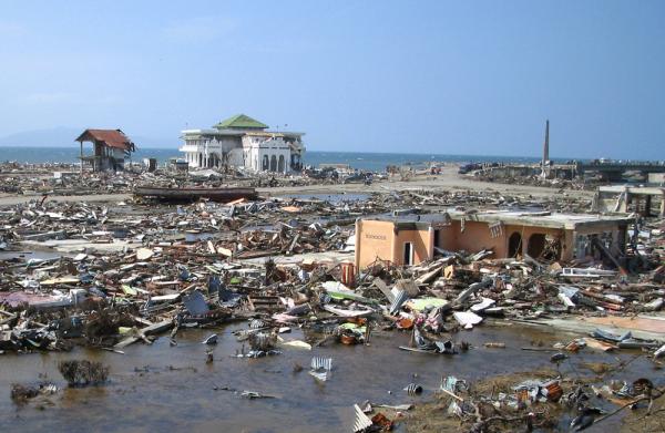
These two Indonesia islands face perhaps more natural disaster hazards than anywhere else. Droughts, floods, earthquakes, landslides, volcanoes and tsunamis all threaten Indonesia, and Java and Sumatra have the highest risk, according to the Center for Hazards and Risk Research at Columbia University.
The most famous disaster to hit Indonesia is the 2004 Indian Ocean tsunami , which killed an estimated 227,898 people after a 9.1-magnitude earthquake triggered the enormous wave. Indonesia was hardest hit among the affected Southeast Asian countries, with over 130,000 people confirmed dead.
But smaller disasters cause more regular suffering. Between 1907 and 2004 (before the tsunami), droughts killed 9,329 Indonesians, according to the Columbia University group. Volcanoes killed 17,945 people in the same time period, and earthquakes killed 21,856. One of the most famous eruptions in history, of the volcano Krakatoa, occurred in the Sunda Strait between the two islands. And as recently as this February, floods drove thousands of west Java residents from their homes, and a landslide in the village of Tenjolaya killed dozens.
Istanbul, Turkey
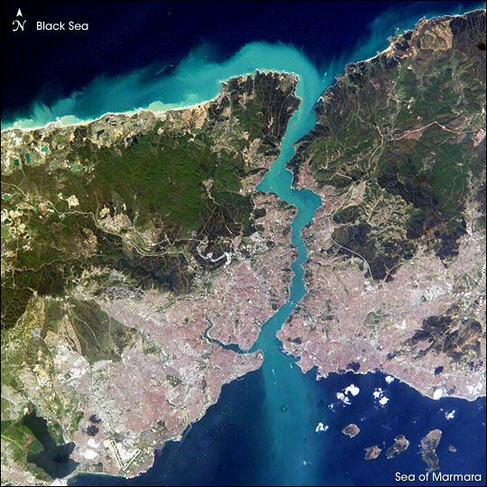
No one knows when the North Anatolian Fault will rupture, but one thing is certain: It will rupture. The resulting earthquake could be very bad news for the 12.8 million people in Istanbul.
For the past century, earthquakes on the North Anatolian Fault in northern Turkey have been creeping westward. The last big quake happened in 1999, when a 7.6-magnitude temblor devastated the city of Izmit . The official death toll was around 17,000, but a 2004 estimate by University of Brasilia researcher Vasile Marza put the number at 45,000.
The next time the ground shakes, scientists expect that it will be even further west, just south Istanbul. A January 2010 study in the journal Nature Geosciences found that tensions along the fault are building and could trigger multiple small-to-moderate quakes. Or the fault could go all at once. In March, USGS geophysicist Tom Parsons told Nature that the chances of Istanbul being hit by a magnitude 7 or greater quake in the next 25 years are between 30 and 60 percent.

Stephanie Pappas is a contributing writer for Live Science, covering topics ranging from geoscience to archaeology to the human brain and behavior. She was previously a senior writer for Live Science but is now a freelancer based in Denver, Colorado, and regularly contributes to Scientific American and The Monitor, the monthly magazine of the American Psychological Association. Stephanie received a bachelor's degree in psychology from the University of South Carolina and a graduate certificate in science communication from the University of California, Santa Cruz.
 Live Science Plus


