Huge Hurricane Eugene Seen from Space
Credit: NASA/NOAA GOES Project " class="caption" />
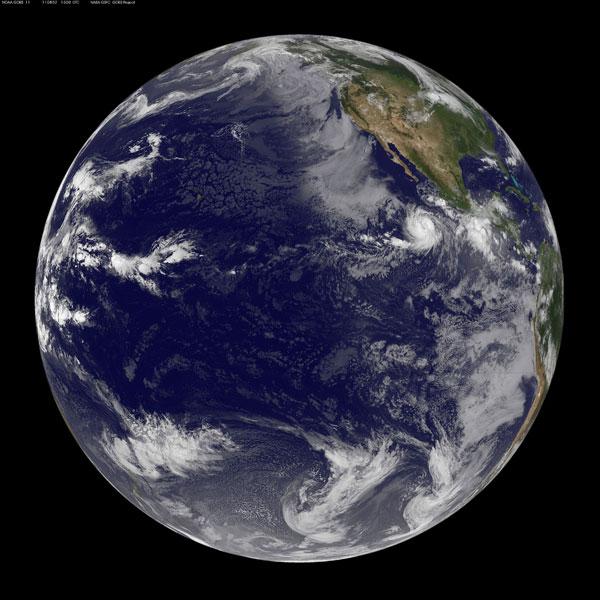
Hurricane Eugene has become a large hurricane in size and strength, and when NOAA's GOES-11 satellite captured an image of the eastern Pacific on August 2, Hurricane Eugene was very obvious because of its size.
Although an eye was not visible in the image, Eugene is a Category 2 hurricane on the Saffir-Simpson scale of hurricane strength. Eugene's tropical storm force winds extend out to 140 miles (225 kilometers), putting the diameter of the storm at about 280 miles (450 km).
Eugene has maximum sustained winds of 105 mph (165 kph), and could become a major hurricane (those of Category 3 or higher), but is not expected to threaten land.
In the Atlantic basin, Tropical Storm Emily is poised to drop large amounts of rain on parts of the Caribbean, including the island of Hispaniola, home to the Dominican Republic in the east and Haiti in the west. Haiti is highly vulnerable to mudslides triggered by massive rainfalls because of its denuded landscape.
- History of Destruction: 8 Great Hurricanes
- Which U.S. Cities Are Most Vulnerable to Hurricanes?
- In the Eye of the Storm: NASA's Hurricane Hunters
Sign up for the Live Science daily newsletter now
Get the world’s most fascinating discoveries delivered straight to your inbox.

