Massive Missouri Floods Linger
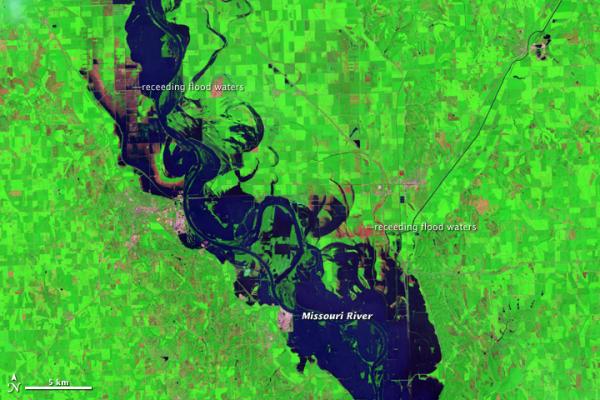
At the beginning of August 2011, flood waters were receding along the Missouri River in eastern Nebraska, but only slowly. On August 3, 2011, the Advanced Hydrological Prediction Service (AHPS) of the U.S. National Weather Service reported moderate flooding of the river at multiple communities on Nebraska's eastern border.
The Thematic Mapper on the Landsat 5 satellite captured these images of the Missouri River on August 1. They show the river and surrounding floodplains near the town of Blair, about 20 miles (30 kilometers) north-northwest of Omaha.
The top image is false color and the bottom image is natural color. While the natural-color image gives a realistic picture of how the area would look in an aerial photo, the false-color image better distinguishes between water and land. Along the length of the Missouri River in these scenes, muddy water both fills the river channel and rests on floodplains, including croplands, to the east and west.
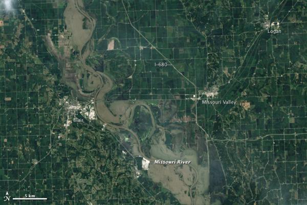
As of August 3, the AHPS reported that the Missouri River reached its 2011 crest near Blair on June 29, at 32.73 feet (9.98 meters). This was the second-highest level recorded for Blair (the highest level was recorded in 1952). The AHPS noted, however, that the 2011 crest data were provisional and could change. As of 7:00 a.m. on August 3, the Missouri River reached 30.84 feet (9.40 meters) near Blair, and a flood warning was in effect for that and several other cities along the Missouri River.
- Muddy Waters Inundate Iowa Town
- 2011 Flooding Could Rival Great Flood of 1993
- Missouri Flood Woes Continue
Sign up for the Live Science daily newsletter now
Get the world’s most fascinating discoveries delivered straight to your inbox.

