Updated Hurricane Forecast Calls for More Storms

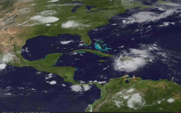
This year's hurricane season could be even more active than originally forecast, according to the U.S. National Oceanic and Atmospheric Administration (NOAA).
NOAA issued its updated 2011 Atlantic hurricane season forecast today (Aug. 4), raising the number of expected named storms from its preseason outlook issued in May. The new forecast calls for 14 to 19 named storms (which include tropical storms and hurricanes), seven to 10 hurricanes and three to five major hurricanes (Category 3 or higher). The previous forecast called for 12 to 18 named storms, six to 10 hurricanes and three to six major hurricanes.
"The atmosphere and Atlantic Ocean are primed for high hurricane activity during August through October," said Gerry Bell, lead seasonal hurricane forecaster at NOAA's Climate Prediction Center. "Storms through October will form more frequently and become more intense than we've seen so far this season."
The climate continues to show signs of an active season ahead. Exceptionally warm Atlantic Ocean temperatures (the third warmest on record), the possible redevelopment of La Niña and reduced vertical wind shear (which tends to cut off storm circulation) and lower air pressure across the tropical Atlantic all favor an active season.
Based on these conditions and on climate model forecasts, NOAA forecasters raised their confidence for an above-normal season to 85 percent from 65 percent in May.
An average Atlantic hurricane season will see 11 named storms, six hurricanes and two major hurricanes.
The Atlantic basin has already produced five tropical storms, but no hurricanes, this season: Arlene, Bret, Cindy, Don and Emily.
Sign up for the Live Science daily newsletter now
Get the world’s most fascinating discoveries delivered straight to your inbox.
Last year saw above-normal hurricane activity, but none made landfall in the United States. The last hurricane to make landfall in the United States was Ike in 2008. The lull since then is the longest since the three-year gap between Hurricane Irene in October 1999 and Hurricane Lili in October 2002. If no hurricanes hit the United States this year, it would be the longest lull between U.S. hurricane landfalls in recorded history. [Related: Which U.S. Cities Are Most Vulnerable to Hurricanes?]
That's not likely to happen, according to forecasters at Colorado State University. Their updated forecast released Aug. 3 forecasts a 70 percent chance of producing a hurricane that would make landfall somewhere along the U.S. coast. The forecast does not make any specific predictions about hurricane landfall, which is driven by where the storms form and the overriding weather patterns at the time the storm approaches land. The team has predicted 16 named storms, nine hurricanes and five major hurricanes.
August through October are the peak months of the Atlantic hurricane season.The busiest season on record remains 2005, which saw 28 named storms, including Hurricane Katrina .


