Hurricane Irene One-Third the Size of East Coast

Get the world’s most fascinating discoveries delivered straight to your inbox.
You are now subscribed
Your newsletter sign-up was successful
Want to add more newsletters?
Join the club
Get full access to premium articles, exclusive features and a growing list of member rewards.
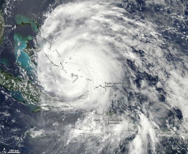
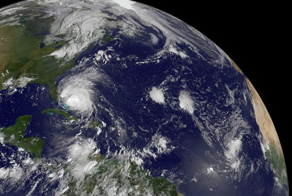
NASA satellite data shows that the diameter of Hurricane Irene is now about one-third the length of the U.S. Atlantic coastline.
The GOES-13 satellite saw Hurricane Irene moving through the Bahamas on August 25, 2011 at 10:02 a.m. EDT and images from the satellite showed that the storm had grown to one-third the size of the East Coast.
The distance from Augusta, Maine to Miami, Florida is 1,662.55 miles (2,675.61 kilometers). Hurricane Irene's tropical storm-force winds extend 255 miles (410 km) from the center making Irene 510 miles (821 km) in diameter. The storm's hurricane-force winds extend 70 miles (113 km) from its center.
Article continues belowNASA satellites are flying above Hurricane Irene, providing forecasters at NHC with temperature, pressure, wind, and cloud and sea surface temperature data. All of those things are critical in helping forecasters determine how Irene will behave and track. [New York Express? Hurricane Threat Based on History ]
On Thursday morning, Aug. 24, a hurricane warning is in effect for the central and northwestern Bahamas. The National Hurricane Center (NHC) has also issued the first watch for the U.S. east coast. A hurricane watch is in effect for north of Surf City, North Carolina to the North Carolina-Virginia border including the Pamlico, Albemarle, and Currituck Sounds. A tropical storm watch is in effect for north of Edisto Beach, South Carolina to Surf City North Carolina.
By 11 a.m. EDT on Aug. 25, Irene had moved north and was 75 miles (105 km) east-northeast of Nassau. Irene's winds dropped slightly from 120 mph (195 kph) to 115 mph (kph) and it was moving to the north-northwest near 13 mph (20 kph). The NHC, however, noted that some further strengthening is possible today and tonight.
Irene's minimum central pressure has fallen from 954 to 951 millibars since the day before, indicating the storm is still intensifying despite the slight temporary drop in maximum sustained winds.
Get the world’s most fascinating discoveries delivered straight to your inbox.
 Live Science Plus


