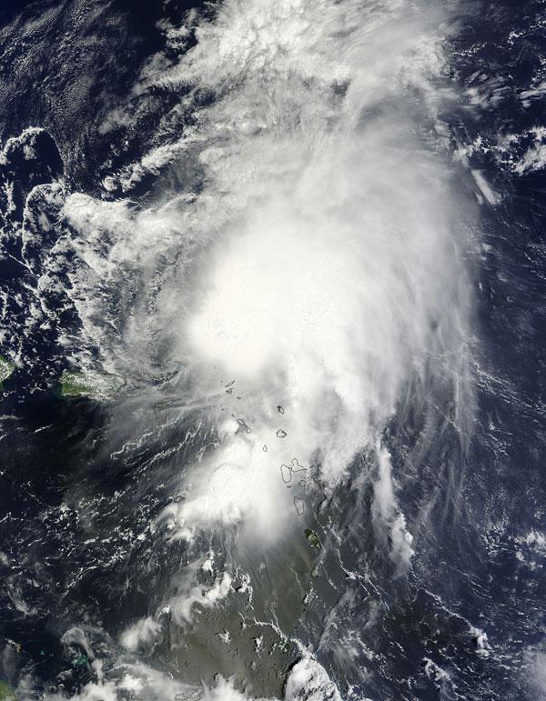
Tropical Storm Maria Edges Past Caribbean Isles

Get the world’s most fascinating discoveries delivered straight to your inbox.
You are now subscribed
Your newsletter sign-up was successful
Want to add more newsletters?
Join the club
Get full access to premium articles, exclusive features and a growing list of member rewards.
Following in the footsteps of Hurricane Katia, Tropical Storm Maria is edging past the outer Caribbean islands before following the curve of the U.S. East Coast and it swerves back out into the Atlantic.
Maria formed last Wednesday (Sept. 7), becoming the 13th named storm of the 2011 Atlantic hurricane season . The season was predicted to be a doozy, with 14 to 19 named storms (which include tropical storms and hurricanes), seven to 10 hurricanes and three to five major hurricanes (Category 3 or higher). So far there have been 14 named storms (Nate formed shortly after Maria, but dissipated after striking Mexico this weekend), two hurricanes and two major hurricanes (Irene and Katia).
Tropical Storm Maria has maximum winds of 50 mph (85 kph) and is about 315 miles (505 kilometers) east of the southwestern Bahamas.
Article continues belowMaria is expected to dump 4 to 8 inches (10 to 20 centimeters) of rain over Puerto Rico as it passes by, with some pockets seeing deluges of 15 to 20 inches (38 to 51 cm). Bermuda could start seeing tropical storm conditions late Wednesday or early Thursday.
In satellite images, such as the one above taken by NASA's Terra satellite on Sunday (Sept. 11), the storm appears disorganized and isn't expected to strengthen into a hurricane.
Get the world’s most fascinating discoveries delivered straight to your inbox.
 Live Science Plus


