Satellite Spies Typhoon Roke Hitting Japan
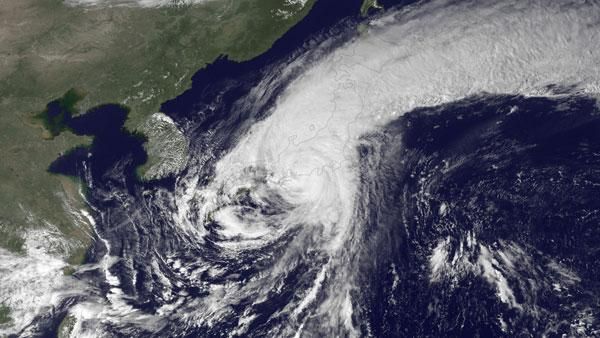
Typhoon Roke, the second typhoon to hit Japan this month, came ashore near Lake Hamana, midway between Toyohashi to the west and Hamamatsu to the east just as Japan's MTSAT-1R satellite snapped a picture of it.
Torrential rains exceeding 3.5 inches per hour in some places and the threat of landslides and flooding have left more than a quarter of a million households without power. Tokushima in southern Japan received nearly 24 inches (60 centimeters) of rain in the last two days, according to the UK Met Office.
See the picture of Roke's landfall here .
The storm, which had achieved a strength equivalent to a Category 4 hurricane on the Saffir-Simpson scale yesterday, is weakening below typhoon status and re-emerging over the Pacific Ocean, according to a Met Office update.
Roke has dumped rain on a part of Japan that was already inundated earlier this month by Typhoon Talas . The sheer volume of rain dropped by Talas created deadly floods and landslides. In one area, Talas dropped 65 inches (165 centimeters) of rain in 72 hours, a new record for the country, according to the Japan Meteorological Agency.
Evacuations of thousands of residents took place before Roke made landfall. Roke has been tracking up the coast of Japan, with worries about the effect its rains could have on the area of Honshu (Japan's main island) impacted by March's devastating earthquake, especially the crippled Fukushima nuclear plant, BBC News reported.
Sign up for the Live Science daily newsletter now
Get the world’s most fascinating discoveries delivered straight to your inbox.


