After Long Lull, Hurricane Season Picks Up With Rina

Tropical Storm Rina formed late Sunday night (Oct. 23), ending a weeks-long lull in the 2011 hurricane season.
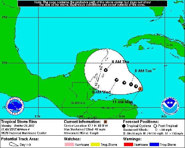
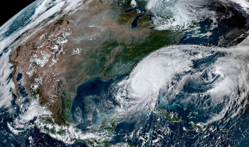
Rina formed over the northwest Caribbean Sea, and is currently about 190 miles (305 kilometers) southwest of Grand Cayman and 370 miles (595 kilometers) of Chetumal, Mexico. The storm is heading toward Belize and the Yucatan Peninsula of Mexico.
Rina currently has winds of 45 mph (75 kph), but is projected to strengthen in to a hurricane tomorrow (Oct. 25), and is expected to maintain hurricane status until it makes landfall along the Yucatan sometime on Thursday.
Rina is the 17th named storm of the 2011 season (storms receive names when they reach tropical storm or hurricane status). If it becomes a hurricane, it will be the 6th hurricane of the season.
The 2011 season was predicted to be a doozy, with 14 to 19 named storms (which include tropical storms and hurricanes), seven to 10 hurricanes and three to five major hurricanes (Category 3 or higher).
The most recent storm before Rina was Phillipe (the letter Q is skipped in the hurricane name list), which first formed in September and churned across the Atlantic for two weeks before becoming a hurricane on Oct. 6. It weakened shortly thereafter and the waters of the Atlantic, Gulf of Mexico and Caribbean were relatively quiet for most of October.
There is about one month left in the traditional Atlantic hurricane season, which begins each year on June 1 and ends on Nov. 30.
Sign up for the Live Science daily newsletter now
Get the world’s most fascinating discoveries delivered straight to your inbox.


