Take A Peek Inside Hurricane Headquarters
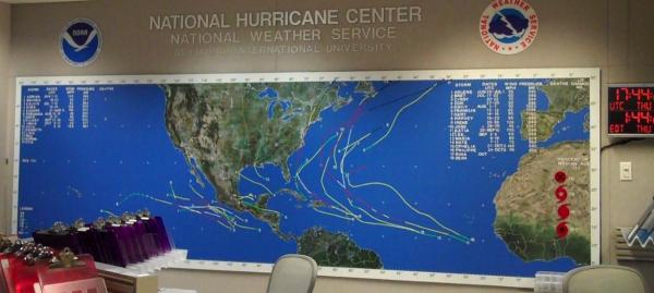
MIAMI There's only one building in Florida that can withstand the biggest and baddest of all hurricanes the Category 5, with winds of at least 165 mph (266 kph) and it's a concrete bunker along an unglamorous stretch of road in South Florida called the National Hurricane Center (NHC).
The NHC never closes. Here, weather forecasters work around the clock, 365 days a year, tracking threatening storms in both the Atlantic and Pacific Oceans. They watch radars, issue storm warnings, and command their airplane named Miss Piggy on airborne hurricane hunter missions.
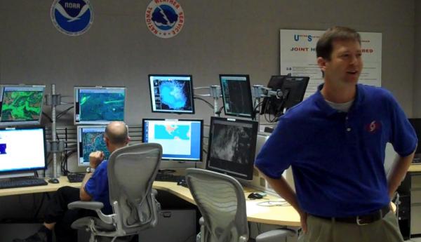
OurAmazingPlanet recently toured the NHC just as forecasters here were becoming concerned about the storm that would become Hurricane Rina (which has since weakened into a tropical storm). In the center's main forecast room, seen on TV during press briefings, one forecaster was just about to issue the latest tropical warning as reporters walked in.
"Done!" he shouted, as if on cue.
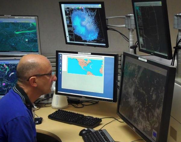
Forecasters sit in front of banks of computer monitors, poring over the latest storm data, doing their best to predict where the storm will go, and how strong it will be when it gets there. But as seen with Rina, which was predicted to become a major hurricane (Category 3 or higher) only to quickly fizzle, forecasters are constantly struggling to make accurate forecasts.
"It's not unusual for our intensity and wind speed forecast to be off," said Chris Landsea, science and operations officer for the NHC's Tropical Analysis and Forecast Branch. "Sometimes we're too high, sometimes we're too low."
Into the heart of the storm
Sign up for the Live Science daily newsletter now
Get the world’s most fascinating discoveries delivered straight to your inbox.
One way that the forecasters get information to plug into the forecast models is from ocean buoys as long as the hurricanes don't destroy them.
"The storms have been buoy hunting this year, which doesn't happen very often," said Daniel Brown, the NHC's warning coordination meteorologist.
The 2011 hurricane season has seen six hurricanes and 17 named storms. (Storm names are given when a system becomes a tropical storm.)
Another way to observe hurricanes is by flying airplanes and drones over, in front of and into the storms. This brand of hurricane hunting began decades ago with a few brave military pilots. [In the Eye of the Storm: NASA's Hurricane Hunters ]
"A couple of Army pilots decided to see if they could go fly that thing," said John Papone, who flew missions in the Pacific years ago, and has been working in the "war room" since it opened in 1968.
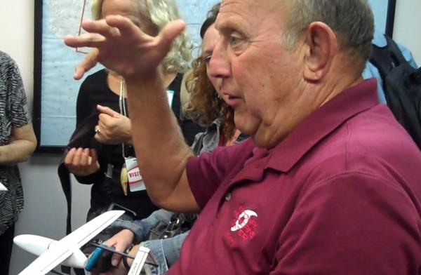
Today's pilots fly out of MacDill Air Force Base in Tampa, Fla., where they patrol the tropics, except for a rectangular "no fly zone" extending from Venezuela into the Caribbean.
They fly an airplane affectionately named Miss Piggy, or P3, (they also have planes named Kermit and Gonzo) at about 10,000 feet (3,000 meters) in a full-blown storm. Once over a storm, the planes deploy instruments called dropsondes, which are biodegradable slender tubes that float into the storm while hanging from a tiny parachute. The dropsondes, at $700 each, collect reconnaissance on the storm, including wind speed, temperature and precipitation. The information is sent back to the NHC in real-time.
"It's on Google within minutes of the time we get it," Papone said.
The P3 flies in a figure-four pattern over a storm and the pilots "pepper the storm" with dropsondes, said Shirley Murillo, the hurricane field program director for the 2011 season. Missions can be up to 8 hours long. [Hurricanes from Above: See Nature's Biggest Storms]
The NHC also relies on a Gulf Stream jet, the G4, which flies in front of storms to see what the conditions are like in the storm's path. The Gulf Stream looks for things such as dry air, which can break up a storm. Another plane, the unmanned Global Hawk, can fly directly into a storm and loiter there for a full day.
Best laid plans
Once the storm data is gathered, staffers in the Hurricane Liaison team work with the Federal Emergency Management Agency (FEMA) to brief communities and states on the latest threat. The NHC director, Bill Read, will teleconference the White House from the NHC's TV studio.
Inside the NHC's Storm Surge Unit, forecasters try to gauge how waters will rise along the coasts and where the most serious flooding could develop.
"Essentially we are the first step in setting evacuation zones," said Jamie Rhome, the unit's leader.
The Storm Surge unit does not order evacuations; they only say what areas may need to flee. Still, as seen during Hurricane Irene , the unit often faces serious scrutiny when their worst-case scenario predictions don't materialize. But Rhome said he believes the Hurricane Irene evacuations were done "about as good as you can do it," pointing out that no deaths were caused by storm surge , which he called "an amazing feat."
"There's no such thing as a perfect evacuation," Rhome said. "You have to overreact so that you don't lose a life."
But even if the NHC nails their forecast, a major landfalling hurricane will still cause severe devastation to the overdeveloped U.S. coastline.
"Maybe we should change what we allow to be done and built," said NHC director Read. "This is risk, folks."
You can follow OurAmazingPlanet staff writer Brett Israel on Twitter: @btisrael. Follow OurAmazingPlanet for the latest in Earth science and exploration news on Twitter @OAPlanet and on Facebook.
