Satellites See Floods Surrounding Bangkok


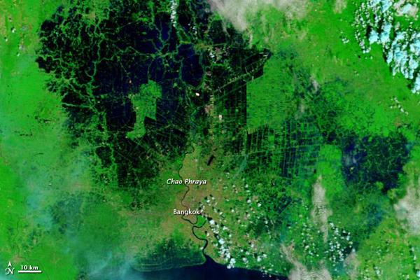
On November 7, 2011, floods surrounded two industrial estates east of Bangkok, Reuters reported. On November 9 (November 8 in the United States), Bangkok Post described desperate attempts by officials to protect the heart of Bangkok from floods as the director of the flood relief operations command warned that more water threatened to flow into the city.
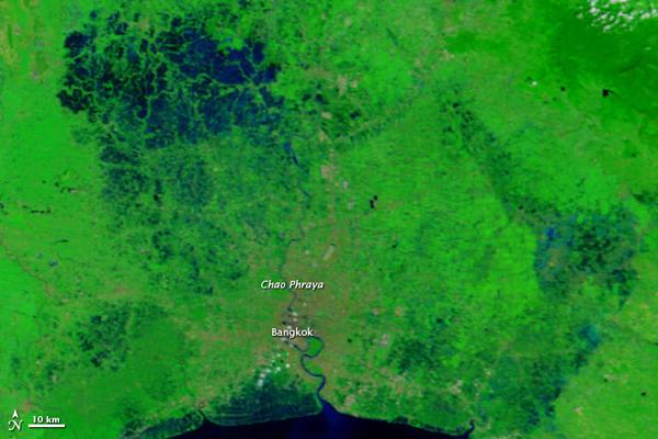
The image from 2008 shows relatively normal conditions in which the Chao Phraya River flows through a dry Bangkok. Three years later, water nearly surrounds the city, west to north to southeast. Floods started in northern Thailand in July and spread southward. By November 8, floods had been slowly encroaching on the Bangkok, just north of the Gulf of Thailand, for three weeks.
According to Bangkok Post, city officials were using pumps to drain overflow into the Chao Phraya River, but excess water was flowing into sewers. Sandbags were protecting the northern part of the city, but the director of the Rangsit Univerity disaster center warned that the sandbags would probably only contain flooding for several more days before water flowed over them and into Bangkok.
- Satellite Sees Massive Thailand Flooding
- Coastal Trees Could Blunt Tsunami's Deadly Impact
- Take a Peek Inside Hurricane Headquarters
Get the world’s most fascinating discoveries delivered straight to your inbox.


