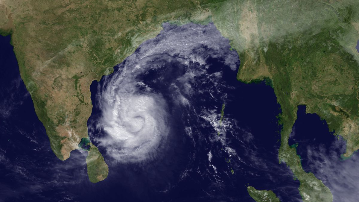
Satellite Spies Tropical Cyclone Thane Targeting India

A NASA satellite captured an image of Tropical Cyclone Thane barreling toward India today. The storm is expected to make landfall south of Chennai late tomorrow (Dec. 29), according to the United Kingdom's Met Office.
The storm formed over the southeastern Bay of Bengal Dec. 25. The Joint Typhoon Warning Center lists the maximum sustained winds at 86 mph (138 kph). The storm is expected to intensify to 90-to-100-mph (145-to-161-kph) winds before making landfall.
In the North Indian Ocean, a tropical cyclone is a storm with winds of 39-to-54 mph (63-to-87 kph). Thane would be called a hurricane in the United States, but in this part of the world, Thane is a Very Severe Cyclonic Storm, which is the name used for storms with winds between 74-and-137 mph (119-to-220 kph).
Thane is the second cyclonic storm of the 2011 North Indian Ocean cyclone season, and the strongest. Thane is a serious threat to the Indian states of Tamil Nadu and Andhra Pradesh, and their coasts have been set on high alert.
Last year, the North Indian Tropical Cyclone season was very active, with six named storms (severe and very severe cyclonic storms are named), nearly above the average of four-to-six named storms. Cyclones Laila, Phet, Giri, Jal and Bandu caused many deaths across India and the Middle East.
Last year's season ran from May 17 to Dec. 8.More than 400 people died during that storm season.
Follow OurAmazingPlanet for the latest in Earth science and exploration news on Twitter @OAPlanet and on Facebook.
Sign up for the Live Science daily newsletter now
Get the world’s most fascinating discoveries delivered straight to your inbox.


