 Live Science Plus


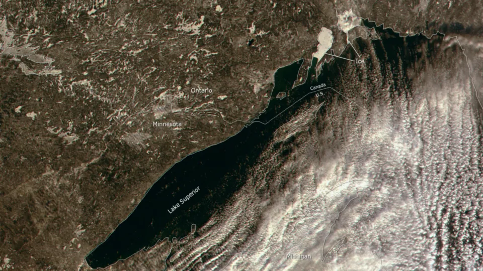
Winter Brings Ice to Great Lakes
From NOAA's Environmental Visualization Laboratory:
Winter has come to the Great Lakes, and with it, the National Ice Center has begun its daily analysis of the ice extent to help ensure safe transportation and accurate weather prediction. This 250 meter resolution image, taken by the NASA MODIS satellite sensor on January 2, 2012, shows ice forming in the upper bays of Lake Superior. From December until late May of each year, the National Ice Center produces daily analyses of Great Lakes ice coverage using high resolution satellite data.
TOPICS

LATEST ARTICLES
