What's Keeping Europe So Cold & Snowy?
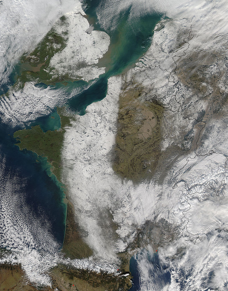
While much of the United States has been left wondering, "Where's winter?," Europeans have been shivering under a blanket of cold air that has sent temperatures plummeting and snows drifting.
The climate pattern is called a "Russian Winter" because the intense cold and snow is triggered by a strong Siberian anticyclone hovering over northern Russia, according to a NASA statement.
In the coldest parts of the year, when the intense cooling of the surface layers of air over northeastern Siberia occurs, the time is right for the formation of a Siberian anticyclone. Also called a Siberian high, it is a semi-permanent system of high atmospheric pressure centered in northeastern Siberia. The Siberian anticyclone is one of the principal sources of polar air masses, and outbreaks of polar air westward from the high-pressure area can cause severe cold spells in the European continent.
Earlier this month a strong such anticyclone formed, and with a low pressure system over Greenland, it worked to push frigid temperatures across Europe . On Feb. 10, CNN reported that 22 countries had posted warnings for extreme cold temperatures and accumulating snow.
The Moderate Resolution Imaging Spectroradiometer (MODIS) aboard NASA's Aqua satellite captured the above true-color image the snow over France and the United Kingdom on Feb. 11.
The cold has reached as far south as Algeria, bringing a rare snowfall. Even Venice's famous canals froze , a rare feat.
Sign up for the Live Science daily newsletter now
Get the world’s most fascinating discoveries delivered straight to your inbox.
