Most Rainfall in Smoky Mountains Comes As Mist

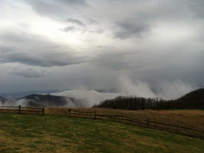
The shroud that envelopes the Great Smoky Mountains isn't actually smoke, it's a mist of water droplets that provides significant amounts of water to the area. Scientists didn't understand how significant a source of water this "light rainfall" was until a recent survey was conducted in the area.
The study has implications for understanding the area's watershed and how it might be affected by climate change.
People are often unaware that the Smokies have the highest annual rainfall in the southeastern United States, about 58 to 60 inches (147 to 152 centimeters), greater even than Florida's Everglades, which sees about 54 inches (137 cm) a year. But most of this rain is barely perceptible, misting rain, the new study has found.
"There's always a little bit of fog and low-level clouds and there's always a little bit of rain," said Ana Barros, an engineer at Duke University, who led the study of the Smokies' rainfall.
Barros, as part of the science team of NASA's Precipitation Measurement Missions that measure rainfall from space, trekked into the southern Appalachians to get better measurements of the light rainfall, which is difficult to characterize with satellites alone.
Beginning in 2007, Barros and her team installed a network of 32 science-grade rain gauge stations throughout the region, all above 3,280 feet (1,000 meters); before her work there were only 10 such gauges, and little detailed knowledge about local rainfall. At the same time Barros downloaded space-based precipitation measurements. By collecting data from the sky and ground, she was able to produce more accurate recordings than ever before.
Barros’ research shows that light rainfall is the dominant form of precipitation in the region, accounting for 50 to 60 percent of a year's total, governing the regional water cycle. By falling slowly and persistently, the rainfall infiltrates soil layers, percolating deeper than sudden rain events, recharging underground aquifers.
Sign up for the Live Science daily newsletter now
Get the world’s most fascinating discoveries delivered straight to your inbox.
Her team’s findings broaden scientists' understanding of the hydrology and climate of the southern Appalachian headwaters, which is the water supply for the nearly 30 million people in Georgia, Tennessee and the Carolinas.
The results suggest the area may be more susceptible to climate change than thought; as temperatures rise, more of the fine droplets from light rain will evaporate in the air and fail to reach the ground. Lower elevations will have to contend with not only higher temperatures, but less cloud cover, Barros said.
Follow OurAmazingPlanet for the latest in Earth science and exploration news on Twitter @OAPlanet and on Facebook.


