Intensifying Hurricanes Have a Need for Speed
Forecasts of the ups and downs of a hurricane's intensity are much less accurate than predictions of its most likely path, with potentially tragic results. But intensity predictions might improve through a better understanding of how wind and water interact, helping to avert disaster, researchers say.
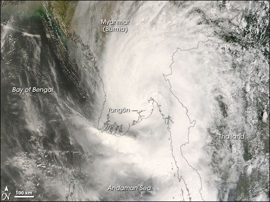
An example of the difference an accurate intensity prediction can make can be seen from a cyclone that was one of the worst ever in the North Indian Ocean and the second deadliest cyclone on record. (Cyclone is another name for a hurricane.)
"Cyclone Nargis hit Myanmar on May 2, 2008, and caused over 138,000 fatalities. Nargis made landfall with sustained winds of about 135 mph (217 kilometers per hour), while it was forecasted to have maximum winds of about 90 mph (145 kph)," said researcher Claudia Pasquero, a climate scientist at the University of Milan-Bicocca in Italy. "The death toll could probably have been much lower if the maximum intensity had not been under-predicted and warnings had not been downplayed."
Large vs. small-scale
The reason forecasts of a hurricane's path are more predictable is because it depends on relatively well-known large-scale wind patterns. However, the storm's intensity depends on small-scale atmospheric and oceanic properties, such as how the winds, air temperature and moisture vary with height — local factors that are difficult to predict, said researcher Wei Mei, a climate scientist at the University of California, Irvine.
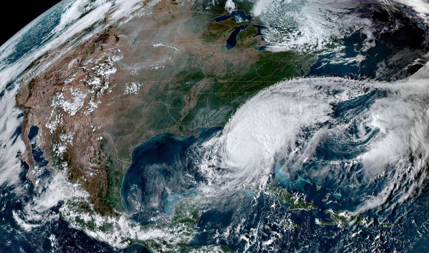
Now, drawing on 40 years of hurricane records representing 3,090 different storms from around the globe, researchers suggest the hurricane intensity is closely linked with the speed at which the hurricane travels forward, its "translation speed."
Hurricanes maintain their intensity by drawing energy from persistent sources of warm water. However, strong winds make the surface ocean turbulent, bringing cold water up from below that can disrupt this flow of energy. As such, the researchers suggest that slow-moving hurricanes have a high chance of weakening in intensity while fast-moving hurricanes are likely to become very intense, Mei told OurAmazingPlanet. A fast-moving storm passes over a given spot before the cold water can have a weakening effect.
Sign up for the Live Science daily newsletter now
Get the world’s most fascinating discoveries delivered straight to your inbox.
The scientists project that for a hurricane of a given intensity, there is a minimum translation speed above which it can sustain or rise in intensity and below which it will begin to wane. For instance, if a Category 4 hurricane with surface winds of 130 to 156 mph (209 to 251 kph) were to intensify to a category Category 5 hurricane with winds above 157 mph (252 kph), it must have a translation speed of at least 7.6 mph (12.3 kph).
More hurricane hunting needed
To learn more about hurricane behavior, more extensive data is needed on the inner structure of these storms.
"We need more reconnaissance flights directly across tropical cyclones, such as done by the 'hurricane hunters' of the Department of Defense, and microwave sensors on geostationary satellites, which are currently under development," Pasquero told OurAmazingPlanet. [Images: Hurricane Hunters in Action]
Knowledge of the physical characteristics of the water under hurricanes would help understand their development as well.
"Unfortunately, this kind of data is currently unavailable, as clouds and heavy rains associated with hurricanes severely limit the capabilities of satellites to gather that info," Pasquero said.
The scientists detailed their findings online April 5 in the journal Geophysical Research Letters.
Follow OurAmazingPlanet for the latest in Earth science and exploration news on Twitter @OAPlanet and on Facebook.

