Earth from Space: River Snakes Through Amazon Rainforest

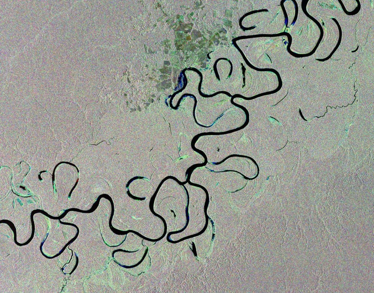
The Juruá River snakes slowly through the half-flooded Amazon rainforest in western Brazil, leaving free-standing oxbow lakes in its wake, which form when a river changes course as it meanders through a floodplain.
The Juruá is the most winding river in the Amazon basin and one of the Amazon River's longest tributaries, exceeding 2,040 miles (3,283 kilometers) in length. Tropical rainforests have some of the largest rivers in the world because of the tremendous amount of precipitation their watersheds receive.
Given its size, remote sensing is the best way to study the Amazon Basin on a large scale — especially for assessing the extent and damage due to deforestation.
This image is a compilation of three images taken by the Envisat satellite on January 2, February 1 and March 3, 2012. The individual images are each assigned a color — red, green and blue — and when combined, reveal changes in the surface between the satellite's passes.
Satellite radar data can be manipulated to map forest height, 3D forest structure and their changes due to natural or man-made disturbances from deforestation.
Since forests assist in removing carbon dioxide from the atmosphere, this could prove to be an important tool for assessing carbon stocks and monitoring our planet's resources.
Following ten years of service, Envisat stopped sending data to Earth on April 8 and after attempts to re-establish contact, the mission was declared over by the European Space Agency.
Sign up for the Live Science daily newsletter now
Get the world’s most fascinating discoveries delivered straight to your inbox.
Follow OurAmazingPlanet for the latest in Earth science and exploration news on Twitter @OAPlanet. We're also on Facebook and Google+.


