Sizzling Summer Heat Breaks Records Across US

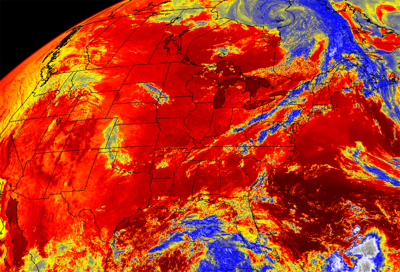
The blast of scorching summer heat hitting the eastern half and southwest regions of the United States has broken a rash of temperature records across the regions.
Yesterday (June 21), on the first full day of summer, high temperatures in states from Maine to New York to Arizona shattered previous record highs for the day, in a catalog that stretches back more than 100 years in some places.
Across the nation, the scalding heat broke a total of 47 record highs and tied 30 of them.
Two places in the Northeast and one in the Southwest experienced their hottest June day ever recorded. In Nantucket, Mass., the temperature soared to 92 degrees Fahrenheit (33 degrees Celsius), breaking the previous record high for the month of 90 F (32 C), set in June 1978.
In Virginia City, Nev., temperatures hit 96 degrees F (36 degrees C), breaking a 1966 record by 1 degree, and in New York's Adirondack region, the high was 94 degrees F (34 C), two degrees hotter than the previous record high for the month, set in 2005.
Six other places in Arizona, Massachusetts, New Jersey, New Mexico, Pennsylvania and West Virginia tied their previous June highs — and the month is not yet over.
Blame it on no rain
Sign up for the Live Science daily newsletter now
Get the world’s most fascinating discoveries delivered straight to your inbox.
Forecasters say some of the blame for the furnace-like conditions falls on two atmospheric conditions. [The World's Weirdest Weather]
The portion of the jet stream above the eastern half of the United States has veered into northern territory in recent days, lingering over southern Canada, said Kevin Witt, a meteorologist with the National Weather Service's Washington, D.C., office. And since the jet stream acts as an atmospheric fence, separating cool northern air from warm southern air, areas to the south of the jet stream are feeling the heat.
"The warm air is able to stay south of that jet stream," Witt told OurAmazingPlanet.
In addition, a high pressure systemin the eastern United States has kept storms and cloud cover at bay, he said, "and with the added sunshine, temperatures are going to soar."
And that high pressure system is centered offshore, off the coast of the Eastern Seaboard. "That is one of the other players," said Joe Pollina, a meteorologist with the New York City office of the National Weather Service.
Air flows clockwise around a high pressure system, Pollina said, which means southwesterly winds are pushing warm air from the Southeast toward the Northeast.
Record-breaking year
The record high early summer temperatures are adding to what has already been a record-breaking year for weather.
This spring — which federal agencies count as March, April and May — was the hottest spring on record for the contiguous United States in a catalog that stretches back to 1895.
In addition, the unseasonably warm season saw the largest departure above the average temperature for any season ever recorded. Spring 2012 was 5.2 F (2.8 C) warmer than the 20th-century average temperature for the season.
The winter of 1999 to 2000 is the runner-up for most unseasonably warm season, with temperatures that were 4.2 F (2.3 C) higher than the average.
Although the week's scalding conditions will likely fizzle out this coming weekend, forecasters say there is a good chance that for a majority of the continental United States, summer temperatures will be hotter than average.
It will take a little bit of time to tease out the significance of the current heat wave, Jake Crouch, a climatologist with the National Climatic Data Center in Asheville, N.C., said during a teleconference on Thursday (June 21).
"That's kind of like describing a car wreck while it's still in motion," Crouch said.
Reach Andrea Mustain at amustain@techmedianetwork.com. Follow her on Twitter @AndreaMustain. Follow OurAmazingPlanet for the latest in Earth science and exploration news on Twitter @OAPlanet. We're also on Facebook & Google+.


