Watch Earth Change with New Zoomable Google Earth Tool
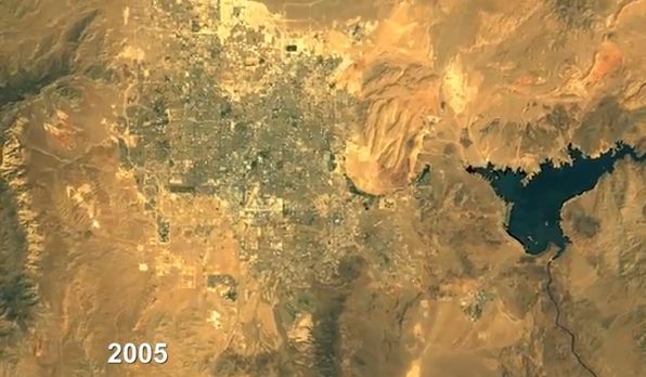
A new online tool allows people to access many of the images taken by NASA satellites over the last 13 years and to look at time-lapse videos of changes on the Earth's surface, such as deforestation and urban sprawl.
This new capability within the Google Earth Engine enhances the public's ability to view the massive amount of imagery collected by NASA's Landsat program between 1999 and 2011. Users can zoom in or out on any spot on the globe and move back and forth in time.
The new tool was created by Carnegie Mellon University, Google and the U.S. Geological Survey (USGS).
For the past 40 years, the Landsat program has continuously collected imagery of the Earth's surface and, since 2008, the USGS has made that imagery available free to the public. But accessing that data — measured in petabytes (there are 1 million gigabytes in a petabyte) — has long been cumbersome, according to a release from Carnegie Mellon University.
Now that 1.5 million of the images are stored in the Google Earth Engine, with more added every day, access is easier. Some of the videos have also been transformed into a set of seamless, "zoomable" videos easily accessible from a modern Web browser, according to the statement.
Carnegie Mellon scientist Randy Sargent said he predicts that the enhanced access to satellite imagery will help foster and ground public discussions regarding land use, urban sprawl, climate change and environmental policy. "You can continue to argue about why deforestation has happened, but you no longer will be able to argue whether it happened," he said in the statement.
Videos demonstrating how the time-lapse tool can be used to explore phenomena such as deforestation, urban growth and drying seas can be viewed at http://earthengine.google.org/#intro.
Sign up for the Live Science daily newsletter now
Get the world’s most fascinating discoveries delivered straight to your inbox.
Follow OurAmazingPlanet on Twitter @OAPlanet. We're also on Facebook and Google+.

