
Best Earth Images of the Week - Aug. 17, 2012
Get the world’s most fascinating discoveries delivered straight to your inbox.
You are now subscribed
Your newsletter sign-up was successful
Want to add more newsletters?
Join the club
Get full access to premium articles, exclusive features and a growing list of member rewards.
Aerial eruption
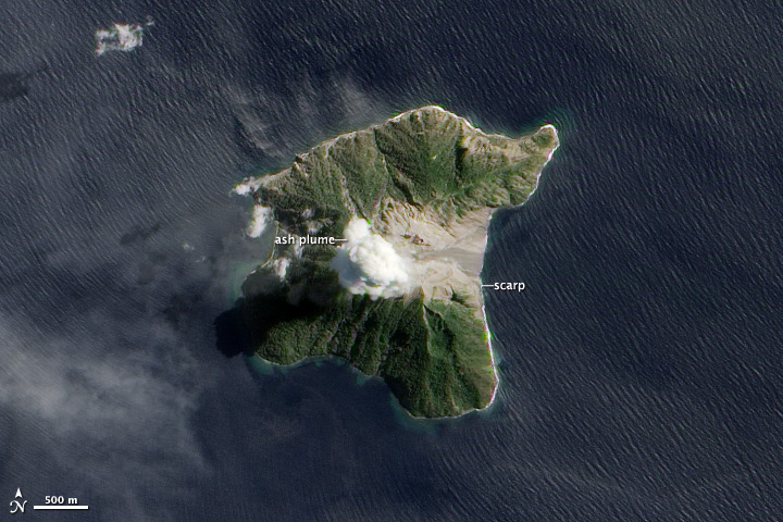
On Aug. 15, NASA's Earth Observing-1 (EO-1) satellite caught a crystal-clear image of a small ash plume emanating from a tiny volcanic Indonesian island.
The volcano, called Batu Tara, is located on the island of Pulau Komba, and has been experiencing frequent, mild eruptions since mid-2006, according to a NASA release.
[Full Story: Photo: Overhead View of a Volcano Eruption]
Fly away free
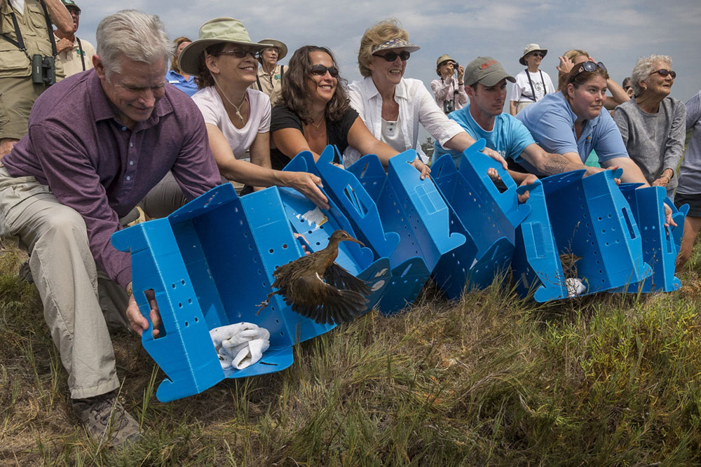
Seven of California's endangered light-footed clapper rails that were bred by the San Diego Zoo were released into the wild this week. The marsh birds added to a banner year for the species.
The seven birds were hatched at the San Diego Zoo Safari Park and Living Coast Discovery Center. They were released at the 915-acre San Elijo Lagoon Ecological Reserve on Aug. 16.
[Full Story: Photo: Endangered Birds Released Into Wild]
Ready, aim, rain again
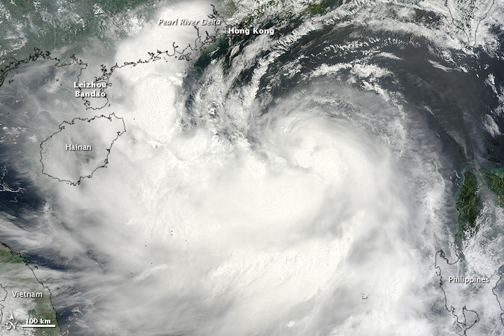
Typhoon Kai-tak, which strengthened from its former tropical storm status, was spotted by a NASA satellite today (Aug. 16) as it prepares to make landfall along the China-Vietnam border.
The typhoon is currently about 155 nautical miles south of Hong Kong and is moving to the west-northwest, which is expected to take it over China's Leizhou Bandao peninsula and northern Vietnam on Aug. 17 and 18, according to the U.S. Joint Typhoon Warning Center (JTWC).
[Full Story: Typhoon Takes Aim at China, Vietnam]
Saharan dust
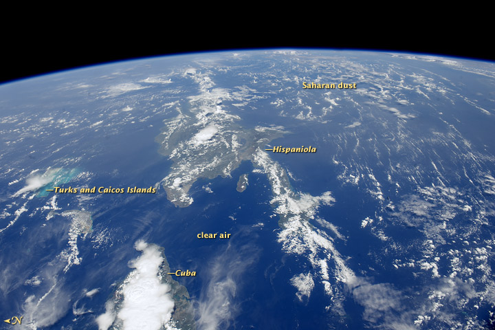
Astronauts sailing around the Earth aboard the International Space Station recently spotted a dull haze blanketing the skies over the Caribbean dust from Africa's vast Sahara Desert that had blown all the way across the Atlantic Ocean.
The dust likely originated some 5,000 miles (8,000 kilometers) to the east, in the dry reaches of northern Mali, according to NASA figures, although some satellite data suggest the dust can come from as far east as Chad or Sudan.
[Full Story: Astronaut Photo: Sahara Dust Enters Caribbean Skies]
What's up, doc?
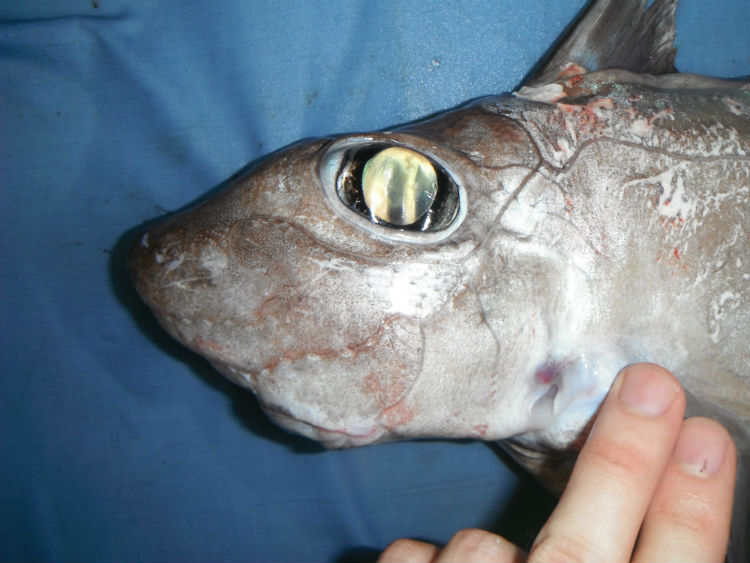
A ghost shark. In the place of teeth, the fish have wide bony plates, lending them a goofy mouth shape that resembles that of a bucktoothed rabbit.
[See More: Images: Weird Deep-Sea Sharks]
Batterd by wind
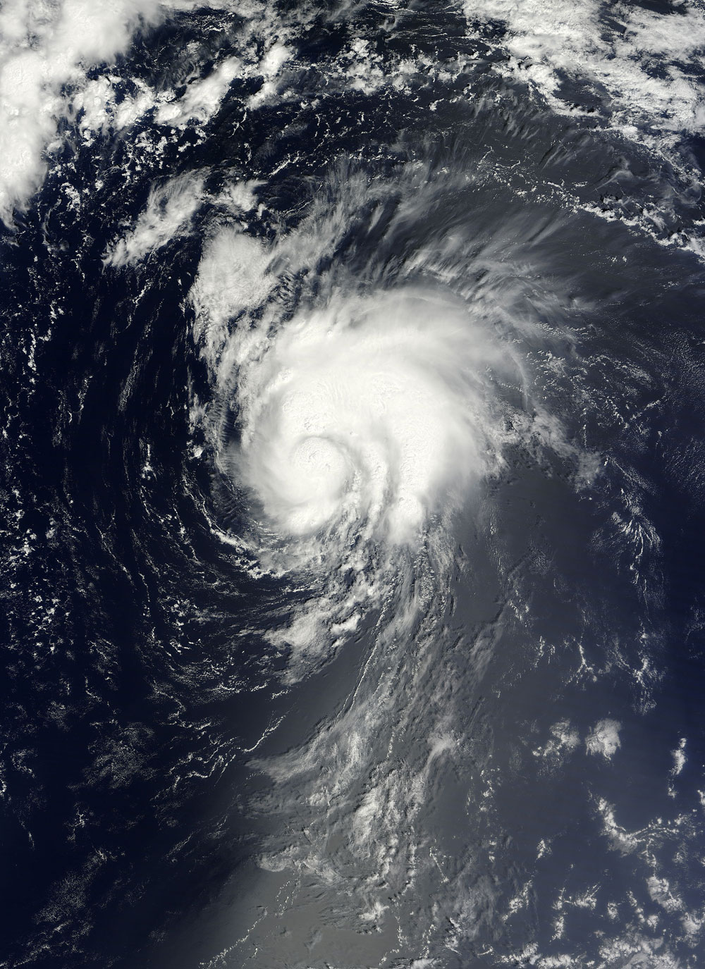
NASA's Terra satellite passed over Tropical Storm Gordon, the most recently formed storm of the 2012 Atlantic hurricane season, yesterday (Aug. 16) and saw that atmospheric wind patterns were battering the storm.
Gordon intensified into a tropical storm early yesterday morning and has strengthened since then. The latest update from the U.S. National Hurricane Center (NHC) put Gordon's maximum sustained winds at 65 mph (100 kph).
[Full Story: Satellite Spies Tropical Storm Gordon]
Get the world’s most fascinating discoveries delivered straight to your inbox.
 Live Science Plus


