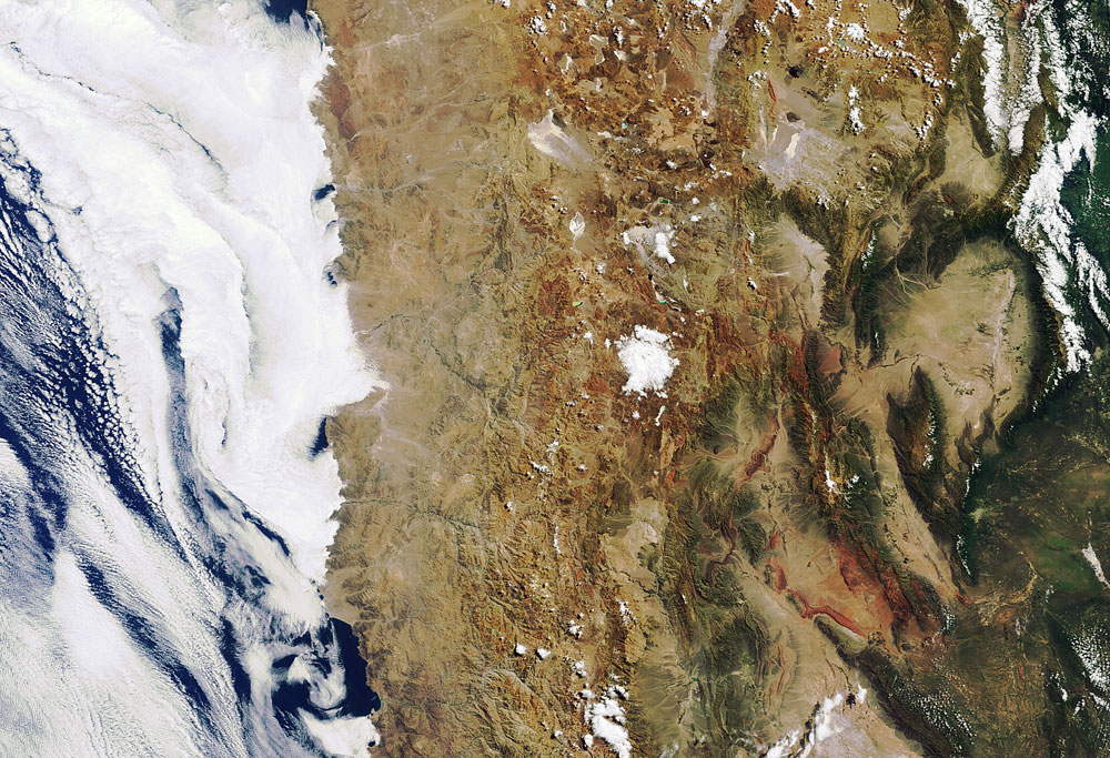
Earth from Above: The Arid Atacama

The dryness of South America's Atacama Desert stands in stark contrast to the moisture evident in the clouds over the Pacific Ocean just next door in image taken by the European Space Agency's (ESA) Envisat satellite on March 4.
The Atacama is one of the driest places on Earth, with parts of it receiving only 1 to 3 millimeters of precipitation per year. It is 50 times more arid than California's Death Valley.
The cold surface of the Pacific Ocean to the west of the desert cools off air masses, which leads to the formation of clouds and precipitation that rain out over the ocean. The Chilean Coast Range blocks the ocean clouds from reaching the desert. This phenomenon is common in several coastal areas such as the North American deserts of the southwestern United States and Mexico, or the Namib Desert on the west coast of southern Africa, according to an ESA statement.
On the other side of the Atacama lie the Andes Mountains, which are so high that they also block clouds that form over the Amazon basin.
The Atacama itself is a 600-mile-long (966 kilometers) plateau; its high elevation combined with its lack of cloud cover and light pollution makes it a prime astronomical observing spot. It is home to two major observatories: the La Silla Observatory and the Paranal Observatory, which includes the Very Large Telescope.
It is also used as an analog for Mars by those planning rover missions to the Red Planet and scientists studying how life might potentially survive under harsh Martian conditions.
The desert also has rich deposits minerals like copper, and is home to the world's largest natural supply of sodium nitrate, the ESA statement said.
Sign up for the Live Science daily newsletter now
Get the world’s most fascinating discoveries delivered straight to your inbox.


