How to Journey to the Center of the Earth

Nearly 150 years ago, Jules Verne published his second novel, A Journey to the Center of the Earth, one of the earliest works of science fiction. In Verne's world, explorers venture underground through an extinct Icelandic volcano armed with hodgepodge scientific and climbing tools, two rifles and two revolvers. After encountering exotic flora and fauna in the planet's bowels, they are shot back to the surface off the coast of Italy by the eruption of another volcano.
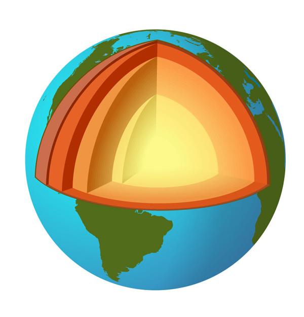
The reality of exploring under Earth's surface isn't so simple, says Damon Teagle, professor of geochemistry at the National Oceanography Center, University of Southampton. Teagle has worked on eight drilling projects worldwide, all of which have extended just miles into the Earth's uppermost layer, the crust. Those holes might sound deep, but they're nowhere near getting to the Earth's center , some 3,951 (on average) miles below the surface.
Teagle's next goal would be a world's first: to reach the mantle, the next layer down. He tells how it's done in just four steps.
Step 1. Pick a favorable region
The Earth's crust varies greatly in thickness. On land, it can extend nearly 40 miles (the deepest hole ever drilled into the crust stretches less than seven miles). On the seafloor, however, the crust is far thinner, at just four miles. So, if you want to improve your chances of reaching the mantle, starting your hole at sea gives you a head start. The ideal drilling region is free from anomalies such as fractured seafloor, volcanoes and seamounts (underwater mountains).
Drilling regions are also usually limited by crust temperature and water depth. The types of drills Teagle uses can't operate in water deeper than two and three-quarters miles or drill at temperatures greater than 575 degrees F, which means steering clear of deep ocean or hot mid-ocean ridges.
Step 2. Pick a good drill site
Sign up for the Live Science daily newsletter now
Get the world’s most fascinating discoveries delivered straight to your inbox.
After a potential region is located, Teagle's team looks for the best drill site using multi-channel seismometers, which help determine the structure of the crust, mantle and the boundary between them. Seismic waves travel through Earth's layers at different rates depending on their density and composition, and theses characteristics differ greatly from one layer to another.
Step 3. Drill, baby, drill
Now for the hard part. Drilling from the platform of a massive ship, which bobs up and down with the ocean's waves, requires GPS to keep the drill on track. The crust's rocky layers are incredibly hard, so the12-inch-diameter rotary-cone drills advance only about 3 feet each day and must be replaced every 60 hours. Some of the drill bits are hollow, in order to cut cylinders of rock for sampling, while others simply grind. Drilling can take one to two years, although Teagle calls this timeframe "optimistic."
Step 4. Take samples
Once Teagle's team reaches the mantle a feat that hasn't been attempted in half a century they'll start measuring the hole every which way they can in order to better understand Earth's geological, geophysical and geochemical history. Just a few potential experiments include: sending down seismic receivers while firing off shots in the surrounding water to more accurately measure the layers' composition, sampling fluids to look for signs of microbial life, and measuring fluid pressures to see how the crust and mantle move relative to each other.
Most would-be amateur crust drillers can't join an expedition like Teagle's, but if you're a teacher or graduate student, you might be in luck. The Integrated Ocean Drilling Program sends science teachers from kindergarten to the college level on drilling expeditions, and the Consortium for Ocean Leadership offers training programs for grad students to learn the trade.
Follow Life's Little Mysteries on Twitter @llmysteries, then join us on Facebook.


