Photos: Strange Structures in China's Gobi Desert
Intro
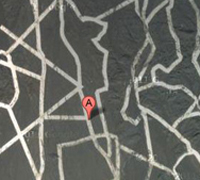
Newfound Google Maps images have revealed an array of mysterious structures and patterns etched into the surface of China's Gobi Desert. Rather than street maps of major American cities, or messages to (or from) aliens, as some media outlets have suggested, experts say they are most likely used by China's spy and radar satellites.
Click ahead to see the strange structures several of which were discovered by Gizmodo.com's readers that have set off all the speculation, with analysis by Jonathon Hill, a research technician at the Mars Space Flight Facility at Arizona State University, who works with images of the Martian surface taken by rovers and satellites, as well as data from Earth-orbiting NASA instruments.
Side 2
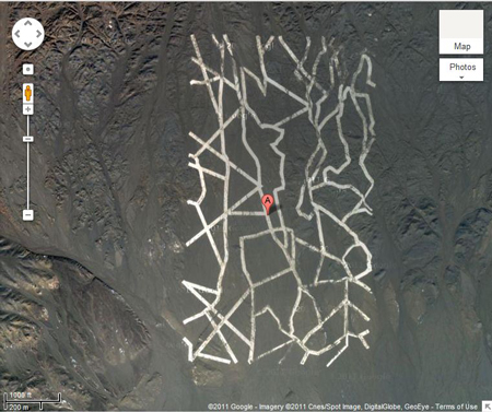
This strange grid of randomly zigzagging white lines, which are probably painted onto the land surface, is most likely used to calibrate China's spy satellites, Hill said. Satellite cameras focus on the grid, which measures approximately 0.65 miles wide by 1.15 miles long, and use it to orient themselves in space.
To view the original Google Maps data, click here.
Side 3
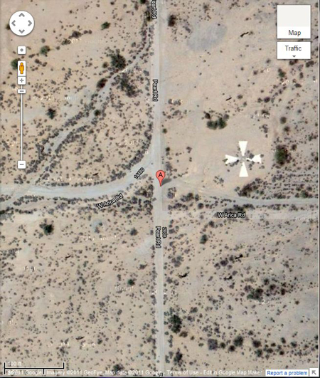
The white cross, located in Casa Grande, Ariz., was created in the 1960s and used by the United States military to calibrate its Corona spy satellites. The calibration targets that have recently been found in China's Gobi Desert are used in the same way this one was, Hill told Life's Little Mysteries.
To view the original Google Maps data, click here.
Side 4
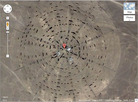
This Stonehenge-like arrangement of objects radiating outward, with fighter jets at its center, is almost certainly a calibration/test target for orbital radar instruments, Hill said. The bumps in the terrain around the planes scatter radar away from the area, partially masking the planes. By testing radar return from this structure using radar instruments flying overhead, Chinese radar experts can learn how best to hide China's military operations from other countries' spy satellites. However, the fact that the planes are made out of metal will increase their radar return and make it very hard to completely mask them.
To view the original Google Maps data, click here.
Side 5
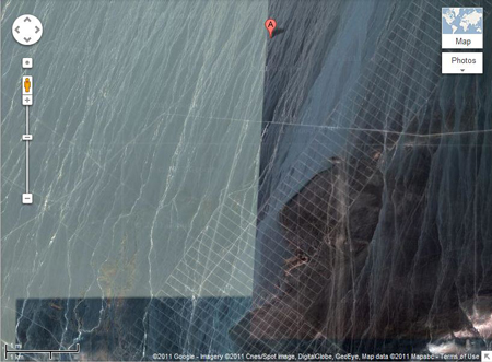
According to Hill, this is most likely some sort of Yagi antennae array. The grid may in fact be a series of roads they've constructed to build and maintain the array, which is constructed of towers and wires, which are too small and thin to be seen without a higher resolution image. This is probably comparable to the SHARE antenna in Antarctica, Hill said.
Antenna arrays like this can be used for a huge number of things such as weather tracking, space weather tracking and high-altitude atmospheric research all of which are interesting to militaries.
To view the original Google Maps data, click here.
Side 6
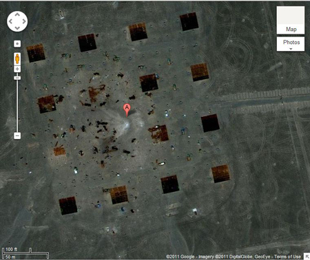
According to Hill, this is almost certainly a weapons test area, though just what is being tested is unclear. Almost exactly at the center is a large mark with lines radiating to the west, suggesting a small bomb was dropped as the carrier plane was flying east-to-west, which is why the explosion is asymmetrical. The squares might be small replica houses, barns or hangers, but it's hard to tell since they're so dark.
The two closest to the explosion mark (to the west of it) are the most heavily damaged, which is what you would expect, since the bomb would explode asymmetrically when it hit, releasing more energy in the direction of travel. Also notice that away from the blast mark, you see a very precise grid of small objects in-between the squares and even extending past them; these are probably pressure measurement stations. Pressure measurements, especially in an organized grid like this, are really useful when comparing the predicted yield of an explosive device to the actual yield.
To view the original Google Maps data, click here.
Sign up for the Live Science daily newsletter now
Get the world’s most fascinating discoveries delivered straight to your inbox.

