This Was the Coldest Spring Since 1996
This year's spring seemed more like a never-ending winter for much of the country, and it wasn't just in their imaginations. The chilly weather was the coldest spring since 1996, the National Climate Data Center (NCDC) said today (June 13).
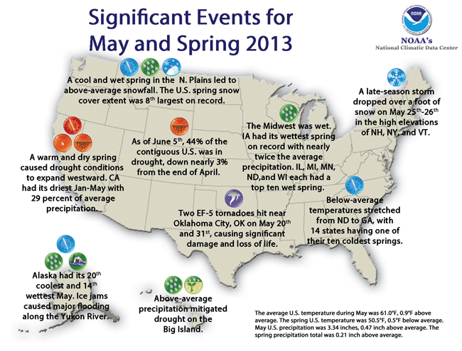
Fourteen states east of the Rockies had spring temperatures that ranked among their 10 lowest since record-keeping started more than 100 years ago. In Alaska, residents of Galena were evacuated in May after lower-than-normal spring temperatures slowed the annual melting of Yukon River ice, causing an ice jam that flooded the town.
The low temperatures also meant fewer tornadoes than average struck in May. However, two devastating EF-5 tornadoes plowed through towns in Oklahoma. The powerful twisters, one of which was the widest ever recorded, killed more than 20 people and destroyed thousands of homes and businesses. "We saw some very high impact tornado situations, but it's been a very slow spring compared to the last decade," said Deke Arndt, chief of the climate monitoring branch at the NCDC.
Jet stream shifts
Shifts in the jet stream, partly seasonal and partly caused by high-latitude weather systems, were responsible for the unusual spring chill, according to the NCDC. The jet stream pattern brought cold Arctic air to the Midwest and East.
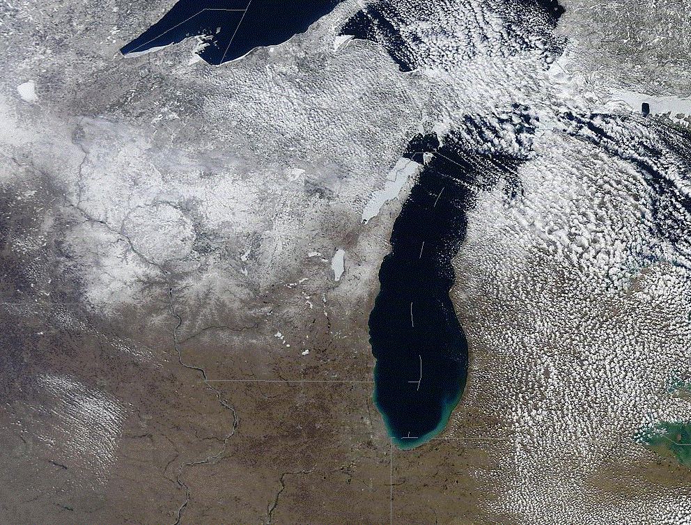
The chilly season followed a string of warmer-than-normal springs, part of the natural variation expected as the climate warms, Arndt said. "We won't stop having colder-than-normal episodes even as the world continues to warm," Arndt told LiveScience.
Even though this spring was significantly colder than previous years, overall, the year-to-date average national temperature of 43.6 degrees Fahrenheit (6.4 degrees Celsius) was 0.2 F (0.3 C) above the 20th-century average, the NCDC report said.
Sign up for the Live Science daily newsletter now
Get the world’s most fascinating discoveries delivered straight to your inbox.
Plains drought improves, West still parched
Snow and rain soaked the Plains this spring, taking the edge off a lingering drought. Iowa had its wettest spring on record, with 8.84 inches (22.45 centimeters) of precipitation, according to the NCDC report. Above-average precipitation in May also contributed to flooding along several major rivers in the Midwest, including the Mississippi River and the Illinois River, the NCDC said.
But the cold and wet spring stopped west of the Rockies. Drought continues to parch the West, where it was warm and dry from January through May. California saw only 29 percent of its average precipitation for January through May, the report said. Areas of extreme drought increased in southeastern Colorado and New Mexico. [Dry and Drying: Images of Drought]
"This is still a big drought event, and it's likely going to be one of the major weather and climate stories of 2013," Arndt said. "It's going to continue to present major problems this year."
Email Becky Oskin or follow her @beckyoskin. Follow us @livescience, Facebook & Google+. Original article on LiveScience.com.

