India's Severe Floods Spied by Satellite

An Earth-observing NASA satellite has captured images of northern India's devastating floods that have left hundreds of people dead this month.
India's seasonal monsoon kicked off with unusual intensity in the state of Uttarakhand, which borders Tibet and Nepal. From June 13 to June 19, an average of 12.68 inches (322 mm) of rain was dumped on the state, far more than the typical 1.34 inches (34 millimeters) of rainfall for this period, AccuWeather reported.
The inundation has triggered flash floods and landslides that have swept away homes, bridges and even entire villages. While rescue operations are underway to save thousands of people stranded by the flooding, Indian officials said they expect the death toll to pass 1,000 as the heavy rain continues, the BBC reported.

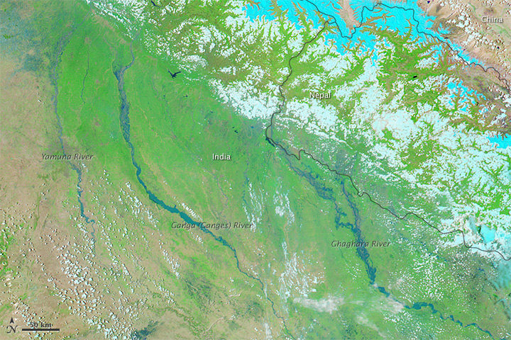
The Moderate Resolution Imaging Spectroradiometer (MODIS) aboard NASA's Aqua satellite observed the region from space on June 21, 2013, with the floodwaters shown in dark blue and vegetation in bright green.
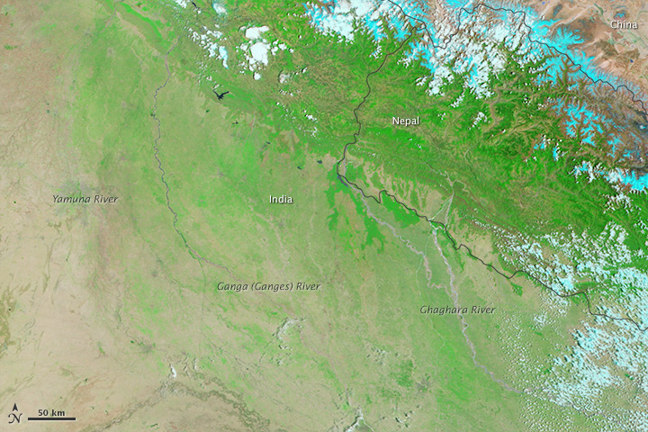
An image from the same area obtained on May 30, 2013, shows just how much the Yamuna, Ganges and Ghaghara Rivers have spilled over in recent weeks.
The images combine visible and infrared light to throw the water and land into greater contrast, according to NASA's Earth Observatory. Himalayan glacier ice and snow can be traced in the pale blue to cyan veins in the top right corner of the images, while the light blue-green flecks in the lower left corner represent clouds.
Aqua was launched on May 4, 2002, and it carries six instruments to collect data on Earth's water cycle, including evaporation from oceans, clouds, precipitation, sea ice and snow cover.
Sign up for the Live Science daily newsletter now
Get the world’s most fascinating discoveries delivered straight to your inbox.
Follow Megan Gannon on Twitter and Google+. Follow us @livescience, Facebook & Google+. Original article on Live Science.


