What An Ancient Lake Reveals at Its Core
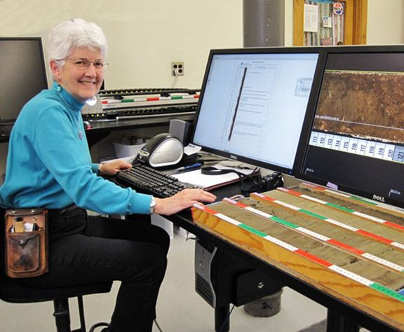
Kay Behrensmeyer is a curator of vertebrate paleontology at the Smithsonian National Museum of Natural History. This article was adapted from her post on the blog Digging the Fossil Record: Paleobiology at the Smithsonian, where this article first ran before appearing in LiveScience's Expert Voices: Op-Ed & Insights.
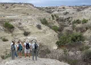
Fieldwork has been a major focus of my career as a paleobiologist and geologist. I really like being outdoors in the field and in exotic places, and I especially like walking over rocky outcrops looking for fossils and deciphering the geology and ancient environments from evidence in piled-up layers of rock.
When my colleague Rick Potts organized a core-drilling project in one of my favorite field areas in southern Kenya, Olorgesailie (a local Maasai name pronounced "O-lorg-eh-sigh-lee"), I was very curious about how that would compare with field research. I didn’t know whether I would like spending time in a laboratory examining a narrow, plastic-packaged core of rock .
After eight intensive days working on the core with a team of 17 other people, I can say that I do like it and, more than that, I am amazed at how much information is contained in our tiny vertical sample from an ancient lake basin.
Our group did the core analysis in the LacCore Laboratory at the University of Minnesota, Minneapolis. Every day, from dawn until dusk, we worked on core splitting, photography, description and sampling — centimeter by centimeter — over a total of 531 feet (162 meters).
Each core section is about 4.9 feet (1.5 m) long, and the lab has trays that hold four of these sections at a time. We typed all the descriptive data into a special standardized data sheet with a picture of the core, so we could match what we were seeing on the tray with the image on the sheet and on three big computer screens in front of us. Sometimes the high resolution photograph was more revealing than the actual core surface.
What did we find out? Before the drilling, we didn’t know what was under the flat, grassy plain in this part of the East African Rift Valley — and we discovered an extinct lake! The layers in the core are very well-preserved and show many periods with volcanic eruptions alternating with quiet lake phases and dry periods when the water receded and soil developed.
Sign up for the Live Science daily newsletter now
Get the world’s most fascinating discoveries delivered straight to your inbox.
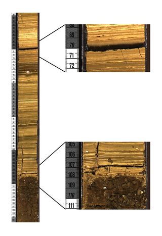
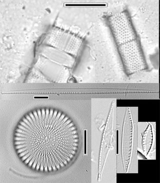
Thin, horizontal stripes in the core, called laminae, formed when diatoms (a type of algae with hard cell walls made of silica) settled on the lake bottom, alternating with layers of clay and volcanic ash. Those features are good evidence that a deep, fairly large lake once existed in that area of Olorgesailie.
We can analyze volcanic ash, brought into the lake by wind, using the technique of radiometric dating, so it will be possible to measure how long ago each ash layer was deposited. The ash bands may also help to align the core with others drilled at different locations since ash from volcanic eruptions tends to settle over wide areas.
The section of the core shown here (see the enlargement in the lower right of the image) also revealed where banded lake deposits have a well-defined contact on top of an ancient clay-rich soil. The water level must have risen quickly to make such a sharp transition from land to lake.
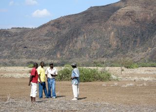
It will take years of work to understand what this core's record means and how old the sediments are. Our research team thinks the core record will overlap in time with sediments 6.2 to 12.4 miles (10 to 20 kilometers) to the north that have many artifacts and fossils, some of which are associated with Homo erectus, an ancestor of modern humans. Using radiometric methods, researchers have dated those sediments to between 10,000 and 1.2 million years ago, and this northern area is where I have done a lot of "outcrop" geology over the past several decades.
There are missing parts of the geological record in the strata north of the core site because geologic faulting in the basin caused uplift and erosion there. The eroded sediments had to go somewhere, and our team suspects that they were carried by streams into the basin where we drilled the core. This means that information about ancient climate cycles that is missing in the north may be preserved in the south, and that is what we are hoping to find.
The ultimate goal is to piece together a relatively complete record of environmental change (e.g., wet versus dry periods) so that we can better understand how early humans adapted to changing climate.
Read a short profile of Kay Behrensmeyer and learn more about the Olorgesailie Drilling Project on the Smithsonian Human Origins website.
The views expressed are those of the author and do not necessarily reflect the views of the publisher. This article was originally published as From the Field: Core Exercises #3 on the blog Digging the Fossil Record: Paleobiology at the Smithsonian.
