The Colorado Plateau: A Geological Wonderland
The Colorado Plateau
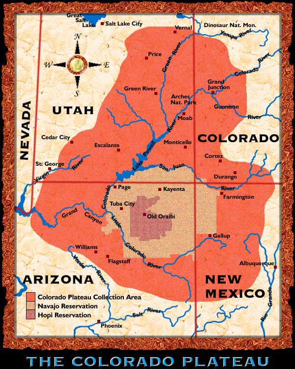
The Colorado Plateau is a geological wonderland that encompasses 130,000 square miles (337,000 square kilometers) centered around the Four Corners area of the American West and within the states of Colorado, New Mexico, Arizona and Utah. It ranges in elevation from slightly over 2,000 feet (600 meters) along the Colorado River in the Grand Canyon to over 12,000 feet (3,660 meters) in the Henry and La Sal Mountains of southeastern Utah. More than 90 percent of the plateau lands are drained by the Colorado River and its major tributaries, the Little Colorado, the San Juan and the Green rivers.
The landscape
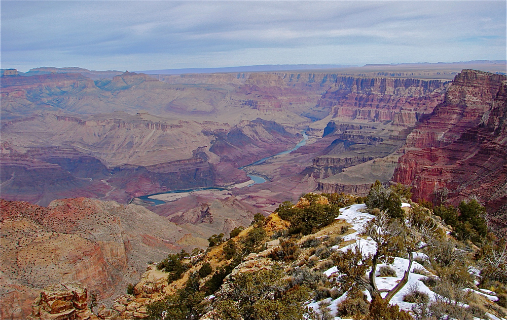
This land is characterized by high mountains, rugged, eroded plateaus, river gorges, volcanic peaks, sandstone arches, spires and hoodoos and includes the splendor of the Grand Canyon. It is the most untamed landscape of the lower 48 states. It is also home to the largest cluster of national parks (10) and national monuments (17) found anywhere in the world. Ten Native American tribes claim the Colorado Plateau as their homeland and share the arid region with a multitude of unique and scarce high desert plants and animals.
An ancient area
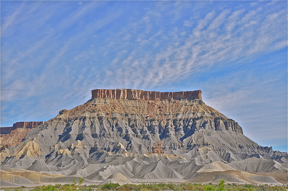
The Colorado Plateau is extremely old — at least 500 million years and possibly older. It is a well-defined, thick mass of continental crust that has remained intact and avoided the common rock reformation (folding and faulting) that affects much of the rest of the planet. While the Western lands surrounding it were being broken and bent, stretched and uplifted, the Colorado Plateau amazingly remained unbroken.
Transition zone
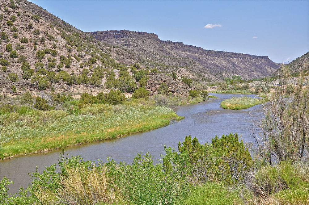
The western boundary of the Colorado Plateau is marked by a large transition zone of common plateau geology and common Basin and Range Province. The northern boundary ends at the Uinta Mountains of Utah and the Rocky Mountains of Colorado. The Rio Grande Rift Valley of New Mexico, shown above in the Rio Grande Gorge, defines the eastern boundary and the Mogollon Rim of central and eastern Arizona marks the southern boundary. At the margins of the Colorado Plateau, major ancient volcanic fields are found.
Six contrasting sections
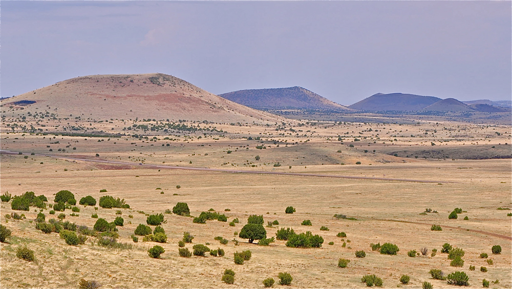
The Colorado Plateau has been divided into six, contrasting sections. The Datil section is located in eastern Arizona and western New Mexico and is mainly volcanic in origin. Here is found the Springerville Volcanic Field, an area of 1,160 square miles (3,000 square kilometers) with more than 400 dormant volcanic vents. The Springerville Volcanic Field, shown above, is third largest volcanic field in the continental United States.
The Grand Canyon
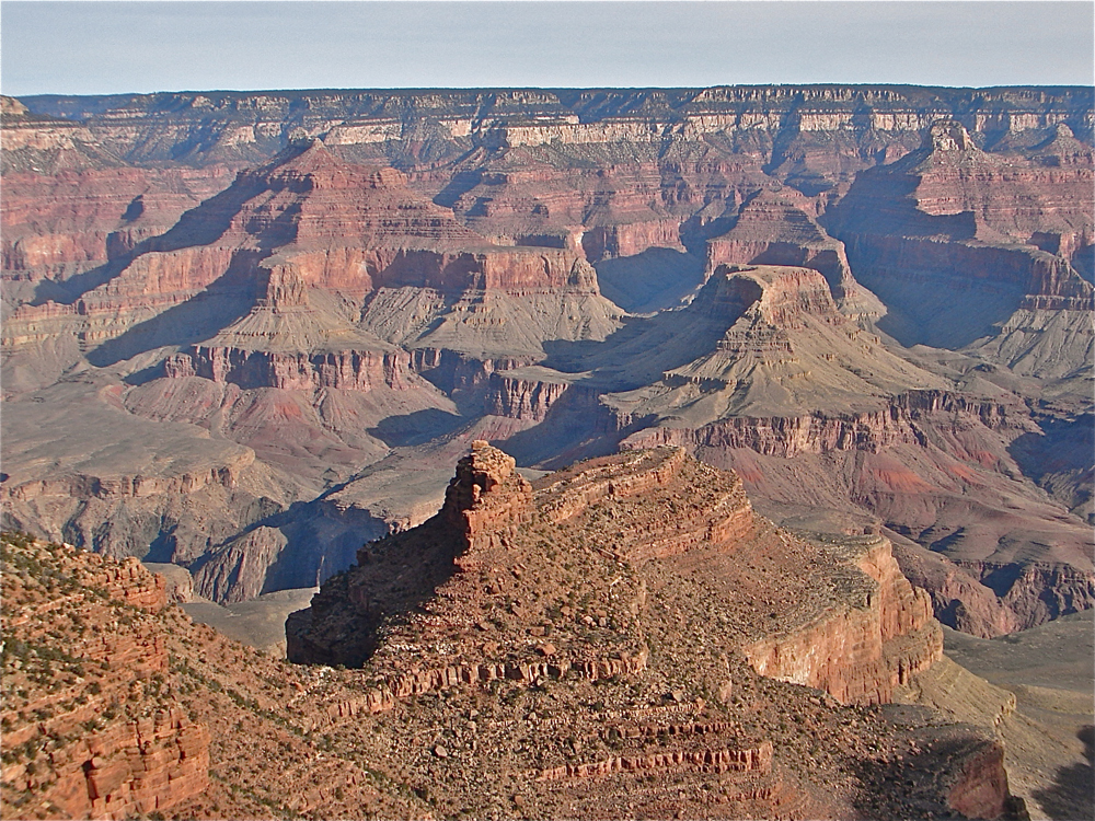
The Grand Canyon section is located in the southwestern and western edge of the Colorado Plateau. It is home, as its name suggests, to the magnificent Grand Canyon. Along the southeastern part of this section is found the San Francisco Volcanic Field, the largest volcanic field in the continental United States, with more than 600 ancient volcanic vents. The last volcanic eruption in this field occurred in 1064-1065 at Sunset Crater, near Flagstaff, Ariz.
The High Plateau
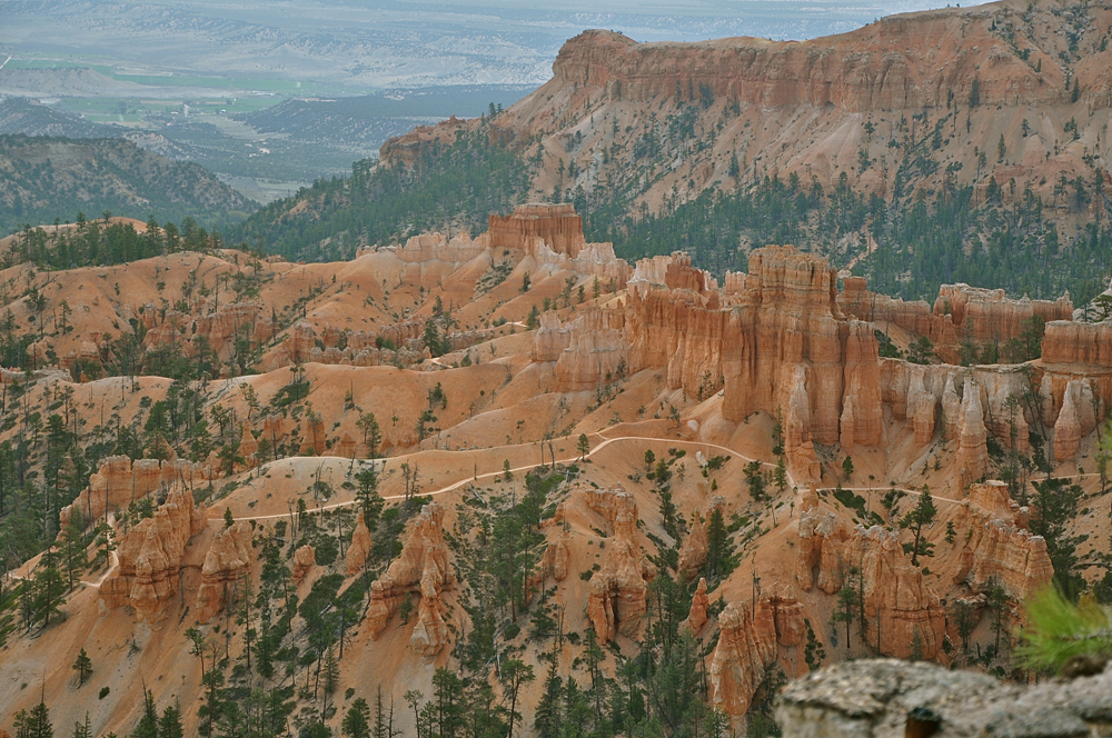
The High Plateau section is located along the western and northwestern part of the Colorado Plateau. It is characterized by large plateaus separated by local faults. This section is home to the incredible geological formations of Zion and Bryce Canyon National Parks. The picture above shows a hiking trail passing through Bryce Canyon.
Sign up for the Live Science daily newsletter now
Get the world’s most fascinating discoveries delivered straight to your inbox.
The Uinta Basin
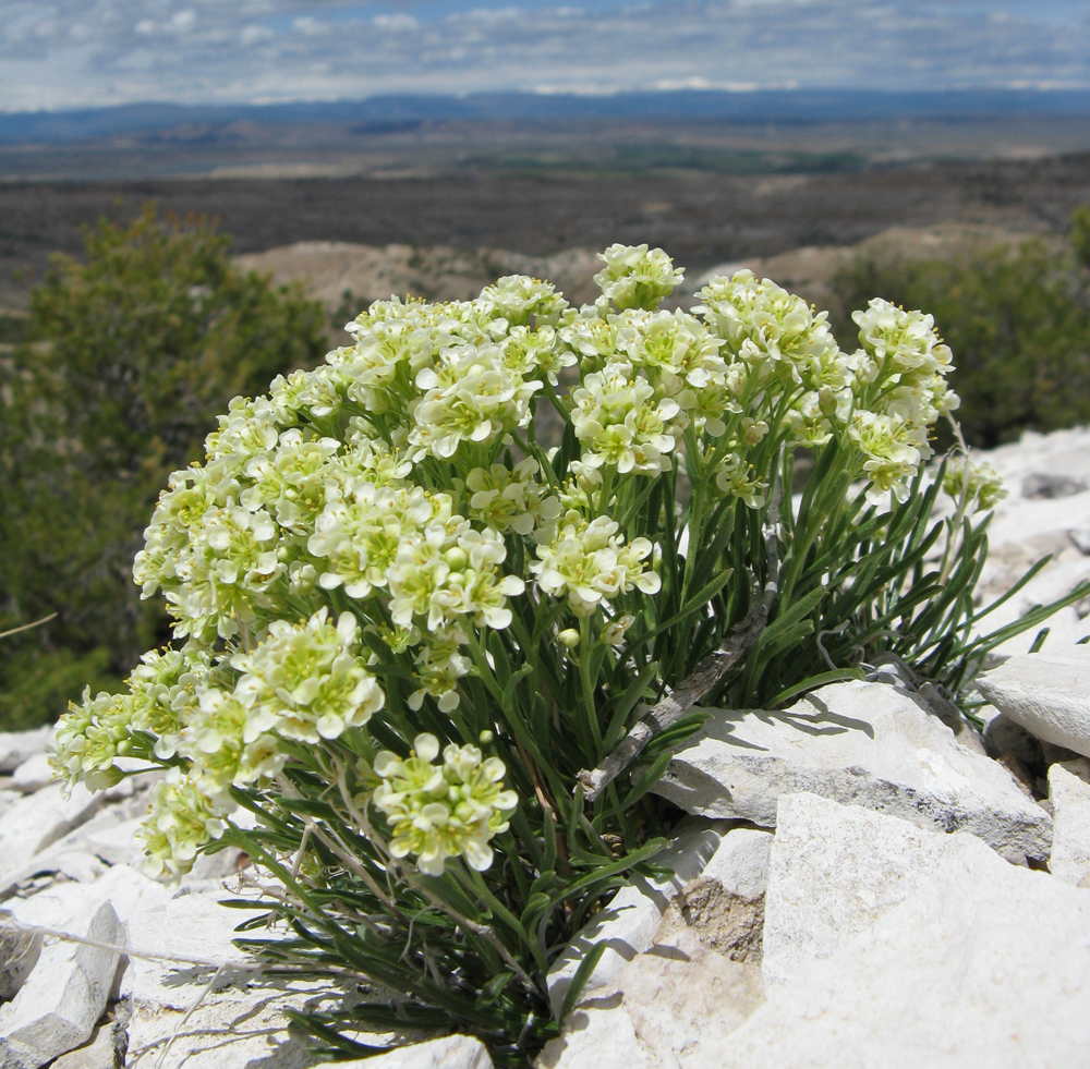
The Uinta Basin is found in the northernmost part of the Colorado Plateau and is the lowest part of the great plateau. Many of the smaller tributaries of the Green River have their origin here in the Uinta Mountains. The great Spanish explorer, Father Silvestre Velez de Escalante, first visited this area in September 1776. The photo above is of the rare and endangered Barneby Ridge Cress (Lepidium barnebyanum) found only in the Uinta Basin.
The Canyonlands
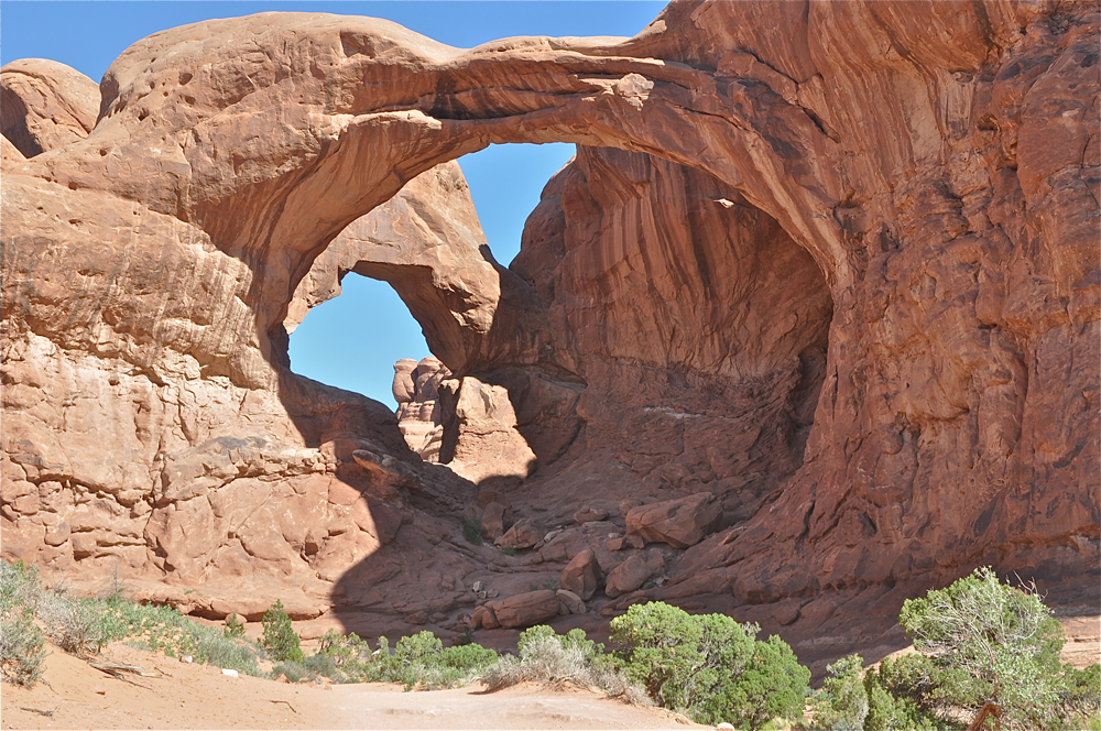
The Canyonlands section is located in the northeastern part of the Colorado Plateau and is home to deeply cut canyons in a high desert environment. The landscape has been shaped and carved by the drainage systems of both the Green and Colorado Rivers. This is a land of spectacular vistas and home to both Canyonlands and Arches National Park. The photo above is of the formation known as Double Arch.
The Navajo
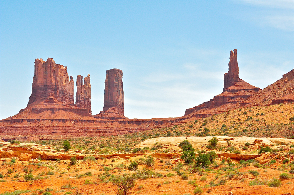
The Navajo section of the Colorado Plateau is home to the Four Corners area of the American Southwest. It is the central area of the Colorado Plateau, with landscapes of high plateaus separated by arid, high desert valleys. Many national monuments like Canyon de Chelley and Navajo Tribal Parks like Lake Powell and Monument Valley, shown above, are located in this dramatic section of the Colorado Plateau.
Deep canyons
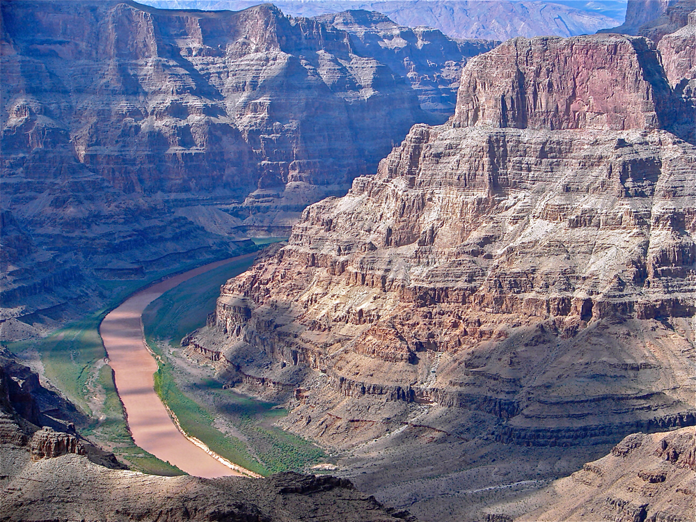
Because of the eroding effect of the rivers that crisscross the Colorado Plateau, the many deep canyons found here are like an open textbook of geological time. Precambrian metamorphosed gneiss and schist lie exposed at the bottom of the Grand Canyon and are thought to be over 1,600 million years. The brilliant colors of the thick layers of sandstone and limestone sedimentary rocks resulted from the 380 million to 145 million-year-old ancient seas of the Permian.


