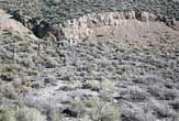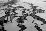
This planet never rests; even decades after major shaking, the ghosts of earthquakes past continue to stretch and tweak the surface.
A new study finds that a portion of the Earth's crust in central Nevada is still quietly reeling from a series of temblors that struck more than 50 years ago.
Between 1915 and 1954, four large events with magnitudes ranging from 6.8 to 7.6 struck an earthquake-prone region of central Nevada. Using satellite data, researchers showed that the ground is still shifting and rising as it searches for a state of equilibrium.
Post-seismic relaxation
When a large earthquake strikes, it can deform the Earth's mantle, the planet's middle layer between the crust and core, to depths of more than 20 miles. Over a time span that can range from weeks to decades, these deformations will eventually smooth out through a process known as "post-seismic relaxation."
The new study is the first to detect the process going on so long after the actual quakes.
The researchers detected the changes using two satellite methods. One is called radar interferometry. A satellite bounces a radar signal off the ground, then measures the time it takes the signal to return. On another orbit when the satellite is in the same location, days or even years later, it repeats the process. Any change in the time the signal takes to go down and back indicates ground movement.
The other is the familiar Global Positioning System, or GPS.
Sign up for the Live Science daily newsletter now
Get the world’s most fascinating discoveries delivered straight to your inbox.
GPS relies on a constellation of 24 satellites that are constantly circling the Earth. The satellites continually broadcast a signal coded with a time stamp and a description of its position in space relative to other satellites. Receivers on the Earth's surface pick up signals from four or more of these satellites and use this information to figure out their location on Earth.
"With GPS, we can actually see the earthquake happen because all our little [receivers] move," said William Hammond, a geologist from the University of Nevada, Reno who was not involved in the study.
GPS can also be used to observe post-seismic effects because as the Earth's crust relaxes, the planet's surface shifts.
In Nevada, this relaxation actually causes the Earth's crust to rise.
"The relaxation has a vertical component to it," Hammond told LiveScience. "It's going against gravity right now, but in the long run gravity does have an effect."
Hammond compares the Earth's surface to Silly Putty, a flexible, rubbery plastic toy popular with children. Silly Putty can be rolled up into a ball, molded, stretched or bounced. Left alone though, it will "relax" and melt into a puddle.
"The Earth is a very, very slow form of Silly Putty," Hammond said.
Piecing together past earthquakes
By examining the effects of post-seismic relaxations on the Earth's crust, the researchers were also able to estimate the magnitudes of the four historic earthquakes.
Noel Gourmelen and Falk Amelung, geologists from the University of Miami in Florida who did the study, visited the affected regions and gathered information about the length and depth of the fault lines where the earthquakes struck, as well as the amount of surface displacement that occurred.
After taking into account the effects of post-seismic relaxation, the researchers calculated the magnitudes of the four historic earthquakes to within about 10 percent of the recorded values.
Although the four earthquakes struck the same general region, they happened in slightly different areas, Gorumelen said in a telephone interview.
For example, the 1915 Pleasant Valley earthquake and the 1932 Cedar Mountain earthquake were separated by about 90 miles. This distance was enough to allow the researchers to separate the effects of each from the other.
The study was reported in the Dec. 1 issue of the journal Science.
Image Gallery

Deadly Earthquakes


