Antarctic Mission to Feature Robot Subs & Seals with Sensors
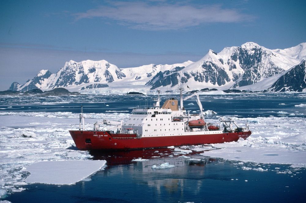
A team of British scientists is preparing for a mission to Antarctica — an ambitious journey that will involve sensor-carrying seals, seafaring robots and state-of-the-art radar technology — to uncover what may be causing the rapid loss of ice on the West Antarctic Ice Sheet.
The researchers, who will begin their mission in November, aim to focus on shrinking glaciers in the Amundsen Sea region, such as the Pine Island Glacier, the longest and fastest-changing glacier on the ice sheet. Studying the cause and pace of changing ice in this part of Antarctica will help scientists understand the likely impact on future sea-level rise, the researchers said.
"We used to think that the volume of water flowing from Antarctica's melting glaciers and icebergs into the ocean was equal to the amount of water falling as snow onto the ice sheet, and that this process was keeping the whole system in balance," said Andy Smith, a glaciologist with the British Antarctic Survey and science program manager for the Natural Environment Research Council's iSTAR program, which is leading the new Antarctica mission. [Album: Stunning Photos of Antarctic Ice]
"But Pine Island and Thwaites glaciers on the West Antarctic Ice Sheet are losing ice at a faster rate than they are being replenished," Smith said in a statement. "This affects sea level all over the world. The speed of changes to this region has taken scientists by surprise, and we need to find out what's going on."
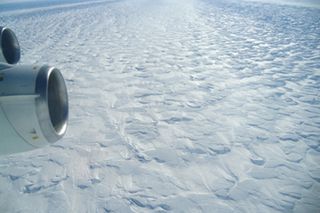
Journey to the South Pole
In November, the first group of scientists will spend 10 weeks traveling 600 miles (1,000 kilometers) across the West Antarctic Ice Sheet.
The researchers will use ground-based radar and seismic technologies to map the area beneath the Pine Island Glacier and assess the state of the glacier bed to determine how subsurface conditions affect the flow and thickness of the ice. For areas of the ice sheet that are inaccessible from the ground, the scientists will rely on satellite remote sensing technology.
Sign up for the Live Science daily newsletter now
Get the world’s most fascinating discoveries delivered straight to your inbox.
In January, a team of researchers will sail into the Amundsen Sea on a 30-day mission to install instruments to measure ocean temperatures at specific locations in order to determine when, where and how warm ocean water is when it is close to the ice. The scientists will also deploy a fleet of ocean robots, called Seagliders, and an unmanned submarine to measure ocean temperature, salinity and the speed of currents at different depths. These observations will help scientists determine how ocean currents transport heat beneath the ice shelf, and how climate change will affect this part of Antarctica.
Four autonomous radar instruments, capable of taking measurements year-round, will also monitor the gradual shifts in the thickness of the ice shelf, the part of the glacier that floats on the ocean, in order to understand the rate at which this thickness changes over time, the researchers said.
Warming waters and melting ice
During the Antarctic winter, when the sun sets in the South Pole in March and only rises again when austral summer returns in September, the researchers will turn to some unlikely assistants to help them continue their research: seals. Fifteen seals with small sensors temporarily glued to their fur will help the scientists collect data while the ocean surface is covered by sea ice, making much of the region inaccessible for research ships.
The sensors attached to the Antarctic seals will gather information on ocean temperature and salinity, or salt content. Satellites will send the data back to the scientists in their laboratories. The sensors are designed to fall off when the seals molt their fur, the scientists said. The observations may also help the researchers understand how changing Antarctic conditions are affecting seal populations in the region.
The upcoming mission to Antarctica will help improve a wide variety of computer models that are used to forecast future climate and sea-level rise, including whether the rapid loss of ice in the region will ramp up or slow down in the future, the researchers said.
"We are attempting to tackle this big science question from a number of different ice and ocean perspectives," Karen Heywood, a professor of physical oceanography at the University of East Anglia in the U.K. and principal investigator of one of the iSTAR program's ocean investigations, said in a statement. "Our observations and measurements will be a major contribution to the ongoing, and urgent, international scientific effort to understand our changing world."
Follow Denise Chow on Twitter @denisechow. Follow LiveScience @livescience, Facebook & Google+. Original article on LiveScience.

Denise Chow was the assistant managing editor at Live Science before moving to NBC News as a science reporter, where she focuses on general science and climate change. Before joining the Live Science team in 2013, she spent two years as a staff writer for Space.com, writing about rocket launches and covering NASA's final three space shuttle missions. A Canadian transplant, Denise has a bachelor's degree from the University of Toronto, and a master's degree in journalism from New York University.
