Landslides Scar Colorado After Major Flood

DENVER — The floods that struck northern Colorado in September left their mark in the form of landslides that scarred spots from the high mountains to the low foothills.
Hundreds of landslides occurred during the storm that dropped record rains on the Boulder area, Jonathan Godt, a U.S. Geological Survey researcher with the Landslide Hazards Program, reported here Tuesday (Oct. 29) at the annual meeting of the Geological Society of America.
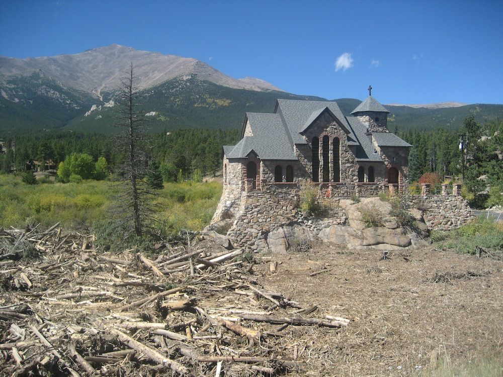
The damage occurred inside a triangle along Colorado's Front Range Mountains, spanning an area some 1,150 square miles (3,000 square kilometers). Rockslides are a danger even now, more than a month later, Godt said, and will remain so for some time to come. [Photos of Colorado's Landslides]
Several days of heavy, tropical-style rain fell in northern Colorado beginning Sept. 9 and intensifying Sept. 11 and 12, when floodwaters began to rise in Boulder (which saw more than 7 inches, or 18 centimeters, of rain in one day) and other foothill towns. Lyons, Colo., was cut off from the outside world by raging waters; roads snaking through canyons were washed away entirely. East of Denver, the city of Aurora also saw extreme rain and flooding.
Three people died in landslides and debris flows during the flooding, including a man in Jamestown, Colo., whose home was hit. There were also many thousands of dollars of uninsured damage to property, Godt said. One building on Arapahoe Avenue in Boulder was cut in half by a landslide.
"That building was formerly one building," Godt said. "Now it's two."
Landslides spanned the gamut of northern Colorado geology and environments, Godt said. There were slides in Boulder and Golden, both towns in the foothills at elevations around 5,500 feet (1,676 meters). Far above, slides scar Rocky Mountain National Park near the continental divide at about 12,000 feet (3,658 m). The widespread nature of the rain and flooding meant that nothing was safe from slope failures: Sedimentary rocks slid, as did crystalline rocks immediately west of the foothills. Hillsides turned into landslides in residential areas among grasslands and in alpine environments along the treeline.
Sign up for the Live Science daily newsletter now
Get the world’s most fascinating discoveries delivered straight to your inbox.
Many of these landslides started off small and gained momentum as they rolled down slopes, Godt said. Some left behind rivers of debris about 6 .5 feet (2 m) thick. Some slides moved boulders 6.5 to 10 feet (2 to 3 m) long as if they were pebbles. Among the most impressive slides was one on the east flank of Twin Sisters Peak in Rocky Mountain National Park. That slide measured between 2.5 to 3 miles (4 to 5 km) long.
"These are on the scale of what we'd expect in the Pacific Northwest with volcanoes, not what we're accustomed to here in Colorado," Godt said.
Landslides aren't an uncommon result of mixing steep slopes with heavy rain, particularly in areas scarred by wildfires, as parts of northern Colorado have been in recent years. But the September storm was unusual nonetheless, Godt said.
"In terms of the geographic extinct and the intensity of activity, this event is without well-documented historical precedent," he said.
Follow Stephanie Pappas on Twitter and Google+. Follow us @livescience, Facebook & Google+. Original article on LiveScience.

Stephanie Pappas is a contributing writer for Live Science, covering topics ranging from geoscience to archaeology to the human brain and behavior. She was previously a senior writer for Live Science but is now a freelancer based in Denver, Colorado, and regularly contributes to Scientific American and The Monitor, the monthly magazine of the American Psychological Association. Stephanie received a bachelor's degree in psychology from the University of South Carolina and a graduate certificate in science communication from the University of California, Santa Cruz.


