Photo Gallery: Typhoon Haiyan Hits Philippines
Haiyan heads for Philippines
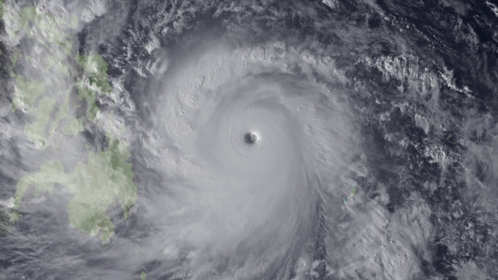
Super Typhoon Haiyan, the strongest storm seen in during the satellite era, was spotted by the Japan Meteorological Agency's MTSAT on Nov. 7, 2013, as it headed toward landfall over the Philippines.
Eye of a typhoon
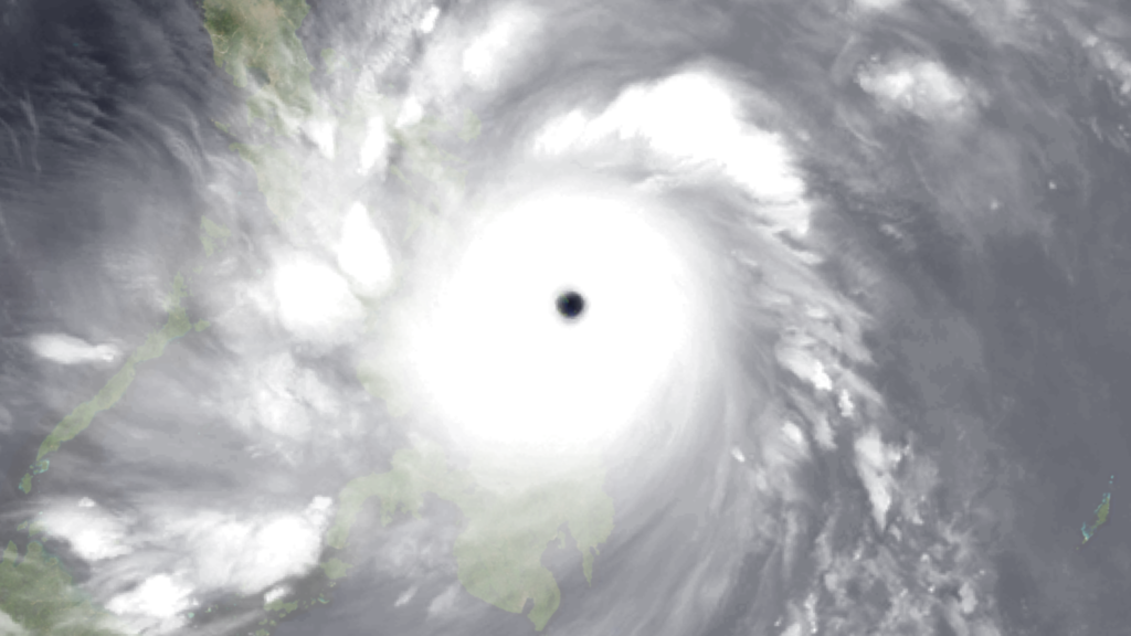
This image shows some of the islands at the mouth of the Leyte Gulf in the Philippines through the eye of Super Typhoon Haiyan. This imagery is of water vapor as measured in the infrared spectrum from the Japan Meteorological Agency's MTSAT geostationary satellite, taken at 2030 UTC on Nov. 7, 2013.
Over Panay Island
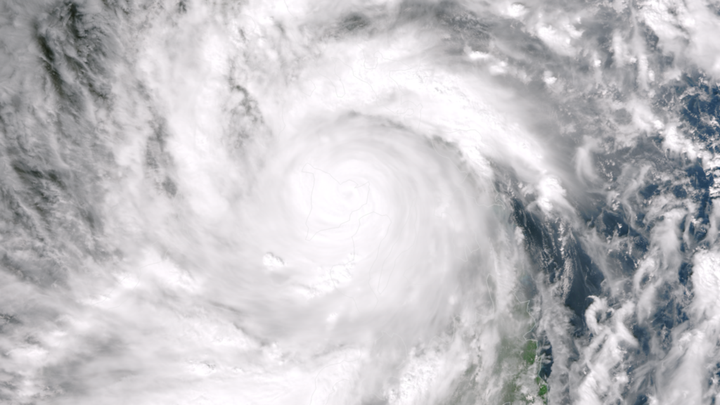
Super Typhoon Haiyan roared into the Philippines archipelago on the morning of Nov. 8, bringing historic wind, rain and storm surge. The Suomi NPP satellite's VIIRS instrument captured this true color data image between 0500 UTC and 0514 UTC as the storm's center passed over Panay Island.
Astronaut sees a storm
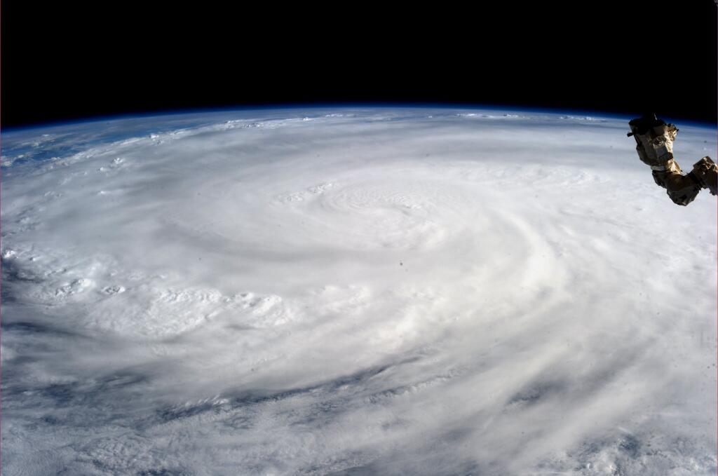
NASA astronaut Karen Nyberg took this photo of Super Typhoon Haiyan from her home on the International Space Station on Nov. 9, 2013, one day after Haiyan devastated the Philippines.
Philippine Red Cross evaluates damage
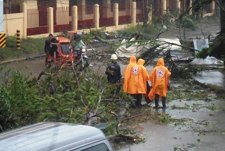
Philippine Red Cross (PRC) Capiz Chapter staff and volunteers conduct assessment and monitoring after Super Typhoon Haiyan (known locally as Yolanda) battered the province of Capiz.
Only stumps remain
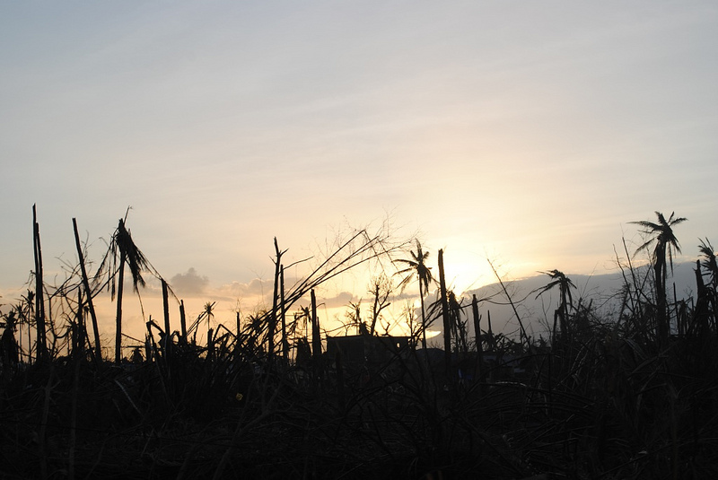
In the rural areas in southern Leyte province, on the island of the same name, only stumps of trees remain.
Mounds of debris
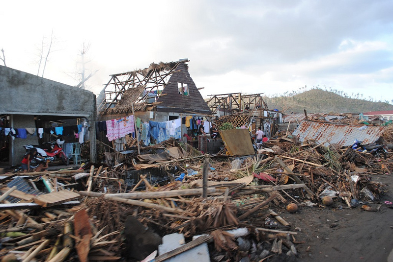
Huge piles of debris littered the roads in Leyte and made access to rural communities there very difficult, the European Community Humanitarian Office (ECHO) said.
Sign up for the Live Science daily newsletter now
Get the world’s most fascinating discoveries delivered straight to your inbox.
Trees on houses
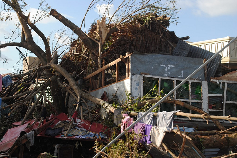
Tress were uprooted by the storm and then crashed into people's houses, ECHO reported.
Haiyan heads for Vietnam
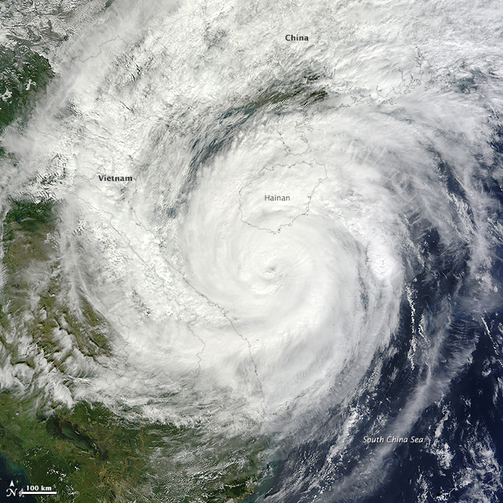
The Moderate Resolution Imaging Spectroradiometer (MODIS) on NASA's Terra satellite captured this image of Typhoon Haiyan heading toward Vietnam on Nov. 10, 2013. The storm was weakening as it headed for its second landfall; as of early Sunday morning, the storm had maximum sustained winds of about 90 miles (145 kilometers) per hour, the equivalent of a Category 1 hurricane.
This image released by the American Red Cross is flawed, and inaccurately shows Super Typhoon Haiyan taking up the entire continental U.S. It was instead much smaller.
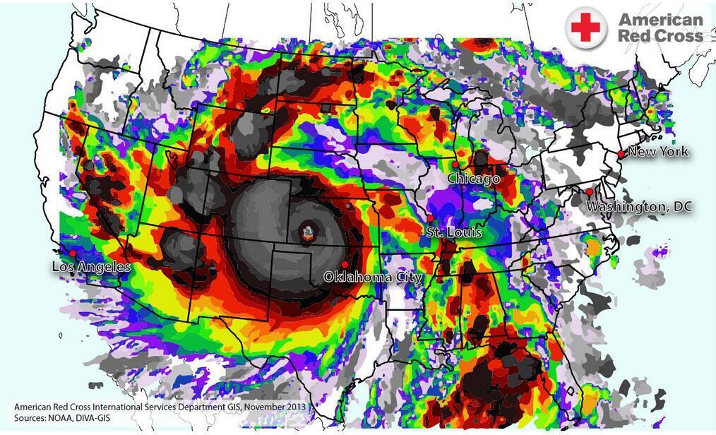
This image released by the American Red Cross is flawed, and inaccurately shows Super Typhoon Haiyan taking up the entire continental U.S. It was instead much smaller.
Military Aids Typhoon Haiyan Recovery in the Philippines
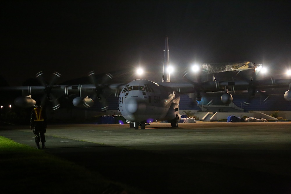
A KC-130J Super Hercules carrying U.S. Marines from the 3rd Marine Expeditionary Brigade taxies toward the terminal with guidance from a Philippine airman at Villamor Air Base in the Philippines on Nov. 10, 2013. Marine Corps forces are working with the Philippine government to rapidly deliver humanitarian assistance and disaster relief in the wake of Typhoon Haiyan.


