What Happens When 10 Inches Of Snow Isn't 10 Inches?
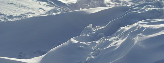
(ISNS) - Dylan Thomas once wrote that he could never remember whether it snowed for six days and six nights when he was twelve or whether it snowed for twelve days and twelve nights when he was six. As it turns out, measuring exactly how much snow fell is a tricky science problem – with a number of new solutions.
The trouble with snow is that it doesn't stay in one place. Winds can move it while it's falling, so that large areas can have different amounts of snowfall within them – and snow compacts in minutes, or can be washed away by rain. Scientists are most interested in the average levels of snow that fall on land – and more specifically, in the water deposited from the snowfall.
"Snow's structure changes hour by hour on the ground," said Nolan Doesken, state climatologist for Colorado at Colorado State University in Fort Collins. "Rain is rain, and it can't be compressed or packed. But snow can be so different – if you turn your back it'll be almost gone."
Having accurate measurements of snowfall isn't just child's play. Cities need to know how much snow falls to activate their snow removal procedures, airports need accurate counts to de-ice planes, and climatologists need to know to track trends from year to year or decade to decade.
The basic technology for measuring snow is still remarkably simple – a ruler, a spatula, a rain gauge and a flat white board. More than 20,000 Americans help out the weather service by measuring precipitation through the Cooperative Observer Program, and the Community Collaborative Rain, Hail and Snow Network. "Not 50 percent, not 80 percent, but probably 98 percent of the snow measurements across U.S. as a whole have come from citizen volunteers," said Doesken.
When looking at snowfall data from years past, Doesken says that amounts are often inaccurate and too low because of one simple factor: wind. Since winds pick up snowflakes and blow them around, fences that block the wind around a small area, slowing down the winds so the flakes fall vertically can help tally the snow more accurately. This means that decades of climatological data may not be accurate.
At the National Center for Atmospheric Research in Boulder, Colo., researchers are testing double-layer wind shields that allow flakes to fall vertically instead of horizontally. The wind shields surround gauges that measure snowfall minute by minute and report back to a central system.
Sign up for the Live Science daily newsletter now
Get the world’s most fascinating discoveries delivered straight to your inbox.
Scott Landolt, a researcher at NCAR, said that as snow falls, its intensity is rated as light, moderate, or heavy. When visibility is reduced to less than a quarter-mile, the snowfall is considered heavy. But the amount of water falling is a much better measurement, and it’s important for aircraft to determine the right amount of deicing fluid to fly.
"We’re working with the National Weather Service to get away from using visibility and toward using rates on gauges," explained Landolt. Those gauges take many forms, but the most common is a bucket atop a scale, measuring the weight of the snow.
Once snow has reached the ground, scientists use a more sophisticated system to measure it. This method uses a scanning laser mounted on a 20-foot pole, which determines the distance between the laser and the ground over the area of a football field.
"The laser builds a kind of topographic map of the surroundings," said Ethan Gutmann, a hydrologist at NCAR. He says that higher-end technology could do this for a one-mile radius, giving a much more accurate measurement of snowfall over a larger area – important measurements for managing watersheds.
The GPS may give even more precise measurements of snowfall over a large area, says Kristine Larson at the University of Colorado Boulder. Larson and Gutmann published research where they show that it's possible to measure snowfall using the framework of GPS units in the western U.S. that already record fault activity and give early warnings for potential earthquakes.
"You can get two scientific products for the price of one, and I think that's pretty cool," said Larson. When there is no snow on the ground, GPS can be used to measure soil moisture, assess drought conditions, and even measure tides with sub-millimeter precision.
GPS sensors record both satellite signals that reach them directly and signals that bounce off the ground. The signals bounce off the snow at a different frequency than bare soil, showing how deep the snow lies.
Doesken warns that even with increasing technology and automation, humans remain an integral part of the snowfall-measuring process. "Remote sensing is still totally tied to human observations that are used to ground truth and validate the technology."
This story was provided by Inside Science News Service. Katharine Gammon (@kategammon) is a freelance science writer based in Santa Monica, Calif., and writes for a wide range of magazines covering technology, society, and animal science.
