Northridge Earthquake: 20th Anniversary in Photos
The Last Big Quake
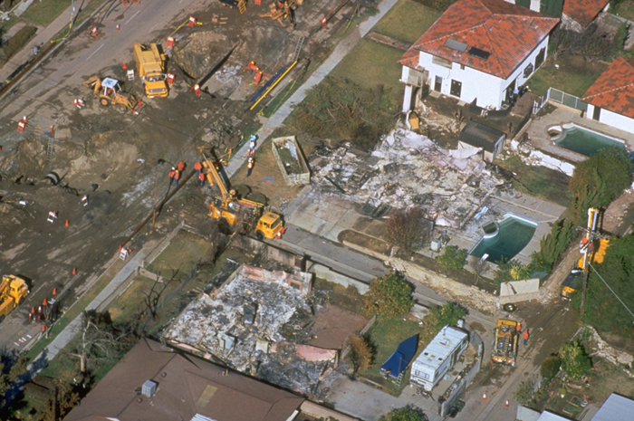
The Northridge earthquake struck on a previously unknown fault at 4:31 a.m. on Jan. 17, 1994. The costliest earthquake disaster in U.S. history, the temblor took 57 lives and injured nearly 9,000 people. In the past 20 years, geologists have probed the Earth's crust beneath Los Angeles, creating detailed maps and computer simulations that predict where the worst damage will occur when the next big earthquake hits this metropolis. But there is still more to be done before the "Big One," as Californians call it, such as retrofitting buildings to meet seismic codes enacted after the Northridge earthquake. Here is a reminder of the damage, and some of the results of the scientific research prompted by the 1994 Northridge earthquake.
Soft-story failure
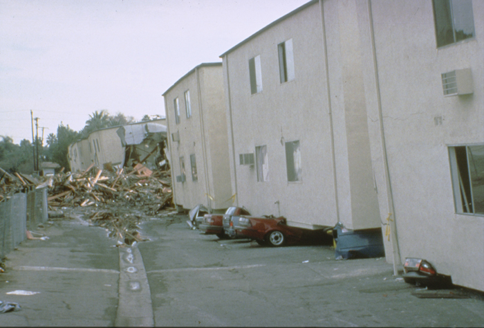
Collapse of buildings into carports, or soft stories, was a common cause of apartment damage in the San Fernando Valley. The carports, because they were open on one side, did not have resistance to shaking. This photo shows a collapsed apartment in Reseda. The building's soft story has collapsed onto cars.
Parking structure bends
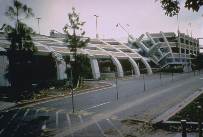
An iconic image of the Northridge earthquake was this collapsed parking structure on the campus at California State University, Northridge. The bowed columns are of reinforced concrete. The inside of the structure failed, and with each aftershock the outside collapsed slowly toward the inside until finally the west side failed totally. The reinforced concrete columns were extremely bent.
Freeways collapse
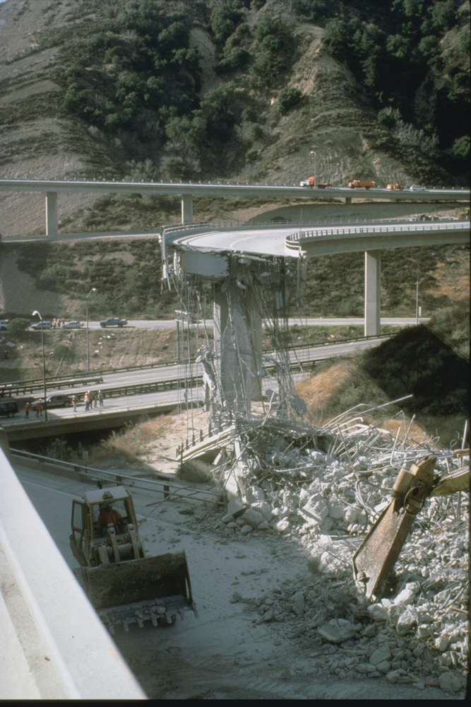
One of the most spectacular effects of the earthquake was the collapse of several freeway overpasses. Pictured here is the collapse at the Antelope Valley (SR14) and Golden State Freeway (I-5) interchange. I-5 is the primary connection between Northern and Southern California. A police officer was killed when he drove his motorcycle off the edge of the freeway in the dark.
Hospitals destroyed
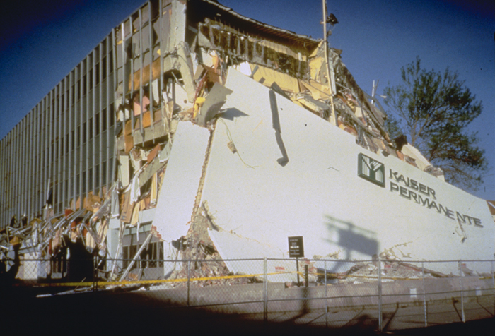
The Kaiser Permanente Clinic at Granada Hills on Balboa Blvd. End walls collapsed and separated from the main unit over the full height of the building.
Santa Monica
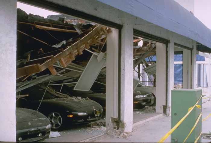
The City of Santa Monica experienced extensive damage in the Northridge earthquake because a fault under the Santa Monica Mountains concentrated seismic energy toward the city, like a magnifying glass can focus the sun's rays. Shown here is the collapsed roof of a Mazda car dealership.
Patches of destruction
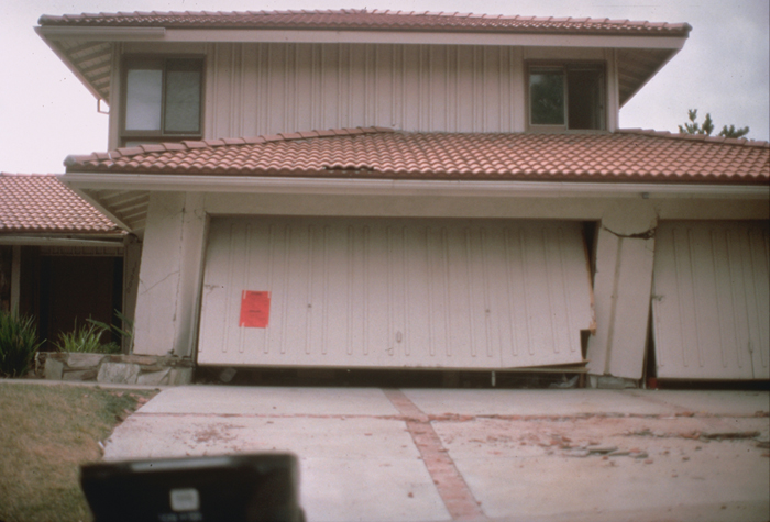
Damage to a single family home on a ridge north of the San Fernando Valley. This damage was part of a several-block zone in which a number of houses were damaged, surrounded by a larger area that did not experience visible exterior damage.
Sign up for the Live Science daily newsletter now
Get the world’s most fascinating discoveries delivered straight to your inbox.
Failed freeway supports
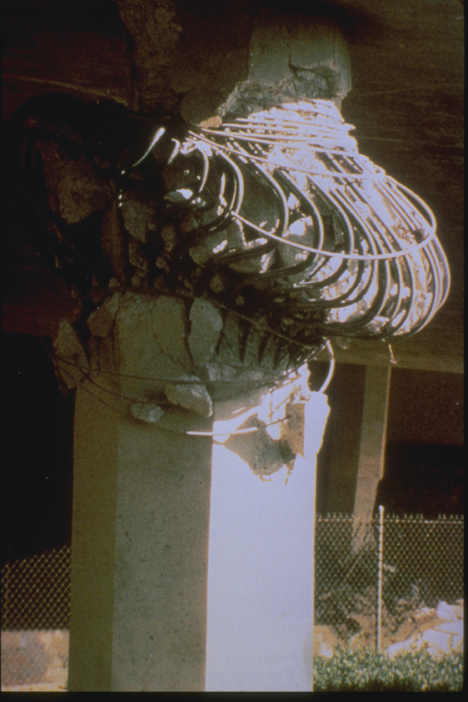
A bridge column supporting Interstate 10 (Santa Monica Freeway) at the La Cienega-Venice overcrossing failed in the 1994 Northridge earthquake.
Earthquakes!
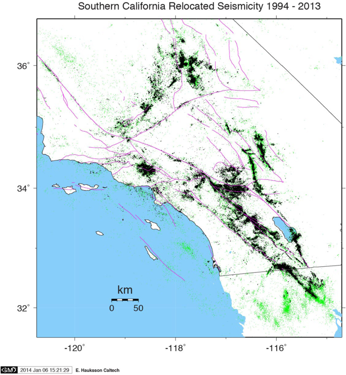
Earthquakes in California since 1994. (Black dots are more precisely mapped (relocated) earthquakes because of advancements in the understanding of how fast seismic waves travel through the subsurface structures of Southern California. Green dots are earthquakes that have not been relocated.)
Earthquake sources
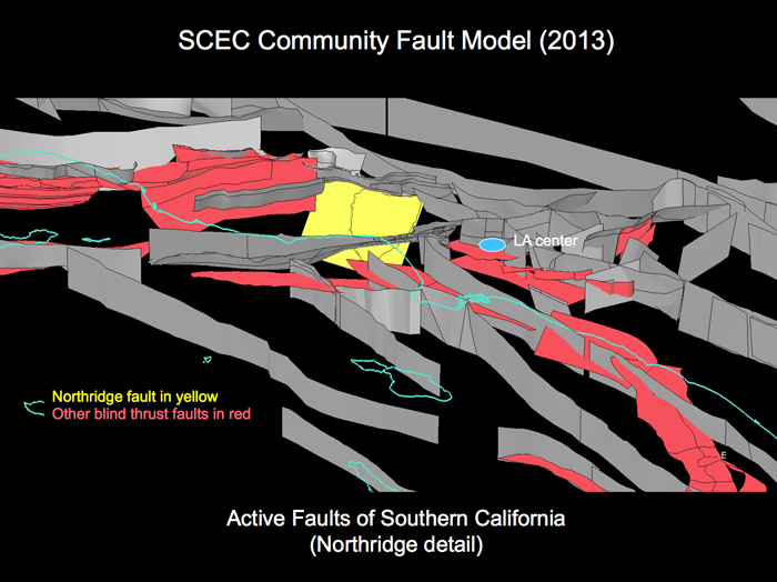
The latest fault model of Los Angeles is similar to a CT scan of the Earth. Since the 1994 Northridge earthquake, geologists have identified several new blind thrusts, which are faults that do not reach the surface but can potentially cause an earthquake, as was the fault that caused the '94 temblor.
Seismic hazard
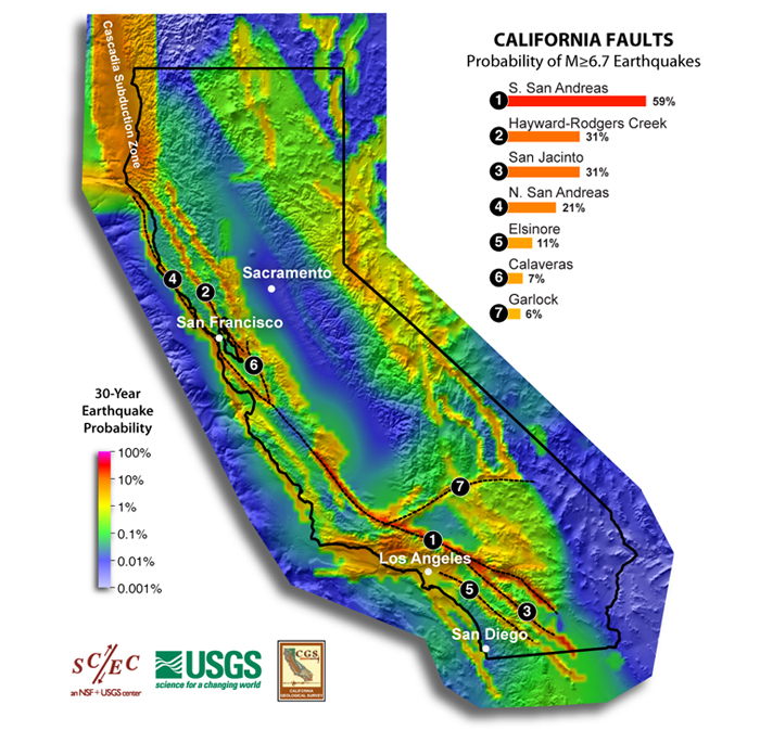
Faults with the highest probability of rupturing in a magnitude-6.7 (Northridge-sized) earthquake in the next 30 years.


