Polar Vortex, Part II? Nah, It's Just Winter
Face it — "polar vortex" is fun to say. It sounds like something that could have killed a red-shirted crewmember on the original "Star Trek" television series. Maybe that's why a weather feature that has been known by this name for decades is getting 15 minutes of fame this month.
For better or worse, polar vortex now seems to be shorthand for any bitterly cold winter air blasting into the United States from the Arctic. But this atmospheric weather pattern is really just winter as usual.
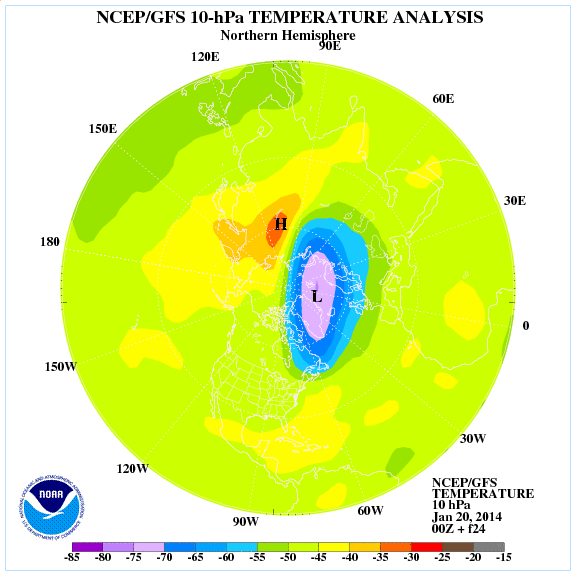
"It's always there and always will be there," said Bob Oravec, a meteorologist with the National Weather Service in College Park, Md. "There's always a polar vortex."
The polar vortex is a winter weather pattern that circles the Arctic, spinning west to east, trapping cold air in the high latitudes. Researchers named the polar vortex in the 1950s (there is a similar vortex over Antarctica, just FYI).
Think of it as stirring a bowl of liquid — the cold air is caught in the "well" in the middle. The vortex never actually leaves the Arctic. But if the spinning weakens, cold air can escape the trap and zoom south, as it did the week of Jan. 5. Currently, the polar vortex low is centered over Greenland. [Video: Watch the Polar Vortex Sweep Across the U.S.]
Weather experts track the polar vortex to help forecast coming cold air masses — it is one of the many puzzle pieces that help predict winter storms.
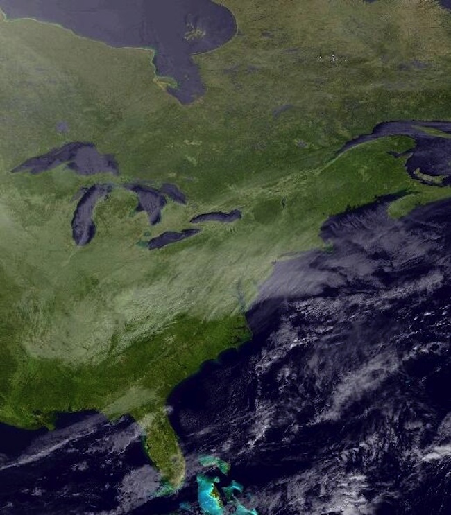
The same polar vortex pattern that struck in early January is happening again this week; only the cold air blanketing the East Coast isn't quite so frigid. But the cold wave will last as long as a week, Oravec said.
Sign up for the Live Science daily newsletter now
Get the world’s most fascinating discoveries delivered straight to your inbox.
"You need a favorable pattern for cold, and the patterns are very similar, it's just the magnitude that's different," Oravec told LiveScience. "It's still pretty impressive cold air, but this one is going to be a little more prolonged."
A shot of cold air will come in across the Plains today (Jan. 21), followed by another Arctic surge on the weekend, Oravec said. Another series of cold air blasts is expected early next week, extending the freeze.
"The temperatures are not quite as cold [as in early January, but the pattern is more persistent in this event," Oravec said.
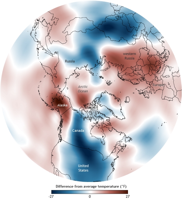
While Americans living east of the Rockies will shiver this week, the weather will be dry and warm in the West and Alaska. That's because atmospheric flow patterns that are freezing the central and eastern United States and Canada are also contributing to the drought and warm temperatures in the West, Oravec said.
"The exact placement of Arctic air over parts of North America is often determined by the same flow patterns that are keeping the West Coast warm and dry," Oravec said.
For example, when the polar vortex weakens, the jet stream may shift south of its usual position and develop kinks and troughs that steer cold air over the East Coast, while keeping the West Coast warm.
Email Becky Oskin or follow her @beckyoskin. Follow us @livescience, Facebook & Google+. Original article on LiveScience.


