Snowy Super Bowl? Too Early to Make the Call

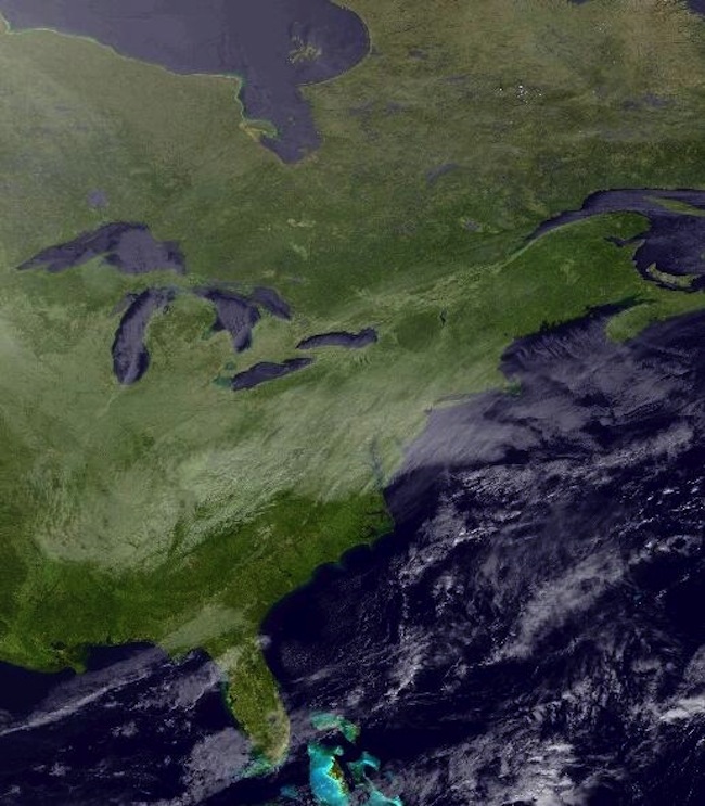
The winter storm that barreled across the Northeast yesterday (Jan. 21) may have football fans anxious to know the weather forecast for this year's Super Bowl, scheduled for Feb. 2 at New Jersey's open-air MetLife Stadium. But, try as they might, fans will struggle to find accurate game-day forecasts until later this week and into early next week.
Despite recent advancements in weather modeling and a steady increase in weather data from satellites over the past several decades, meteorologists still struggle to accurately predict weather conditions two or more weeks in advance. This is due, in part, to lingering computational limitations, but more so to the chaotic nature of global weather patterns, Mitch Moncrieff, a researcher at the University Corporation for Atmospheric Research (UCAR) in Boulder, Colo., told LiveScience.
Whereas near-term weather predictions within a few days can be made based on local or regional weather patterns, longer-term predictions must take into account weather patterns occurring across the planet, along with all the different ways those conditions may interact with one another and change through time, Moncrieff said. They must also factor in how oceanic conditions may change and affect weather patterns through time.
Moncrieff is currently working with colleagues around the world to improve long-term weather forecasts by studying the nature of certain types of weather conditions and tweaking weather models, but says that, to a certain extent, such forecasts will always pose inherent challenges.
"Getting reasonably reliable weather forecasts two weeks or more ahead as a general principle will be very difficult," Moncrieff said. "But there are certain weather scenarios where there is more likelihood for success."
These relatively easier-to-predict weather scenarios include those that last for prolonged periods of time, such as the north-south excursion of the jet stream that caused the infamous "polar vortex" cold snap earlier this month, Moncrieff said. (The polar vortex is actually a long-standing winter weather pattern that spins from west to east around the Arctic and traps cold air in the high latitudes. That cold air can leak farther south, as it is currently doing and did so more severely earlier this month, when the spinning weakens.) Since such conditions stay put for several days at a time, they delay the ripple effects they have on other global weather conditions, buying time for models to predict further out into the future.
When forecasters can't predict into the future, they can turn to historic data to assess the relative likelihood of certain weather patterns occurring based on past events. According to data collected at Newark Liberty International Airport — about 13 miles (21 kilometers) from MetLife Stadium — since 1931, the likelihood of at least 0.1 inches (0.25 centimeters) of snow falling during the week of this year's Super Bowl game (Jan. 30 to Feb. 5) is about 15 percent, according to the Office of the New Jersey State Climatologist. The likelihood of 1 inch (2.54 cm) or more is only 6 percent, and the likelihood of 6 inches (15.2 cm) or more is only 1 percent, UCAR meteorologist Bob Henson wrote in a recent article on long-term weather prediction.
Sign up for the Live Science daily newsletter now
Get the world’s most fascinating discoveries delivered straight to your inbox.
As game-day approaches, forecasts will become ever-more reliable, and could allow the National Football League to change plans accordingly, as needed. Until then, fans will have to wait out this current snowstorm and remember that it has little bearing on the weather conditions just under two weeks from today.
Follow Laura Poppick on Twitter. Follow us @livescience, Facebook& Google+. Original article on LiveScience.


