Sarychev: Photos of a Spectacular Eruption
Spectacular Sarychev
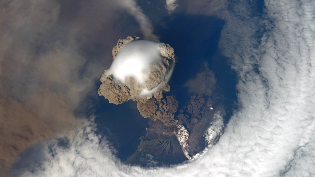
On June 12, 2009, a fortuitous orbit of the International Space Station (ISS) made it possible for an astronaut on board to capture Sarychev Volcano in the early stages of eruption.
The volcano is located on the northwestern end of Matua Island, which is part of the Kuril Islands, a chain of 56 islands northeast of Japan. The eruption sent a plume of brown-colored ash and white steam rising into the atmosphere. The plume was so immense that it cast a large shadow on the island.
Sarychev is one of the most active volcanoes in the Kuril Island chain. Prior to June 12, the last explosive eruption occurred in 1989, with eruptions in 1986, 1976, 1954, and 1946 also producing lava flows.
Watch the video to see how the eruption looked from space.
Highs and lows
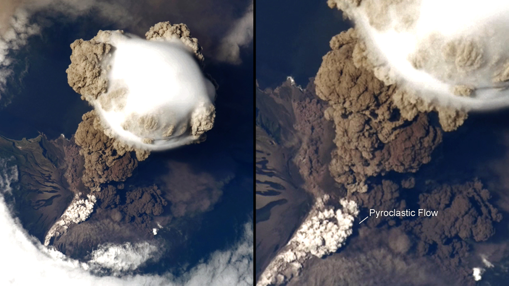
A cloud of denser, gray ash — probably a pyroclastic flow — appears to be hugging the ground, descending from the volcano summit.
Different angles
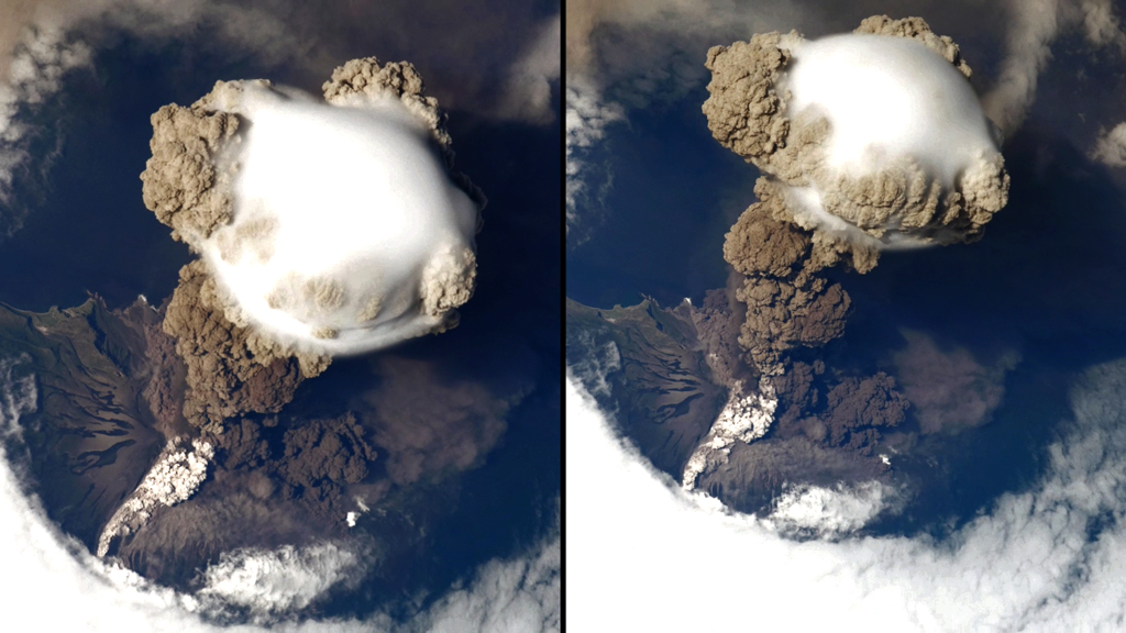
The ISS flyby provided astronauts with views of the eruption from more than one perspective.
The high point
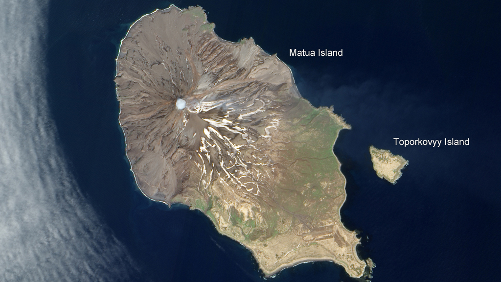
Sarychev reaches a height of 4,908 feet, forming the highest point on Matua Island.
Cloud Cover
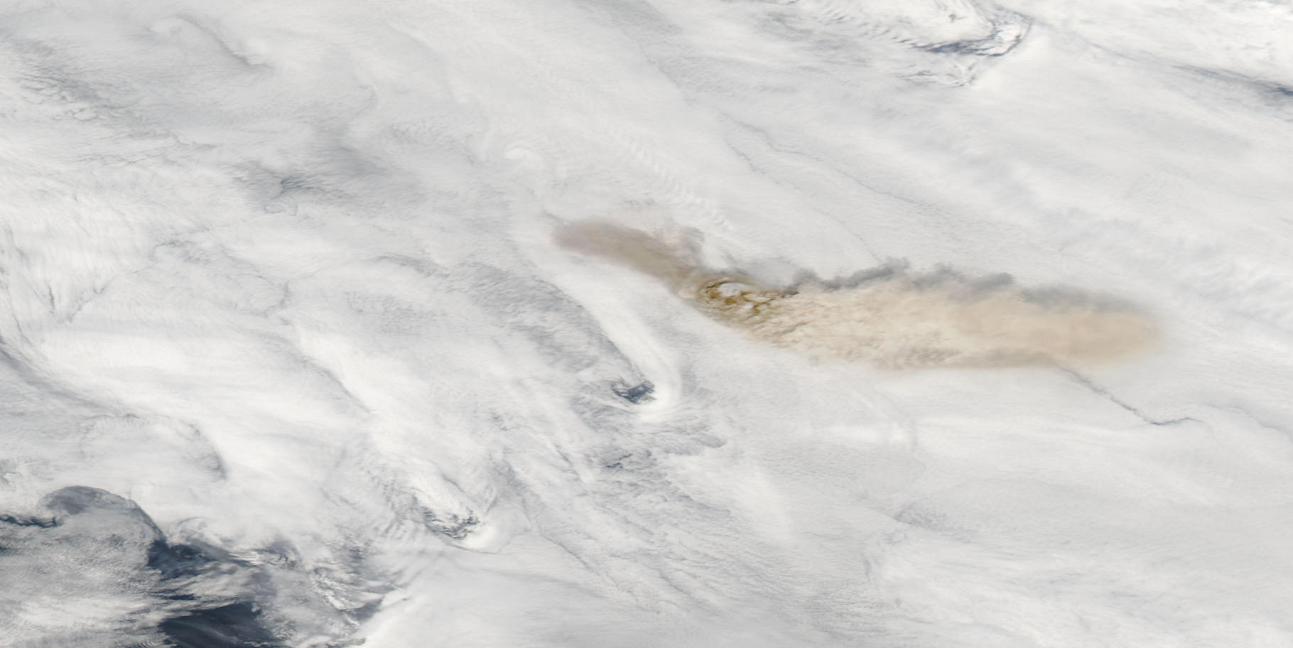
The Moderate Resolution Imaging Spectroradiometer (MODIS) on NASA's Aqua satellite captured this image of Sarychev on June 12, 2009, revealing a thick blanket of clouds over the region. "The larger plume toward the east-southeast casts shadows onto the cloud cover below. The darkest shades of brown appear near the volcano's summit, an indication of high ash concentrations. The relatively light color of the volcanic plume east of the volcano suggests high water vapor content," according to NASA's Earth Observatory.
Casting a shadow
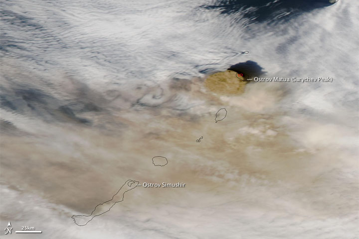
The Moderate Resolution Imaging Spectroradiometer (MODIS) on NASA's Aqua satellite passed over the Sarychev Peak on June 13, 2009, at 2:10 p.m. local time, catching a high-altitude ash plume spewed from the volcano. In this image, "the brown ash plume forms a circular, opaque cloud immediately southwest of Ostrov Matua, casting a large shadow to the north. Farther away from the summit, thinner ash plumes mingle with clouds. Clouds and ash swirl in von Karman vortices west of the volcanic island. The red outline along the ash cloud’s edge indicates a hotspot of high surface temperature resulting from volcanic activity," according to NASA Earth Observatory.
More ash and steam
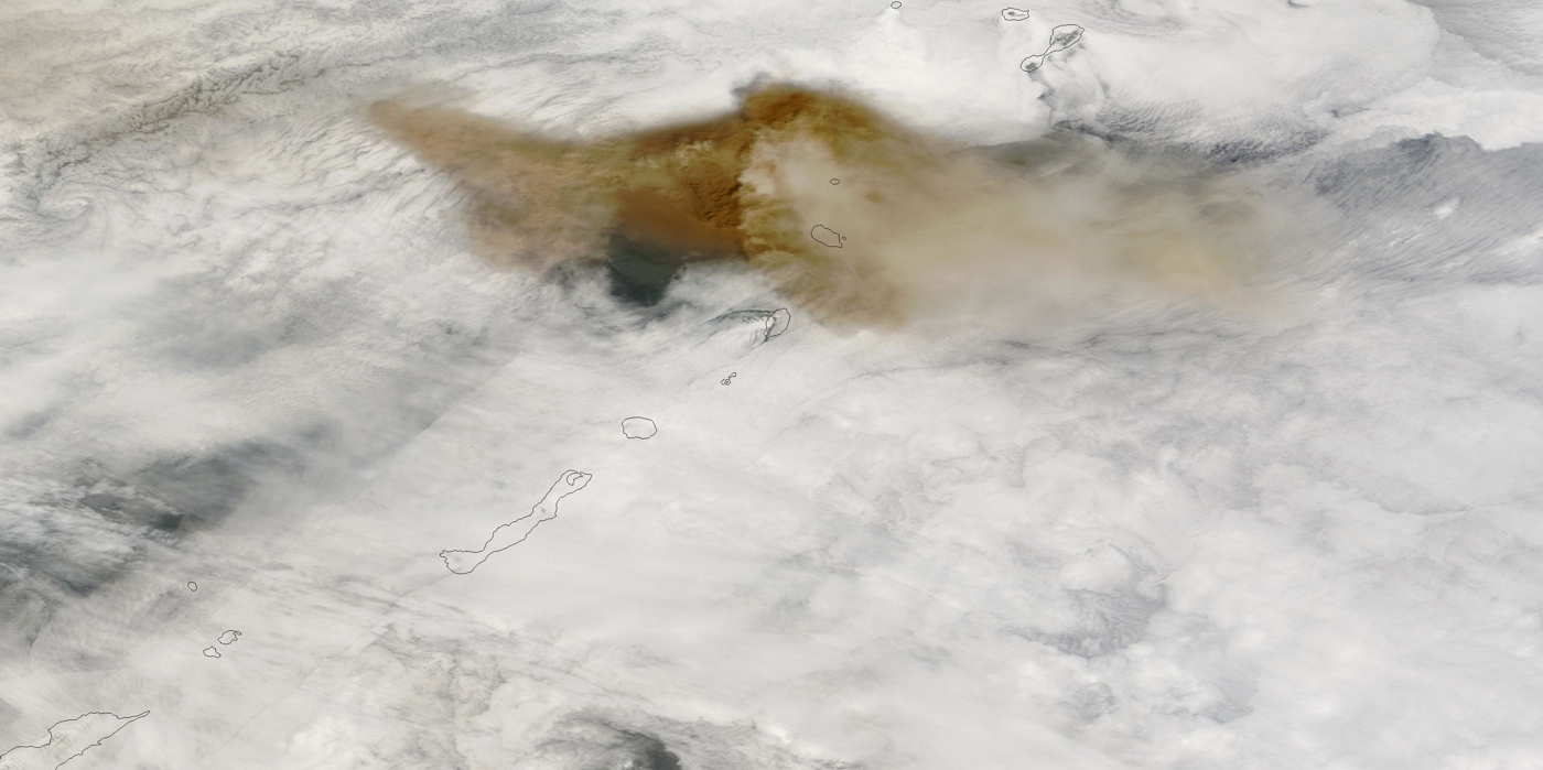
On June 14, 2009, the U.S. Air Force Weather Agency (AFWA) reported that Sarychev Peak on Ostrov Matua in Russia’s Kuril Islands continued to release ash and steam. According to AFWA, ash had spread roughly 700 nautical miles (1,300 kilometers) east-southeast of the volcano and 400 nautical miles (740 kilometers) west-northwest. The same day that AFWA released that bulletin, the Moderate Resolution Imaging Spectroradiometer (MODIS) on NASA's Terra satellite captured this image.
Get the world’s most fascinating discoveries delivered straight to your inbox.
Obscured by clouds
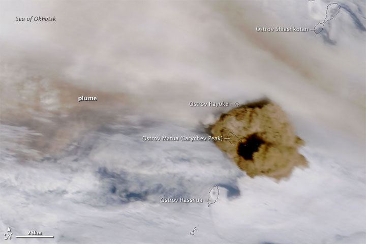
On June 15, 2009, when MODIS aboard NASA's Terra satellite captured this image, Sarychev's ash plume had reached an altitude of 5 miles (8 kilometers), according to the Sakhalin Volcanic Eruption Response Team, as reported by NASA's Earth Observatory.
Yin Yang
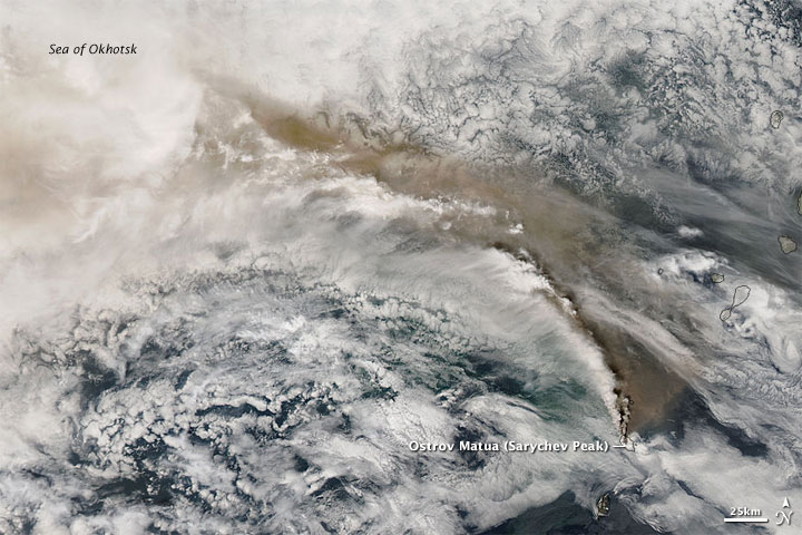
Plumes of ash and steam from Sarychev Peak blew in a counterclockwise direction across the Sea of Okhotsk on June 16, 2009, when this image was taken by MODIS on NASA's Aqua satellite. "A large amorphous brown cloud, likely deriving its color from volcanic ash, appears in the east and north, forming the outer arc of the plume. The inner arc of the plume apparently derives its color from water vapor. Bright white puffs emanating from the pinpoint of the volcano hover over the brown cloud, casting shadows onto the plume below. In the west, the volcanic plume appears to mingle with clouds," according to NASA's Earth Observatory.
White blanket
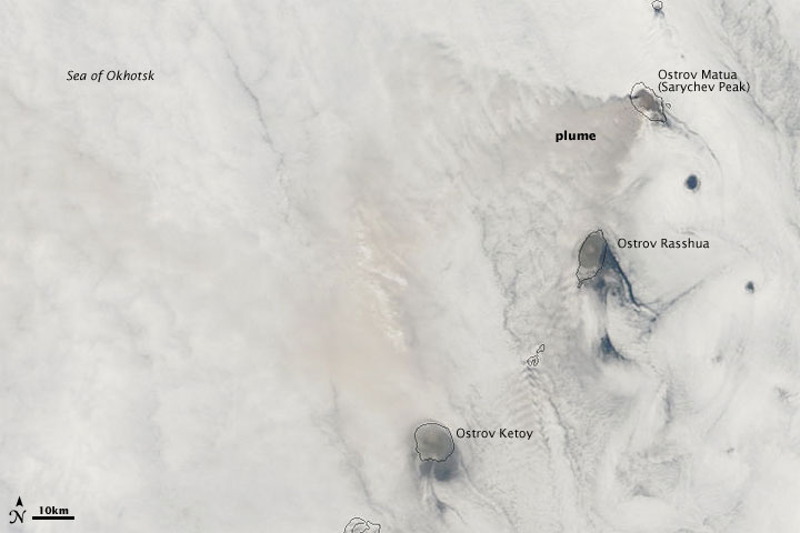
"Sarychev Peak on Ostrov Matua continued producing a visible volcanic plume on June 18, 2009, but the plume was far less conspicuous than it had been earlier in the week. This image, acquired by the Moderate Resolution Imaging Spectroradiometer (MODIS) on NASA’s Terra satellite on June 18, shows a barely discernible plume blowing toward the west and south over a blanket of clouds," according to NASA's Earth Observatory.
Sarychev in 2007
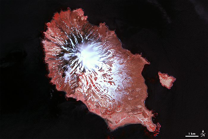
In this image of Sarychev Peak on the Kuril Islands’ Ostrov Matua from May 2007, snow spreads over much of the island, although the snow alternates with snow-free ground. The vegetation is pinkish-gray, suggesting the spring thaw is still underway.


