A Swell New View: Satellites Can Monitor Volcanoes

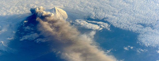
(ISNS) – Predicting when a volcano will blow its top takes constant monitoring. Researchers are now looking to satellites as a valuable eye in the sky, since they can observe the ground around volcanoes for signs of deformation.
Ground deformation can indicate that molten rock, or magma, is flowing. This sometimes hints at an eruption to come -- but it's not a sure sign.
"Just because we detect deformation at a volcano, it doesn't mean that eruption is imminent," said Susanna Ebmeier, an earth scientist at the University of Bristol, in the U.K. "Lots of different processes can cause that."
Even if the deformation is caused by magma, it doesn't provide an exact eruption time. The magma can accumulate slowly underground, remaining dormant for years before the volcano finally explodes.
To clarify the link between deformation and eruption, researchers looked at 18 years' worth of satellite data.
"If you just have a few years of data from one or two volcanoes, it's really hard to see trends," explained Tamsin Mather, a volcanologist the University of Oxford, U.K. "Whereas now, because we're getting data on the decade timescale, and covering larger and larger areas of the globe, we're beginning to look at the patterns, the association between the way in which volcanoes are deforming and then what the outcomes are."
Since the 1990s, satellites have used a method called Interferometric Synthetic Aperture Radar, or InSAR, to monitor ground deformation. In this technique, a satellite uses a radar wave to look at some point on the ground. On its next pass over the spot, it repeats the signal. If two waves have moved out of phase, this means the ground has shifted.
Sign up for the Live Science daily newsletter now
Get the world’s most fascinating discoveries delivered straight to your inbox.
By performing this test on many points on the Earth's surface, InSAR can build up a picture of the ground deformation over hundreds of square kilometers, without requiring the installation of any instruments on the ground. "By using this technique, you can produce a map, from space, of how much the surface has moved," said Daniel Dzurisin, a geologist with the U.S. Geological Survey, in Vancouver, Wash. "There's really no other way to do that."
Other techniques, Dzurisin explained, look at the ground at a single point, or a network of points, rather than building the kind of deformation map that InSAR does. However, InSAR cannot entirely replace these methods. Instead, it functions as a useful addition to the volcano-monitoring arsenal. It's particularly valuable for keeping an eye on volcanoes that are difficult to access, or located in countries that cannot afford to install ground-based instruments.
Over the two decades of InSAR observations, 198 volcanoes had been regularly observed. In addition, 540 sites have data stretching back three or more years. In a paper in the journal Nature Communications, researchers performed a statistical analysis to clarify the link between deformation and eruption.
Volcanoes that erupted during the observation window are four times as likely to deform as volcanoes that did not erupt. However, deformation was not a sure harbinger of eruption: only about half of the volcanoes that deformed later erupted.
On the other hand, lack of deformation was an important indicator that no eruption would occur. Only six percent of volcanoes that did not deform still erupted. This finding is very useful, Dzurisin said, when considering whether to evacuate a heavily populated area. "In areas where you have a large population that's at risk from an eruption, it's important, to the extent possible, to avoid false alarms."
The more volcanoes the scientists can study, the more they can delve into the behavior at individual sites, examining how the type of magma and the size of the volcano affect the deforming behavior. And thanks to the European Space Agency's Sentinel-1 satellites, the amount of data at their fingertips is about to increase dramatically.
On April 3, the European Space Agency launched Sentinel-1A into orbit, soon to be followed by its partner Sentinel-1B. After their instruments are calibrated, the twin satellites will use radar to monitor Earth's surface constantly. Together, they can repeat a pass over a given point every five days. This provides a higher time resolution than other InSAR satellites, which sometimes take weeks between passes.
"We're going to be moving into a really data-rich era in terms of our research in this area," Mather said. "I think the next few years are going to be a very exciting time."
Inside Science News Service is supported by the American Institute of Physics. Sophie Bushwick is a freelance science writer based in New York City. Her work has appeared in numerous print and online outlets. She tweets at @sophiebushwick.


