Wreckage from Secret Cold War Spy Mission Revealed in Aerial Images

In 1947, a crash landing left wreckage from a U.S. Army plane frozen in time on a remote ice sheet in northwest Greenland.
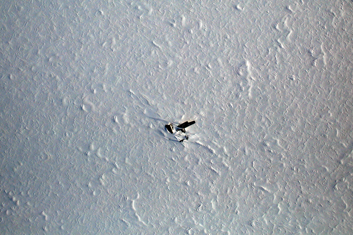
A new aerial image, released by NASA's Earth Observatory, shows the remains of the B-29 Superfortress plane, named Kee Bird, which was en route to the North Pole for a top secret mission during the Cold War.
After encountering bad weather and running out of fuel, the plane made an emergency landing on a lake frozen beneath hard-packed snow. The crew of 11 men spent about three days in the tundra before they were rescued. Forty years later, famous test pilot Darryl Greenamyer and his team tried to restore the warbird, but the plane caught fire and the team abandoned their project. Now, more than 50 years after the Kee Bird landed, wind-blown ice and snow continue to bury what's left of it. [See Photos of Greenland's Melting Glaciers]
The photo was taken by a digital camera attached to NASA's P-3 Orion airplane on May 1. The research plane is part of Operation IceBridge, an eight-year NASA mission that started in 2009 and began its 2014 Arctic campaign this past March.
Operation IceBridge surveys glaciers, ice sheets and sea ice in the Arctic and Antarctic to monitor how polar ice changes over time. Scientists use instruments attached to fixed-wing aircraft; those tools include radars, lasers and the Digital Mapping System (DMS) that snapped the image of Kee Bird.
The missions often bring back stunning images and discover objects buried underneath the ice. In August 2013, IceBridge researchers found Earth's longest canyon beneath Greenland's ice sheet. The gorge reaches about 2,600 feet (800 meters) deep and 6 miles (10 kilometers) wide, making it comparable to America's Grand Canyon.
When it comes to the Arctic, landmarks like the Kee Bird can lend beauty to an otherwise blank canvas.
Get the world’s most fascinating discoveries delivered straight to your inbox.
"When you spend eight hours a day, five days a week staring at a blinding white ice sheet, something interesting to look at comes as a rather welcome sight," John Sonntag, a researcher for NASA's Wallop Flight Facility told the Earth Observatory. Sontaag has been collecting photos of the Kee Bird since the early 1990s.
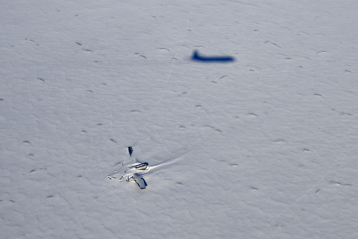
Another image, also released by the Earth Observatory, shows both the Kee Bird and the shadow of the P-3 Orion above the plane's wreckage. IceBridge campaign leader Michael Studinger took the photo, and according to the Earth Observatory, the thin lines in the ice around the Bird are most likely trails from polar bears in the area.
Editor's note: An earlier version of this story described the photo as a satellite image; it was taken from a plane.
Jillian Rose Lim on Twitter & Google+. Follow us @livescience, Facebook & Google+. Original article on Live Science.


