Stunning Soccer: The World Cup 2014 from Space (Photos)
Argentina
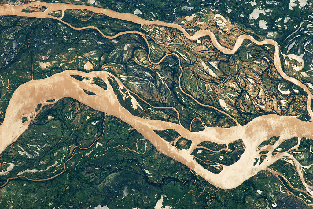
The 2014 FIFA World Cup begins June 12, 2014. Take a look at the countries competing in the heated athletic tournament in these amazing views from space.
South America’s second largest river, the Paraná River (and its tributaries) is seen here in this astronaut photo acquired on April 9, 2011, revealing an 18-mile-across (29 kilometers) expanse of the river downstream from Goya, Argentina (top left of image).
Algeria
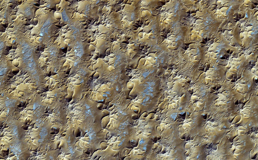
A sea of star dunes called the Grand Erg Oriental in the Saharan Desert of Algeria looks like abstract art in this image snapped on Oct. 27, 2012 by an instrument onboard NASA's Terra satellite. The giant pyramid-shaped dunes in this image form only in spots where the winds blow from several directions, according to NASA's Earth Observatory. The dots of blue scattered within the sand dunes likely represent mineral-rich evaporates, or those sediments left over after a liquid solution has evaporated. The image, taken by the satellite's Advanced Spaceborne Thermal Emission and Reflection Radiometer (ASTER), shows an area near the town of Gadamis in Libya.
Croatia
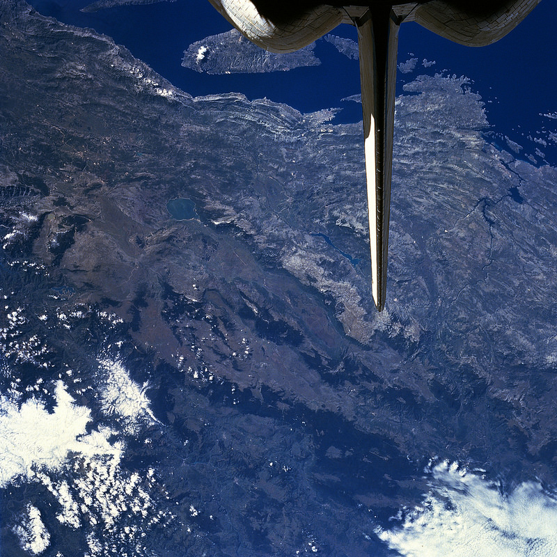
This south-looking view from space reveals part of the rugged Dinaric Alps, which extend 400 miles (645 km) along the coast of the Adriatic Sea. The mountains, made up of limestone and dolomite form a barrier to travel from the coast to the interior, according to NASA's Earth Observatory. The upper part of the image shows the partially submerged western part of the Dinaric Alps along the Croatian coast.
Belgium

An Expedition 34 crewmember on the International Space Station captured this nighttime view of Liege, Belgium, Dec. 8, 2012, using the European Space Agency's Nodding mechanism (NightPod) &mdash an electro-mechanical mount system that helps to compensate for the motion of the ISS relative to Earth. The distance from left to right in the image is 70 kilometers (44 miles).
Australia
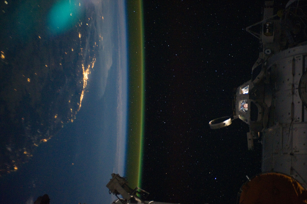
Expedition 28 crewmembers aboard the International Space Station (ISS) captured this view of Australia when passing over an area southwest of Canberra (Brisbane shown along the coast) on Sept. 15, 2011. The cool angle highlight's the ISS's cupola and crew inside, along with Earthly city lights and airglow.
Brazil
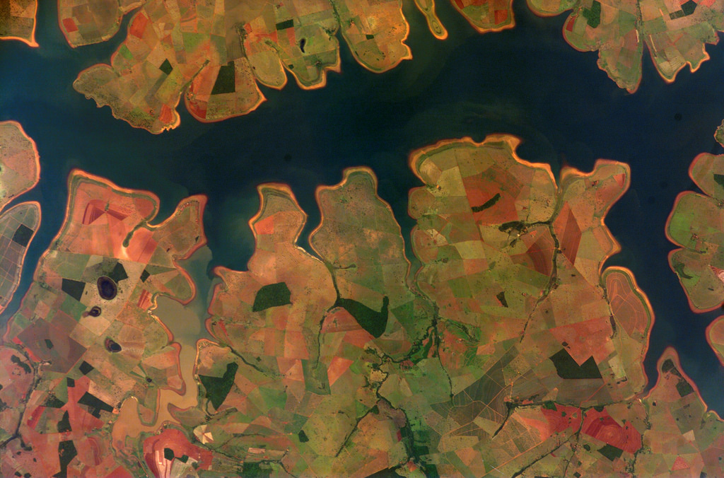
Photographed by an Expedition 16 crewmember aboard the International Space Station, this image shows the Sao Simao Reservoir, Brazil. The reservoir, which spans an area of 600000 square kilometers (232,000 square miles), is located where the Rio Paranaiba and Rio Verde meet up. The image also highlights the area's various agricultural fields.
Cameroon
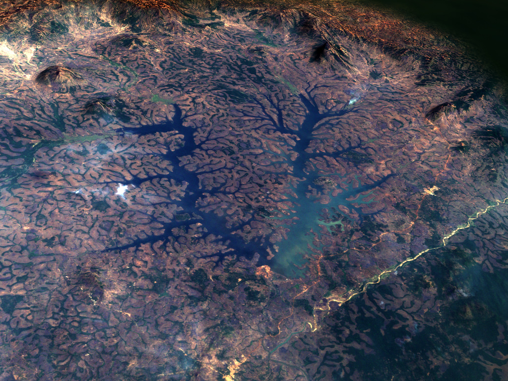
The Lac de Mbakaou in Cameroon, Africa, as seen on Feb. 2, 2001, by the Landsat-7 satellite.
Get the world’s most fascinating discoveries delivered straight to your inbox.
Chile
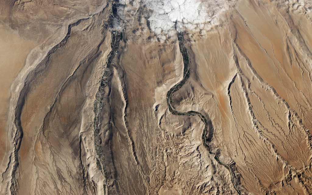
This view of the Lluta River, in Chile's Atacama Desert, was captured on July 19, 2012, by the Advanced Land Imager onboard NASA's Earth Observing-1 satellite. The Atacama Desert is considered one of the driest places on Earth, receiving less than 1 millimeter of rain a year.
Colombia
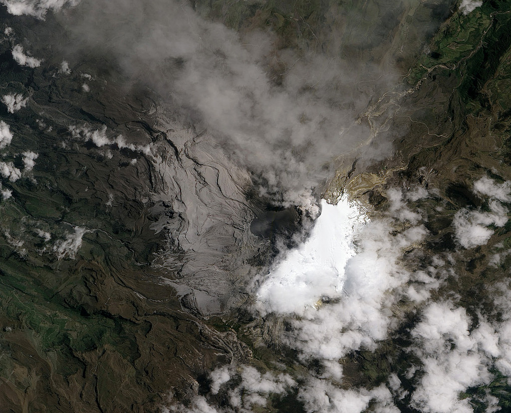
Located in the Colombian Andes, the Nevado del Ruiz Volcano sprang to life in March 2012, spewing sulfur dioxide gas into the air, according to NASA's Earth Observatory. By early June, volcanic ash launched as far as 25 miles (40 kilometers) from Nevado del Ruiz. This natural-color image, captured on June 6, 2012, by the Advanced Land Imager (ALI) aboard the Earth Observing-1 (EO-1) satellite, shows such a burst of ash.
Costa Rica
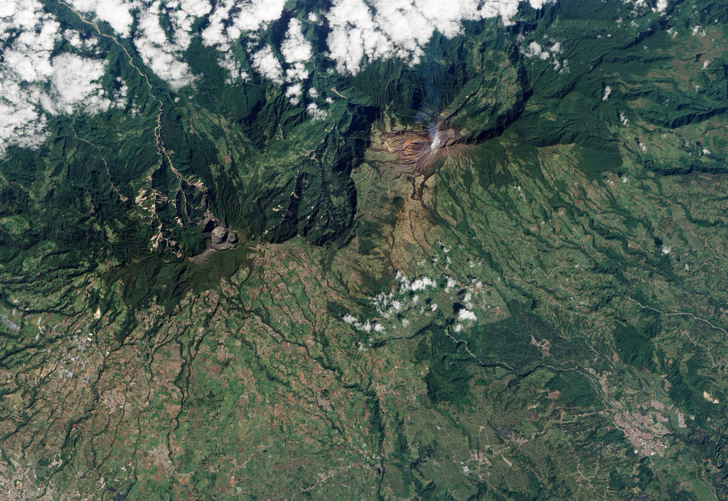
Located in central Costa Rica, the Turrialba Volcano, whose summit reaches 10,960 feet (3,340 meters) high, emits a translucent plume of volcanic gases in this natural-color satellite image taken on Jan. 21, 2010, by the Advanced Land Imager (ALI) aboard NASA’s Earth Observing-1 (EO-1) satellite, according to NASA's Earth Observatory. Apparently, a loud noise rivaling a jet created as gas and ash exploded from fumaroles was heard several miles away.
Ecuador
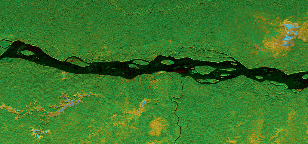
Forested wetlands snuggled around Ecuador's Napo River can be seen in this image captured on March 17, 2013, by NASA's Uninhabited Aerial Vehicle Synthetic Aperture Radar (UAVSAR) onboard a NASA Gulfstream C-20A aircraft. (Yellow, orange and blue represent vegetation inundated by floodwaters beneath a forest canopy; green is healthy forest; black indicates open water of the river and its tributaries.)
Jeanna Bryner is managing editor of Scientific American. Previously she was editor in chief of Live Science and, prior to that, an editor at Scholastic's Science World magazine. Bryner has an English degree from Salisbury University, a master's degree in biogeochemistry and environmental sciences from the University of Maryland and a graduate science journalism degree from New York University. She has worked as a biologist in Florida, where she monitored wetlands and did field surveys for endangered species, including the gorgeous Florida Scrub Jay. She also received an ocean sciences journalism fellowship from the Woods Hole Oceanographic Institution. She is a firm believer that science is for everyone and that just about everything can be viewed through the lens of science.


