Egyptian Pyramids Added to Google Street View

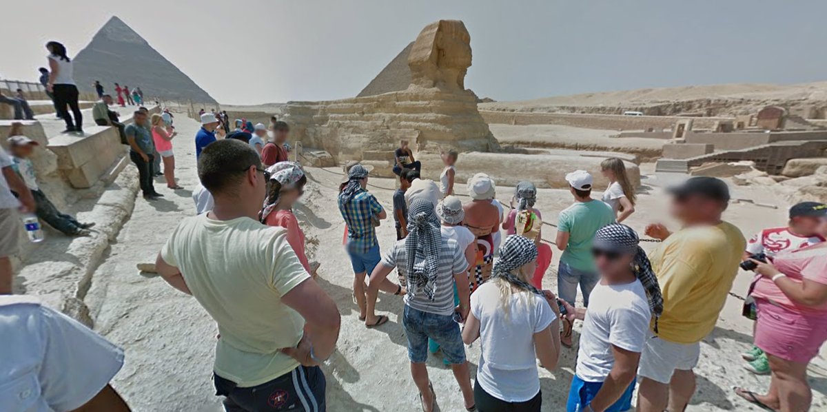
Now you can wander among the ruins of Egypt (and the blurry faces of anonymous tourists) without ever leaving your home.
This week, Google Street View added immersive, 360-degree images of Egypt's Great Pyramids as well as other well-traveled archaeological sites.
A blog post from Google that reads like advice from a travel agent urges armchair explorers to start with the Great Pyramids and the enigmatic Sphinx of Giza before moving on to other sites where the Street View team members lugged their panoramic cameras: Djoser's Step Pyramid in Saqqara, the Christian site Abu Mena and the medieval Islamic fortification known as the Cairo Citadel. [In Photos: Ancient Egypt on Google Street View]
The scenes from Egypt add to Google Street View's growing list of exotic locales, including Mount Everest base camp, Ernest Shackleton's Antarctic hut, polar bear habitats in the Canadian Arctic, the Galapagos Islands, the Grand Canyon and the Great Barrier Reef.
To capture its Street View imagery, Google typically mounts its 75-megapixel orblike cameras on top of cars. But for off-road locations, such the paths around Egyptian archaeological sites, the cameras are attached to backpacks known as "Trekkers" and worn by intrepid Street View team members.
Follow Megan Gannon on Twitter and Google+. Follow us @livescience, Facebook & Google+. Original article on Live Science.
Sign up for the Live Science daily newsletter now
Get the world’s most fascinating discoveries delivered straight to your inbox.


