Typhoon Vongfong Becomes 2014's Most Powerful Storm

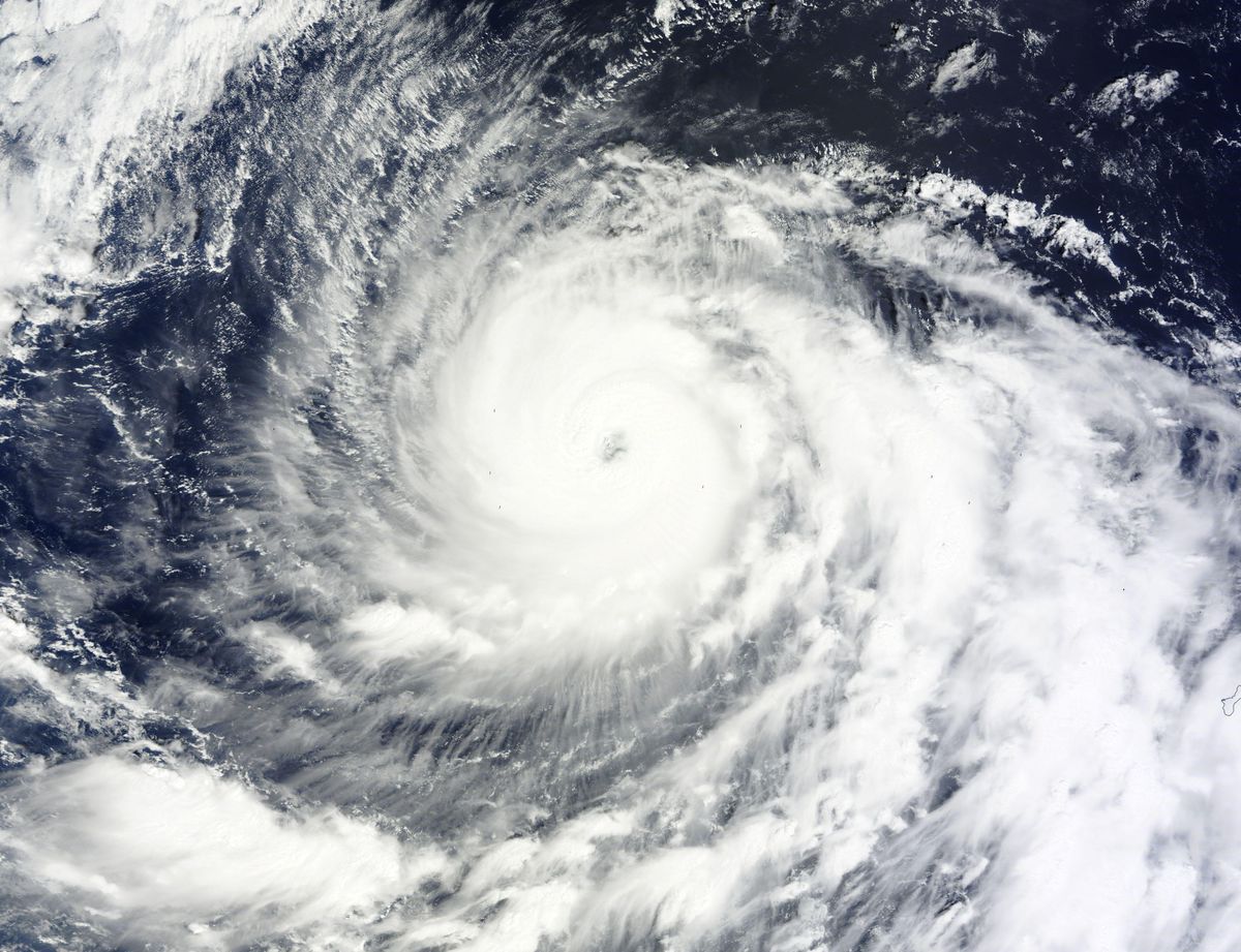
An enormous storm in the Western Pacific rapidly strengthened overnight into the year's most powerful super typhoon.
Super Typhoon Vongfong reached sustained winds of 155 mph (250 km/h) this morning (Oct. 7), with gusts of up to 190 mph (306 km/h), according to the U.S Navy's Joint Typhoon Warning Center in Pearl Harbor, Hawaii.
Satellite estimates from the Japan Meteorological Agency suggest the massive storm's central pressure dropped to 905 millibars, making it the most intense storm of any kind this year, according to The Washington Post's Capital Weather Gang blog. (The average sea level pressure is 1,013 millibars. Typically, storms with a big pressure gradient, or difference in pressure, have stronger winds.) [Super Storms: 8 Terrible Typhoons]
Vongfong is the fifth super typhoon to threaten the Pacific this year. There were also five super typhoons in 2012 and five in 2013, including the deadly Super Typhoon Haiyan, which was one of the strongest tropical cyclones ever recorded. Late July through October is peak typhoon season in the Western Pacific.
Super Typhoon Vongfong is currently a Category 4 tropical cyclone but could grow into an even more powerful Category 5 storm by Wednesday as it lumbers over warm water, which will fuel its powerful spin. In the Western Pacific, tropical storms become super typhoons when their winds top 150 mph (241 km/h). Super typhoons are equivalent to Category 4 or 5 hurricanes.
Vongfong is expected to sharply turn and head north by Thursday, weakening before it nears Japan, according to current forecasts. The storm is following a similar track to Typhoon Phanfone, which lashed central and eastern Japan with fierce winds and torrential rain last week.
Email Becky Oskin or follow her @beckyoskin. Follow us @livescience, Facebook & Google+. Original article on Live Science.
Sign up for the Live Science daily newsletter now
Get the world’s most fascinating discoveries delivered straight to your inbox.


