Nature's Fury: Gripping Images of Natural Disasters
From earthquakes to volcanic eruptions to hurricanes, natural disasters reveal the fearsome power of Mother Nature. Scientists are studying these phenomena to better understand them and find better ways to predict and prepare for them. Here are some photos of nature's fury. [Read full story about the science of natural disasters]
1906 San Francisco earthquake
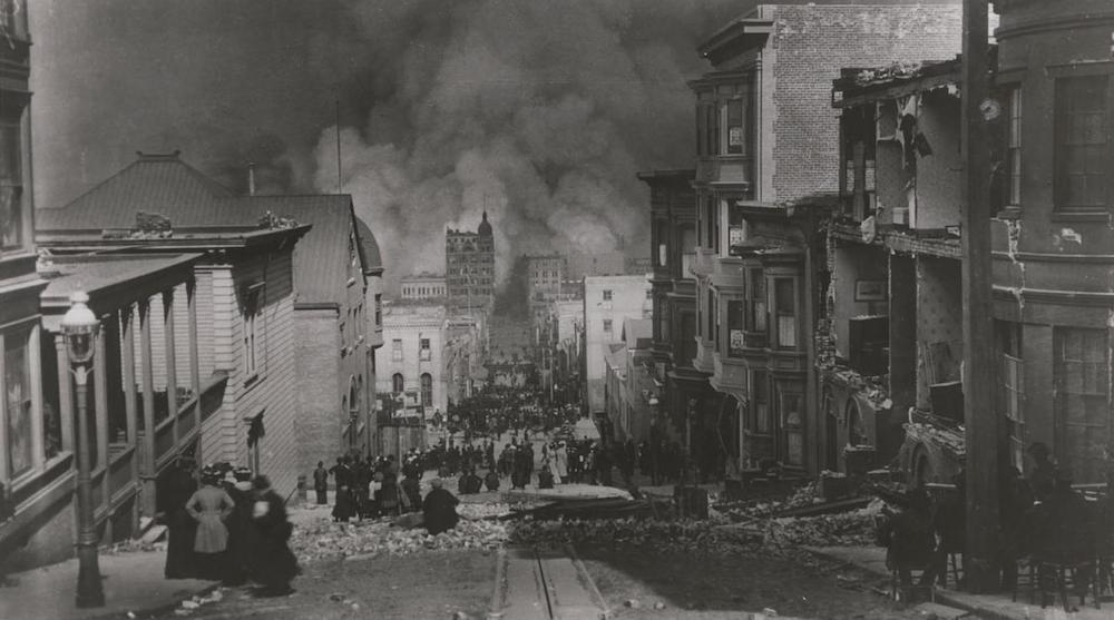
The earthquake that hit San Francisco on April 18, 1906, was one of the most significant earthquakes in history. Caused by a rupture along the northern section of the San Andreas fault, the quake caused a raging fire in San Francisco. The quake killed at least 3,000 people, according to the U.S. Geological Survey. (Image © Library of Congress)
Sloping building on car
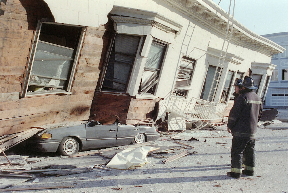
The Loma Prieta earthquake hit northern California on October 17, 1989. San Francisco's Marin District was one of the hardest hit by the estimated 6.9-magnitude quake, as shown by this car crushed by a collapsed house. (Image © Adam Teitelbaum/AFP/Getty Images)
Indian Ocean tsunami
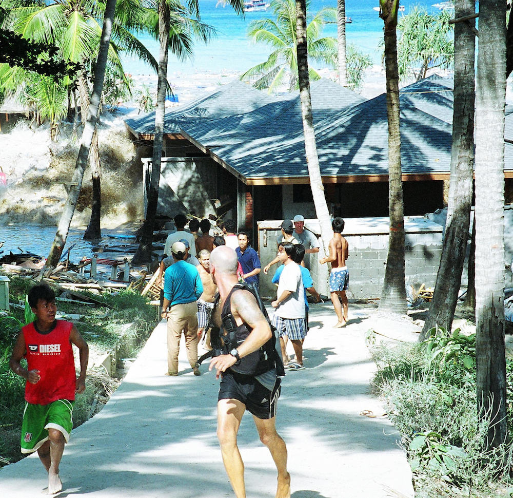
In 2004, a 9.3-magnitude earthquake in the Indian Ocean triggered giant waves along most of the surrounding coastlines, killing more than 230,000 people. Here, people flee a tsunami at Koh Raya, in Thailand's Andaman Islands, on Dec. 26, 2004. The photographer who took the picture managed to escape unharmed as he retreated from the first wave. He stood watching as a second wave tore up the wooden buildings, and a third wave ripped apart the cement buildings "like they were made of balsa wood." (Image © John Russell/AFP/Getty Images)
Sign up for the Live Science daily newsletter now
Get the world’s most fascinating discoveries delivered straight to your inbox.
Erupting volcano
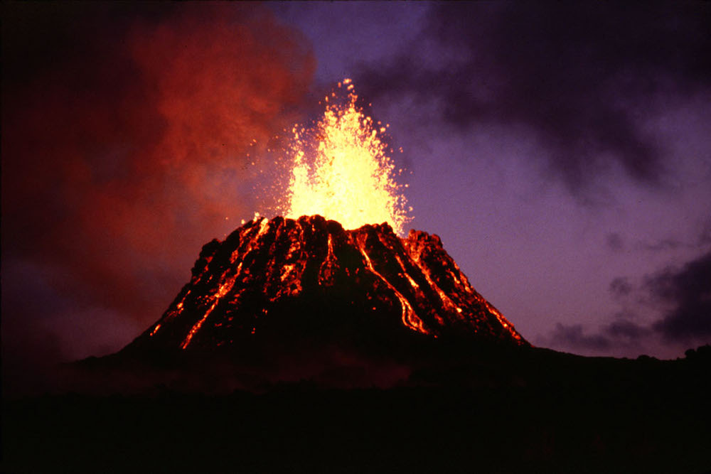
Hawaii's Kilauea volcano, located on the southern shore of the Big Island, has been actively erupting for decades. Shown here is Pu’u ‘O’o, a typical cinder cone spattering a fountain of lava in irregularly shaped globs that fall down in a heap around the vent. (© United States Geological Survey; Photo by G.E. Ulrich)
Mount St. Helens
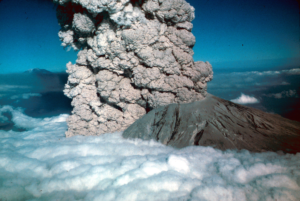
The explosive eruption of Mount St. Helens in the spring of 1980 produced a ball of ash rising through the clouds, as shown in this photo taken on July 22 of that year. The eruption blasted off the top portion of the volcano. The volcanic activity is caused by the subduction of the Juan de Fuca plate off the western coast of North America. Scientists say Mount St. Helens is the most likely volcano in the continental United States to erupt again in the future, according to the USGS. (Image © United States Geologic Survey; Photo by Jim Vallance)
Hurricane Dean
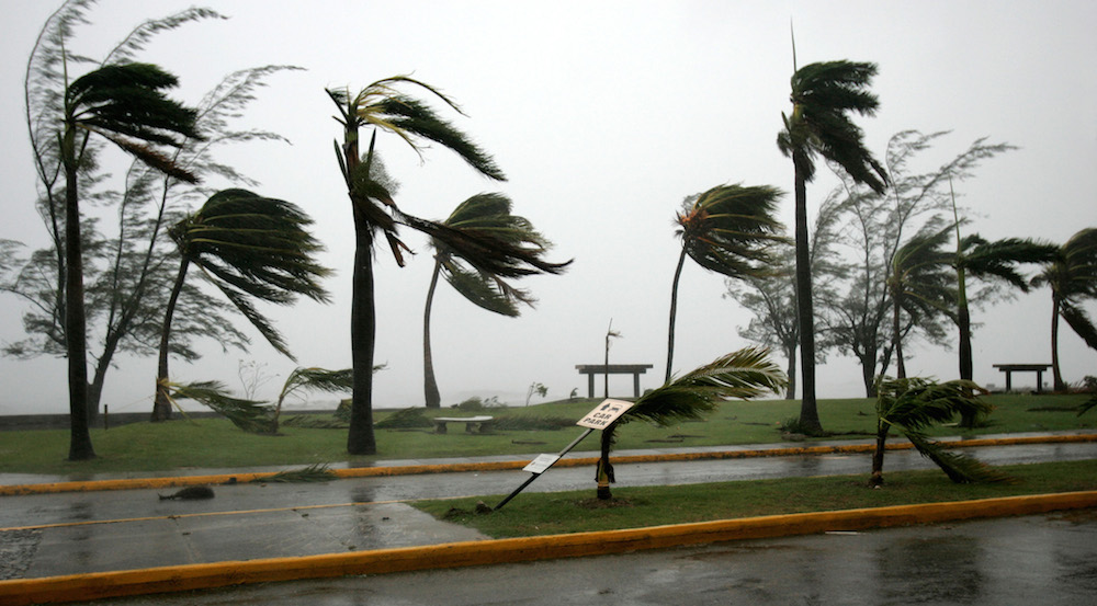
Hurricane Dean was the strongest hurricane of the 2007 Atlantic hurricane season. It struck downtown Kingston, Jamaica on August 19, 2007, battering the city's waterfront boulevard with strong winds and heavy rains. (Image: © Andres Leighton/AP Photo)
Campo tornado
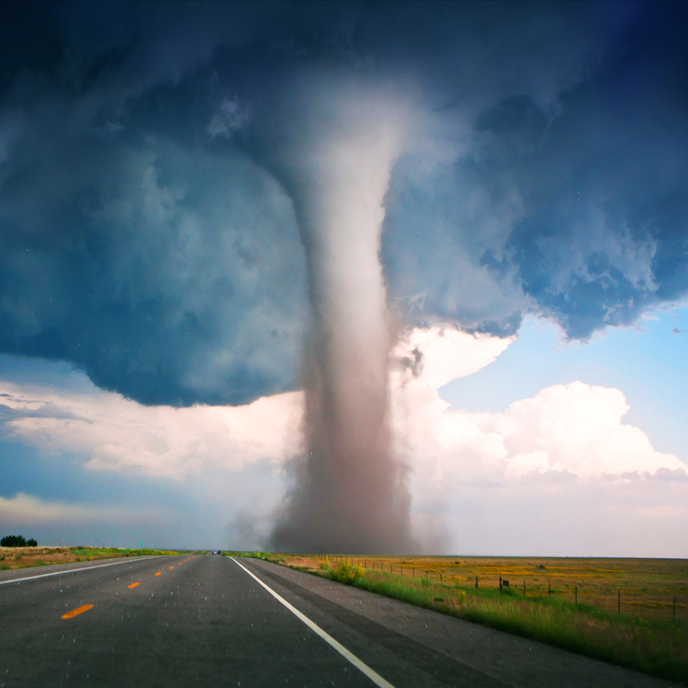
About three quarters of all tornadoes take place in a part of the central United States known as Tornado Alley. The violent winds and funnel-shaped clouds are formed when warm, humid air from the Gulf of Mexico meets cool, dry air from the north, producing thunderstorms. The conditions create an average of 600 tornadoes per year. This 2010 tornado touched down in Colorado and swept into Oklahoma. (Image: © Willoughby Owen)
Shake-it-up interactive
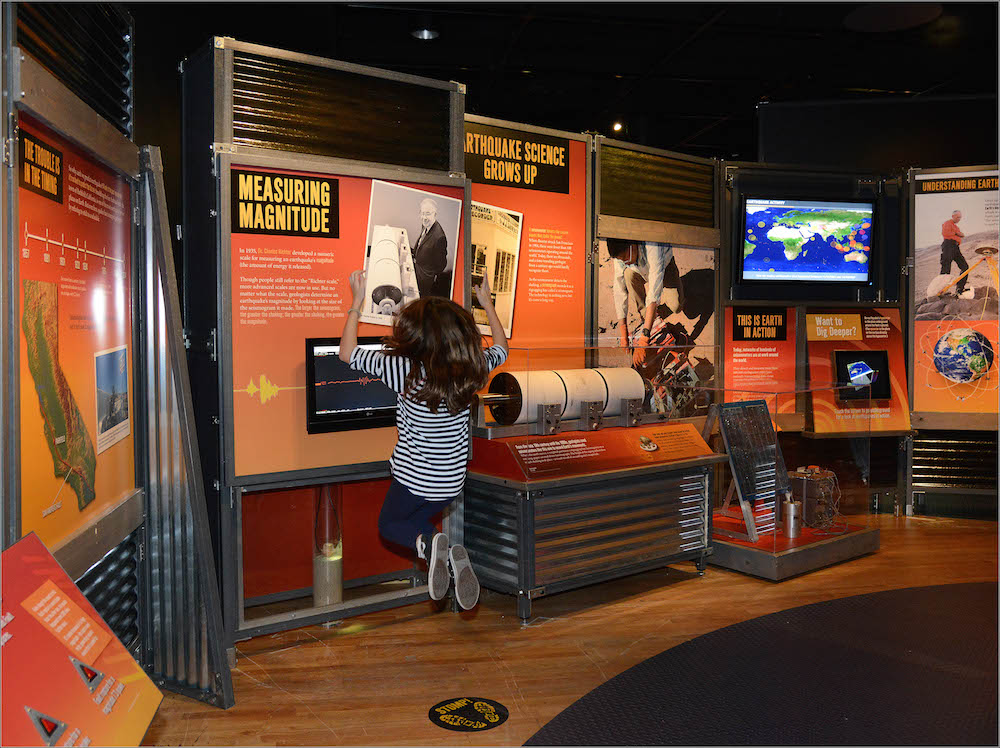
A new exhibit at the American Museum of Natural History, in New York City, lets visitors stomp on the floor next to a seismometer, a device that measures the magnitude of an earthquake on the Richter scale. Each increment on the scale corresponds to a release of 10 times as much energy as the previous increment. (Image: © AMNH/R. Mickens)
Build-your-own-volcano
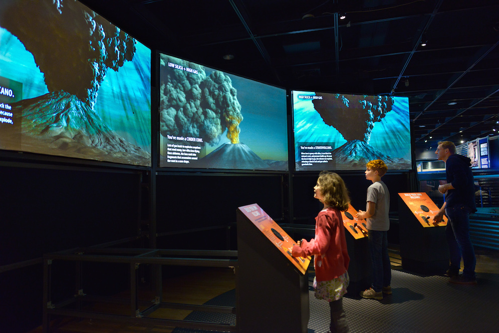
Museum visitors can also create their own virtual volcano. By adjusting the levels of gas and silica in the volcano's lava, they can create different types of volcanoes. More silica results in more viscous and gooey lava, whereas more gas makes an eruption more explosive. (Image: © AMNH/D. Finnin)
Stand in the eye of a tornado
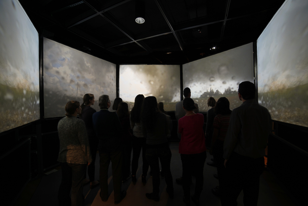
In this tornado exhibit, visitors can experience what it looks like inside the eye of a tornado. Storm chaser Tim Samaras captured this unique footage of a tornado near Storm Lake, Iowa, from a special probe attached to the ground. (Image © AMNH/M. Shanley)
Hurricane Sandy interactive
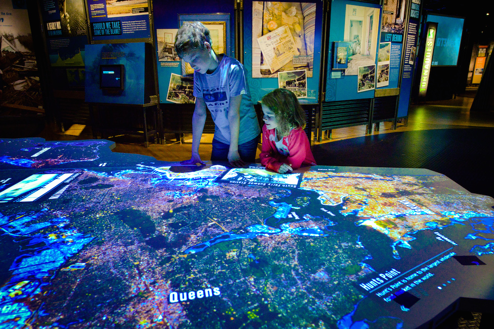
The exhibit also contains an interactive map of New York City showing its 520 miles (837 kilometers) of coastline (longer than the coastlines of Miami, Boston, Los Angeles and San Francisco combined). The exhibit shows the parts of the city that were most vulnerable to Hurricane Sandy's storm surge in 2012, and includes some of the efforts being made to mitigate the effects of future storms. (Image: © AMNH/D. Finnin)
Follow Tanya Lewis on Twitter. Follow us @livescience, Facebook & Google+.


