Expect More Giant Snowstorms as Climate Warms (Op-Ed)
Marlene Cimons writes for Climate Nexus, a nonprofit that aims to tell the climate story in innovative ways that raise awareness of, dispel misinformation about, and showcase solutions to climate change and energy issues in the United States. She contributed this article to Live Science's Expert Voices: Op-Ed & Insights.
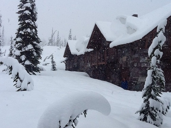
The storms that buried the Buffalo, New York, area in more than 7 feet (2.1 meters) of snow this week shattered records and shocked residents — even in a region accustomed to dealing with heavy snow. The storms are certain to provide new fodder for climate-change skeptics who seem to embrace every monster blizzard as evidence that global warming doesn't exist.
And yet, the science behind these catastrophic storms suggests that they do not occur despite global warming, but in fact because of it. [Will U.S.-India Summit Bring Historic Climate Action? (Op-Ed )]
"Part of what gave us the record lake-effect snowfall in Buffalo was warm, late-fall lake-surface temperatures that combined with something highly unusual: a 5 sigma event. That is, a very unlikely event on the order of 1-in-a-million — a remarkably persistent, anomalous configuration of the jet stream, which brought frigid Arctic air down into the United States so early in the season," said Michael Mann, professor and director of the Earth System Science Center at Pennsylvania State University. "The cold winds traveling over the warm moisture-laden lake created a perfect storm of conditions for record lake-effect snow."
The basic science behind snow and its relationship to climate change is fairly straightforward. Warmer temperatures cause more water to evaporate into the atmosphere, and warmer air holds more water than cooler air. The air's water-holding capacity, in fact, rises about 7 percent with each 1 degree Celsius (1.8 degrees Fahrenheit) of warming. The warming results in air that becomes supersaturated with water, often bringing drenching rainfall, followed by flooding or, if it is cold enough, heavy and intense snowfall. [Snow in Spring? Why a Cold March Doesn't Disprove Global Warming ]
A study of 20th century snowstorms published in the August 2006 issue of the Journal of Applied Meteorology and Climatology, before the big storms of recent years, found that most major snowstorms in the United States occurred during warmer-than-normal years. The climatologists who authored the paper — the late Stanley Changnon, a scientist with the Illinois State Water Survey, David Changnon, a professor with the Northern Illinois University department of geography, and Thomas R. Karl director of the National Oceanic and Atmospheric Administration’s National Climatic Data Center — predicted that "a warmer future climate will generate more winter storms.''
That outcome was especially dramatic in 2010, when storms walloped the Atlantic states — most notably, a back-to-back punch only one day apart in February of that year that broke records in many major cities and, in Washington, D.C., became known as "Snowmageddon.'' Rare storms also brought heavy snows to the Deep South, including the northwestern panhandle of Florida. In fact, by the second week of February, every state but Hawaii had snow on the ground.
Sign up for the Live Science daily newsletter now
Get the world’s most fascinating discoveries delivered straight to your inbox.
So what was unique about what occurred in upstate New York this week? While 2014 is on track to be the hottest year on record, the country has been experiencing a blast of unseasonably frigid conditions resulting from atmospheric blocking, a geographically broad pressure pattern with little or no movement, causing a sustained period of cold, mid-November temperatures.
Moreover, warm ocean waters strengthened Super Typhoon Nuri and caused the storm to travel farther north than normal, pushing the jet stream farther south in the United States. The jet stream also may have slowed due to a warmed Arctic, easing the way for Nuri to drive it southward, bringing frigid sub-Arctic conditions with it.
"If Jennifer Francis, Stefan Rahmstorf and others who have published work suggesting that the increased tendency for unusually persistent meanders in the jet stream might be a consequence of human-caused climate change are right, then climate change may have indeed played a hand in this event," Mann said.
Another reason for the recent extreme snowfall in Buffalo may be that unseasonably cold air in the region created an extreme difference between water and air temperatures, increasing the magnitude of snowfall produced as cold winds moved across the warmer lake water. Water temperatures in eastern Lake Erie earlier this week, for example, were about 50 degrees F (28 degrees C) warmer than the air.
Since 1950, in fact, there have been signs of an increase in lake-effect snowfall along and near the southern and eastern shores of the Great Lakes, according to the United States Global Change Research Program. (USGCRP). Such snow results from the strong flow of cold air across large areas of relatively warmer ice-free water. Ice coverage on the Great Lakes has dropped with the warming climate, creating conditions favorable to more evaporation and heavier snowstorms. Western New York, for example, also experienced extreme lake-effect snow in February 2007, when more than 10 feet (3 m) of snow fell during a 10-day period. At least one study shows how lake-effect snowstorms increase with global warming.
"The Buffalo blizzard of November 2014 is fully consistent with our understanding of human-induced climate change," said Michael Wehner, a senior staff scientist at Lawrence Berkeley National Laboratory and the University of California, Berkeley. "Undoubtedly, the Buffalo event will attract some research, perhaps even from our group."
On the surface, it almost seems contradictory — although, in reality, it is not. On one hand, warming temperatures are leading to milder and shorter winters in most areas, including a later start to winter and earlier onset of spring. During the past 30 years, temperatures have risen faster in winter than in any other season, with average winter temperatures in the Midwest and northern Great Plains increasing by more than 7 F (4 C), according to the USGCR.
On the other hand, the nation still is experiencing big snowstorms, especially in the northern part of the country. Climatologists predict that the coming decades will bring more of the same, meaning unusually warm winters and potentially record-breaking snowstorms.
"If you look at model projections of climate change for the next few decades under 'business as usual' carbon emissions, what they show is that you'll still have 'winter' over regions like the United States — that is, there will still be a wide seasonal window where it is cold enough for snow,'' Mann said. "But because winters will be warmer, the atmosphere will have the ability to hold more water vapor, and so there is more of that water vapor available for precipitation. Again, as long as it's cold enough for that precipitation to be snow, which it will be, you'll actually get larger snowfalls.''
Paradoxically, winter as a season likely will become shorter as a result of increasing warming, potentially hurting winter recreation areas that depend on tourism, while snow, when it does fall, probably will be heavier. "Most likely, we will see a shorter snow season but more intense individual snowfall events,'' Mann said.
Average precipitation projections for the future are going both up and down, depending on the region. In high latitudes, especially in the far North — Siberia, Canada and the northern United States — precipitation is expected to increase during winter and spring. That is due to both the water-holding capacity of the air and circulation changes that drive greater moisture from the tropics into higher latitudes, Wehner said.
As a result, "you will have a bigger effect in the winter and also in the spring,'' Wehner said. "Interestingly, when it's supercold, it doesn't tend to snow because the air is too cold and can't hold much water," he added. "When it gets a little warmer, but still below freezing, that's when it tends to snow.
"The models all agree there will be more precipitation in the northern United States as global temperatures continue to increase," Wehner continued. "This translates to more snow as long as it stays below freezing. However, at some point, winter temperatures will be high enough that this extra precipitation will take the form of rain instead.''
Mann agreed. "As long as it's cold enough to snow — which it will be in the winter — you potentially will get greater snowfalls," he said. "In fact, up to a point, the warmer the air — when it is still below freezing — the more snow you will get."
Read more op-eds by Marlene Cimons on Expert Voices. Follow all of the Expert Voices issues and debates — and become part of the discussion — on Facebook, Twitter and Google+. The views expressed are those of the author and do not necessarily reflect the views of the publisher. This version of the article was originally published on Live Science.
