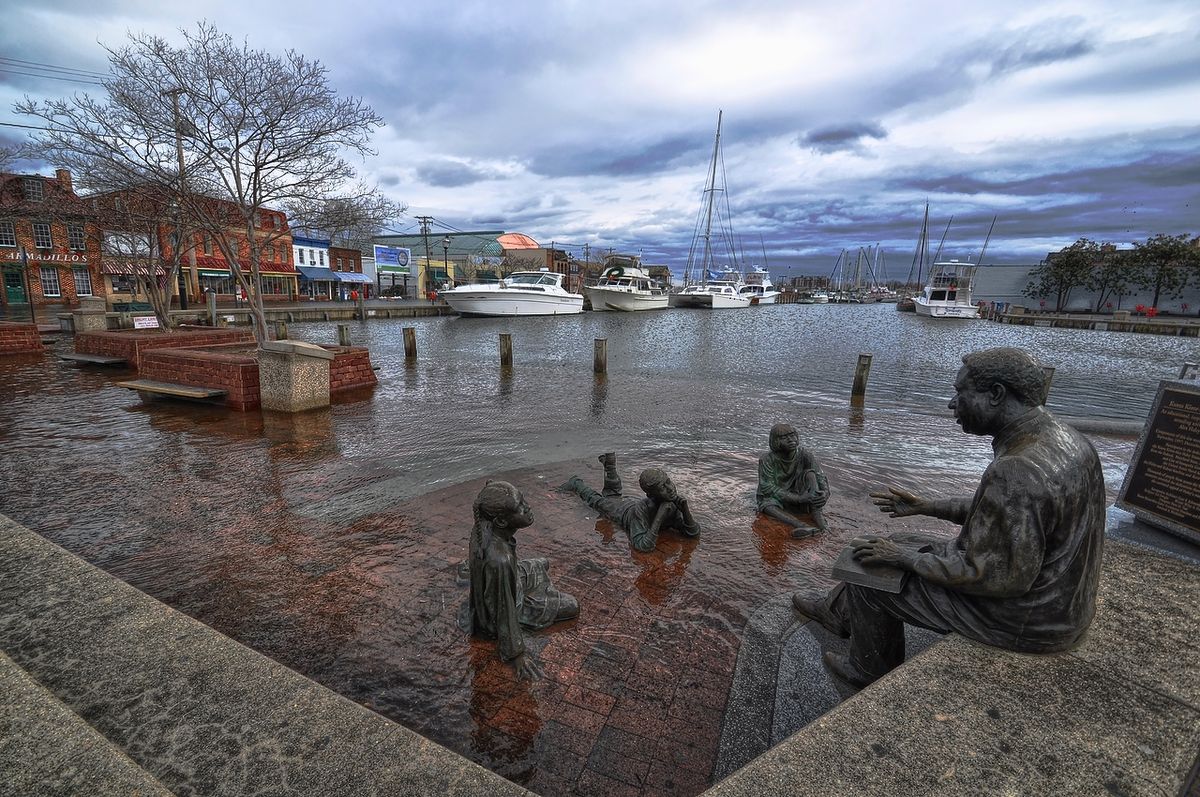
Mysterious East Coast Flooding Caused by Weird Wind Patterns

Mysterious flooding and high tides along the East Coast in 2009 and 2010 now have an explanation: a major change in the Atlantic Ocean's wind patterns and warm-water currents.
At the time, the unusually high tides caught people by surprise. Now, researchers know why the ocean was flooding beaches and barrier islands: Sea levels temporarily jumped by up to 2 feet (61 centimeters) above the high tide mark, as measured by tide gauges along the Atlantic Coast from Maine to Florida. Over the two-year period, coastal sea levels rose an average of 4 inches (10 cm) from New York to Newfoundland, Canada, researchers reported today (Feb. 24) in the journal Nature Communications.
"This extreme sea level rise is unprecedented in tide gauge records," said study co-author Jianjun Yin, a University of Arizona geosciences professor who specializes in climate modeling. "This is a one-in-850-year event, based on the past records."
The unexpected surge was caused by a major slowdown in the Gulf Stream, one of the Atlantic Ocean's great currents, the new study reports. About two months before sea levels spiked along the East Coast, the strength of the Atlantic meridional overturning circulation (AMOC) declined by 30 percent, according to earlier research by other scientists. The Gulf Stream, which is part of the AMOC, flows from the tip of Florida up the coast to Newfoundland, Canada. [7 Ways the Earth Changes in the Blink of an Eye]
The AMOC brings warm water from the tropics to the North Atlantic and the polar regions, where the water cools and sinks, and then flows back to the tropics via the deep ocean. These water temperature differences drive the current. In 2009 and 2010, the current's speed slowed down because warmer-than-average temperatures in the Labrador Sea (between Canada and Greenland) backed up the current, creating an effect similar to a jam on a highway overpass, said lead study author Paul Goddard, a University of Arizona geology graduate student. This slowdown piled up water in the North Atlantic, just like cars trapped in traffic.
"The anomalous heat made the surface waters less dense and less likely to sink, and it created a bottleneck," Goddard said.
Although the backed-up current can trigger coastal sea level rise on its own, the researchers think the extreme sea level jump seen in 2009 and 2010 was triggered by persistent winds that pushed the water up against the Atlantic Coast.
Sign up for the Live Science daily newsletter now
Get the world’s most fascinating discoveries delivered straight to your inbox.
The steady winds were associated with a negative phase of a natural climate pattern called the North Atlantic Oscillation (NAO). The NAO flip-flops between negative and positive phases. In years with a negative NAO, winds drive water onto the northeast coast, Yin said.
Although temporary, the rapid sea level rise seen during the study can threaten coastal homes and businesses, especially if the spikes coincide with severe storms.
"If this type of situation occurs more often in the future, there's always a chance of it being superimposed on a storm surge," Goddard said.
Climate models suggest that sea level anomalies may become larger and more frequent this century as global warming alters ocean temperatures, Yin said. In the Atlantic, such changes will push sea levels higher along the East Coast, the researchers said.
Eight of the top 10 U.S. cities that have seen an increase in coastal flooding are on the East Coast, according to a National Oceanic and Atmospheric Administration report published in August 2014.
Follow Becky Oskin @beckyoskin. Follow Live Science @livescience, Facebook & Google+. Originally published on Live Science .


